Topographical Surveys
Measured ground fordesign that has to fit
Topographical surveys
Design does not repair a poor survey base
A topographical survey records the visible site within one coordinate and level framework before design starts. We deliver a coordinated 2D plan and 3D model, so architects and engineers are not left reconciling drawings built from different origins.
Before anyone attends, the marked extent, datum requirements, visible detail, adjoining context and output formats are written into the scope. The price is fixed against that scope before work begins; time on site does not rewrite the invoice.
Terrain and levels
One coordinate framework across ground, features and levels
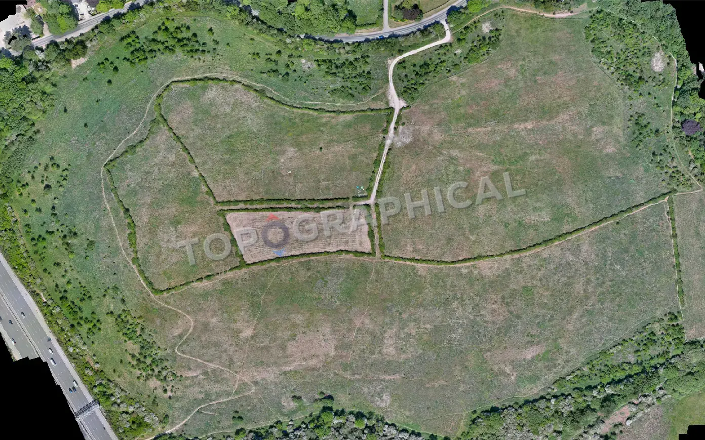
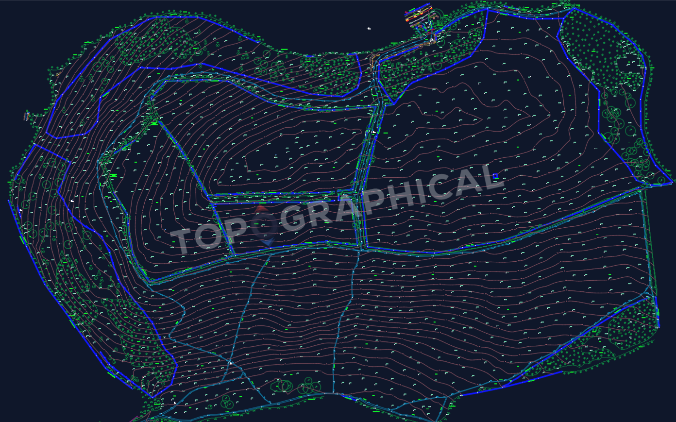
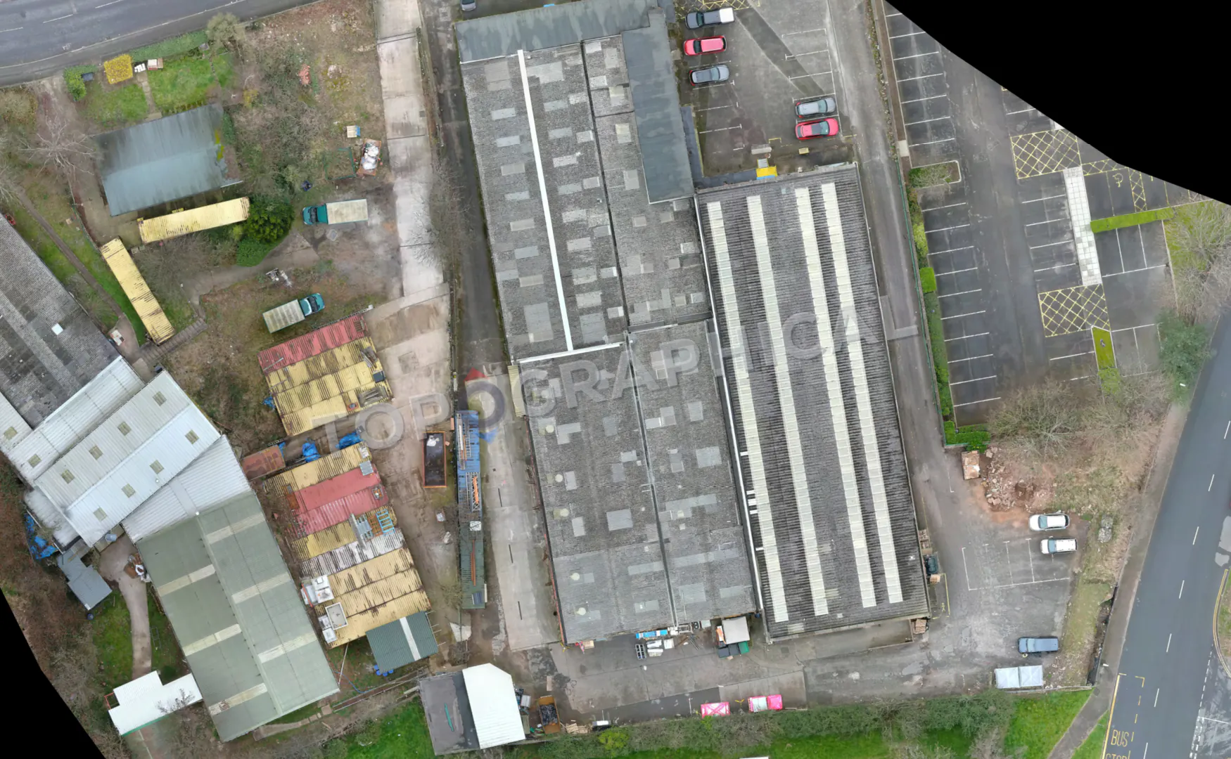
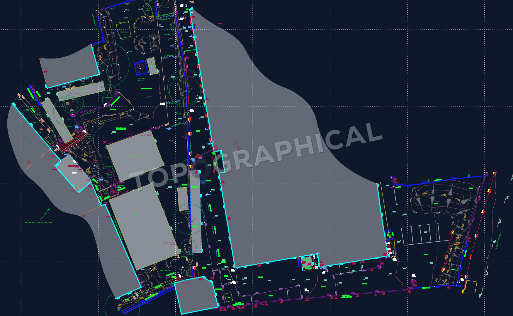
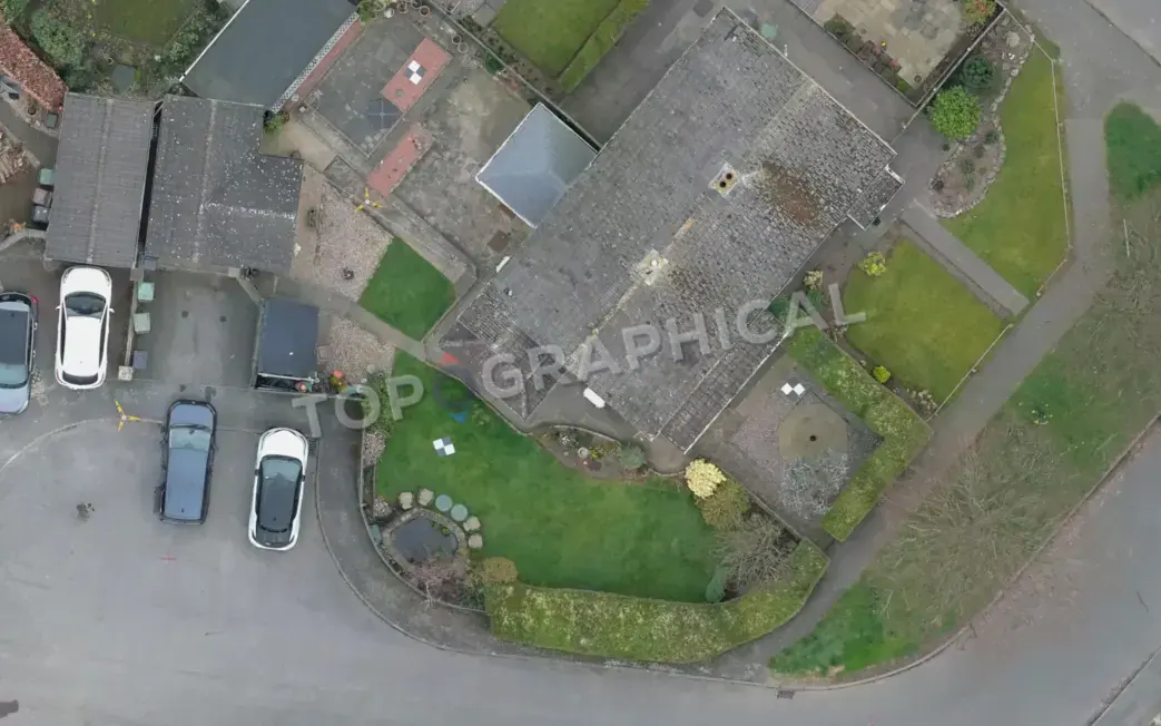
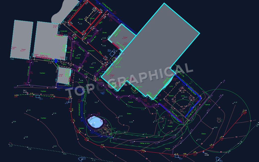
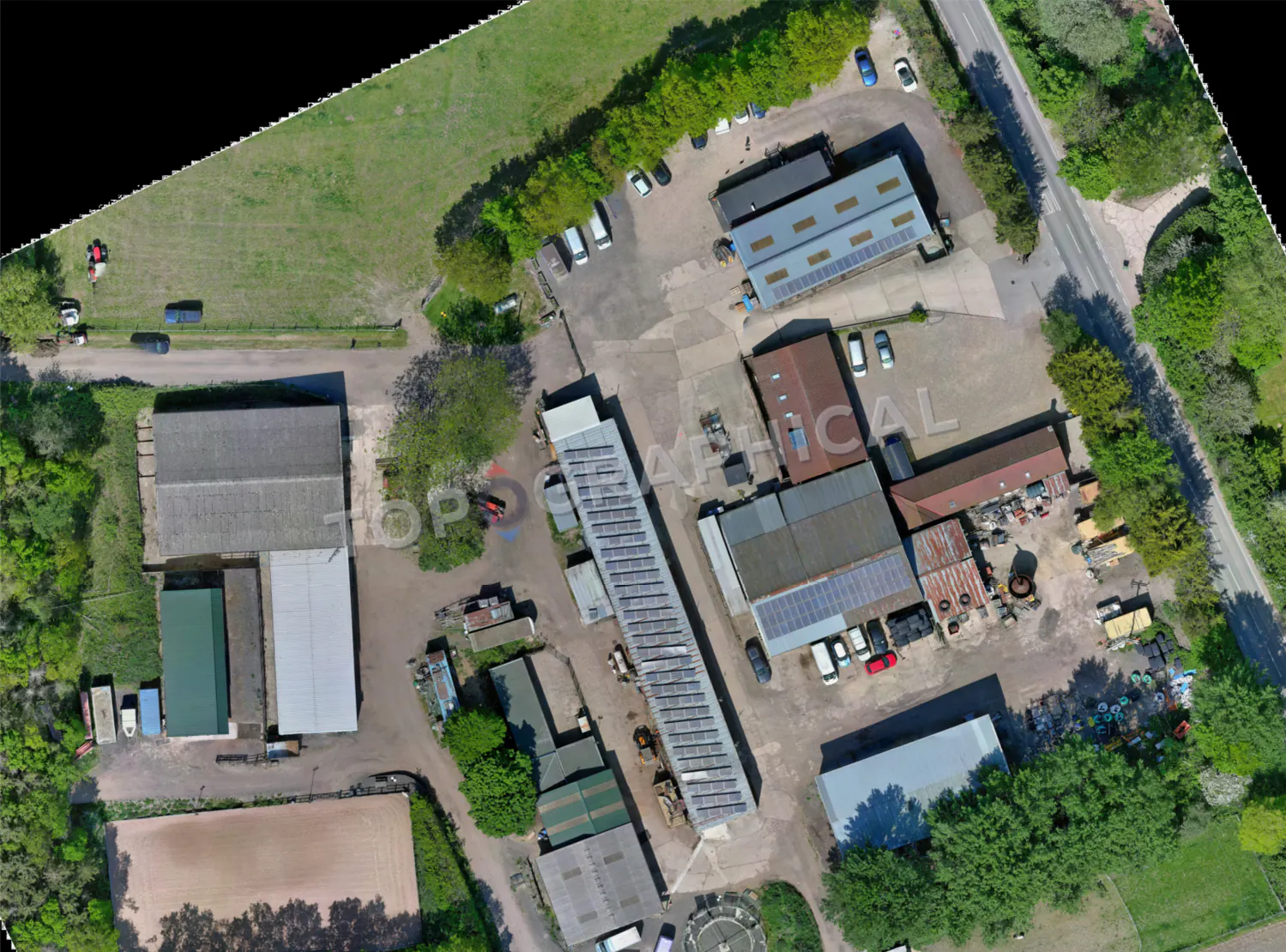
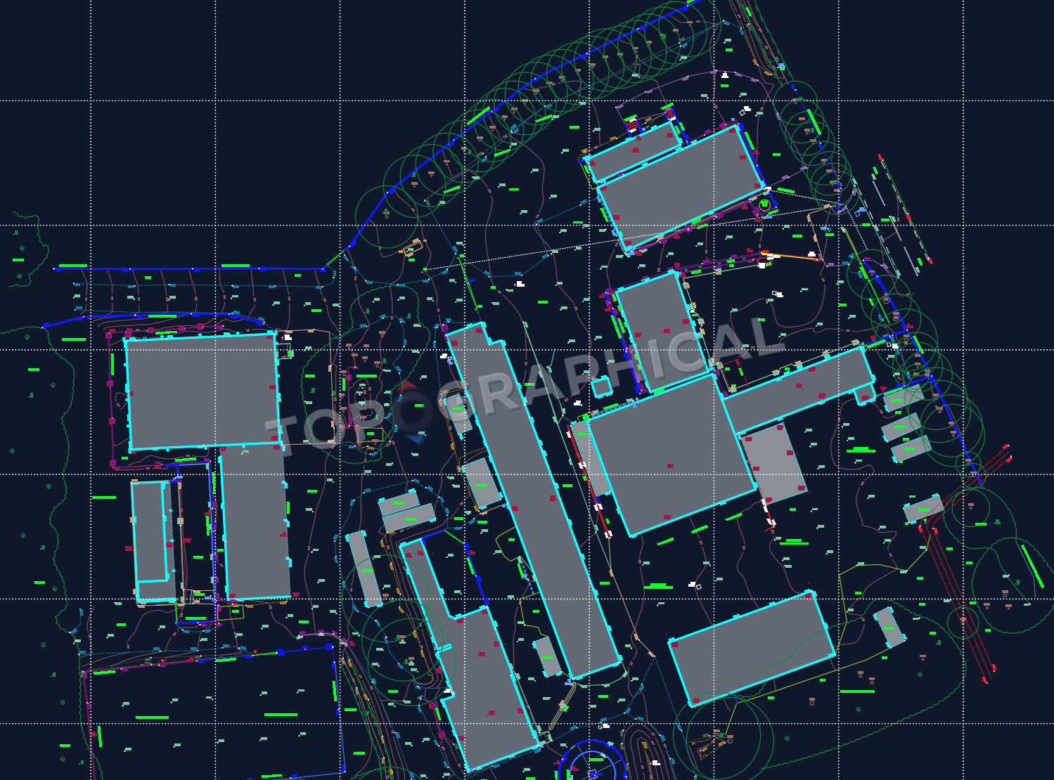
The left view is site imagery. The right shows linework and levels compiled from the full measured dataset, not traced from the photograph.
Brief the decision, not the instrument
The drawing must answer a specific design question
A drainage engineer needs falls, channels and visible cover levels. A planning application may need building heights, trees and adjoining context. A highway design cannot use a junction or tie-in that sits outside the survey boundary. Tell us what follows the survey, and the fixed price can cover the detail the design will use rather than detail it will discard.
Highways and corridors
Survey the junction, not just the strip
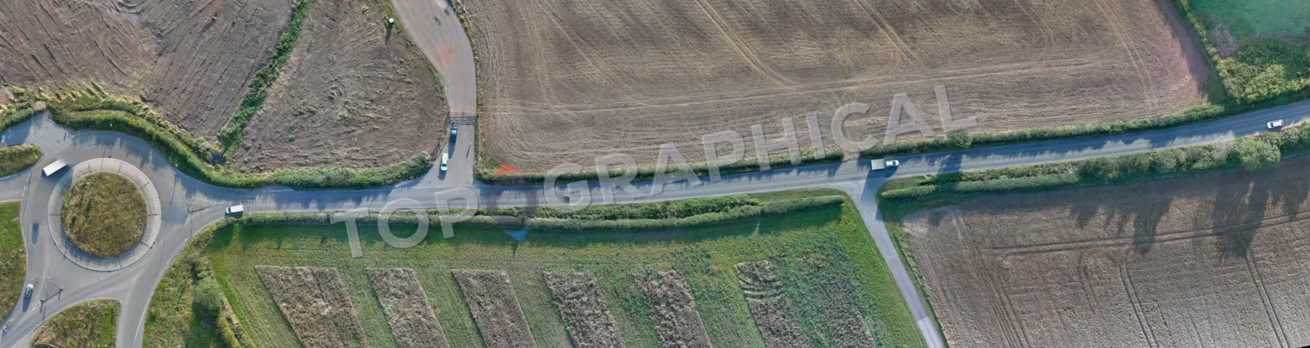
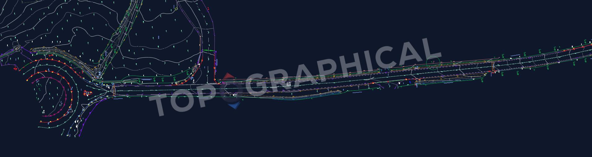
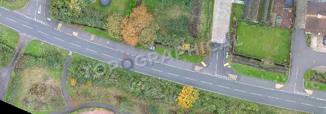
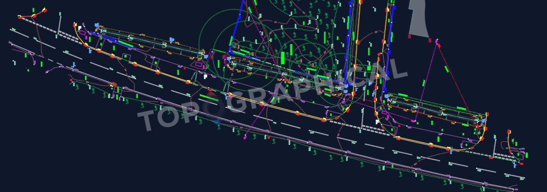
Carriageway edges, kerbs, verges, junction geometry, visible covers and levels remain connected along the route, giving the highway designer measured tie-ins at both ends.
Different instruments must produce one dataset
A total station, GNSS receiver, scanner and drone do not become a survey merely because they collected coordinates. Where methods are combined, each dataset is registered and checked within the specified coordinate and level framework. Documented control is supplied for later reference only when it forms part of the commission.
Trees obstruct satellites, structures block sight lines, traffic restricts safe occupations and vegetation hides surfaces. The method changes around those constraints, and any area that could not be measured is identified in the issue information rather than guessed in CAD.
Industrial sites
An operational site needs more than its building outline
The drawing separates structures, kerbs, hardstanding, surface changes, visible drainage covers and access routes within one coordinate and level framework.
The red line is not always the useful limit
A development may sit inside one boundary while its levels, access, drainage fall or highway tie-in depend on land beyond it. The brief must name the adjoining context required for design and any access that the client needs to arrange before attendance.
Residential context
The design boundary rarely ends at the wall
The survey relates the building to access, garden levels, retaining features, visible boundaries and the neighbouring context named in the brief.
Issued information
One survey base, supplied in 2D and 3D
- A coordinated 2D topographical plan and 3D terrain model in the agreed DWG or DXF structure.
- Spot levels, contours, breaklines and terrain surfaces specified for planning, design or volume work.
- Visible buildings, boundaries, access, trees, surface features and adjoining context within the marked extent.
- Coordinate, datum and control information stated to the level specified in the commission.
- PDF issue drawings with the measured extent, access exclusions and material limitations stated plainly.
We can record the position and top level of visible covers when briefed. We do not lift covers, trace utilities, carry out GPR or CCTV surveys, measure inverts, or investigate anything below ground; those are separate specialist commissions. Visible boundary features are surveyed, but legal ownership and title boundaries are not determined.
Coordinated 3D delivery
A rural site model keeps buildings and terrain connected
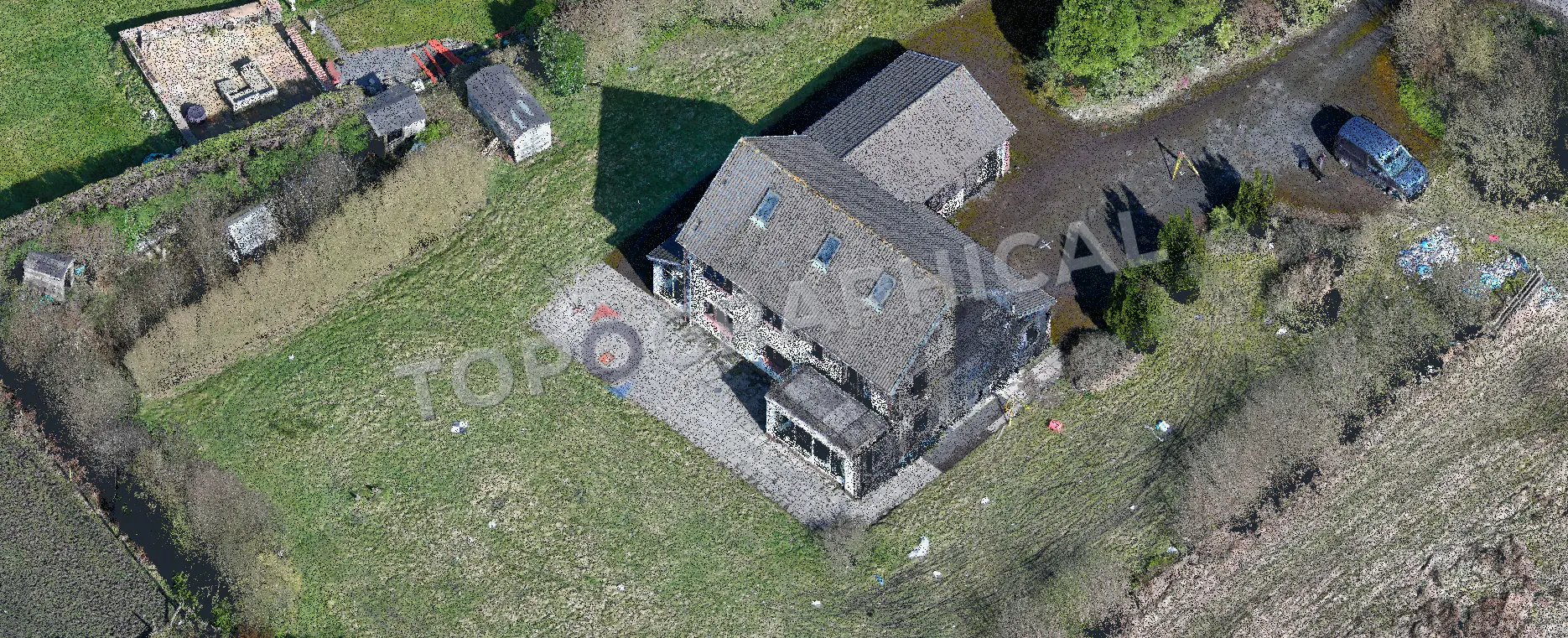
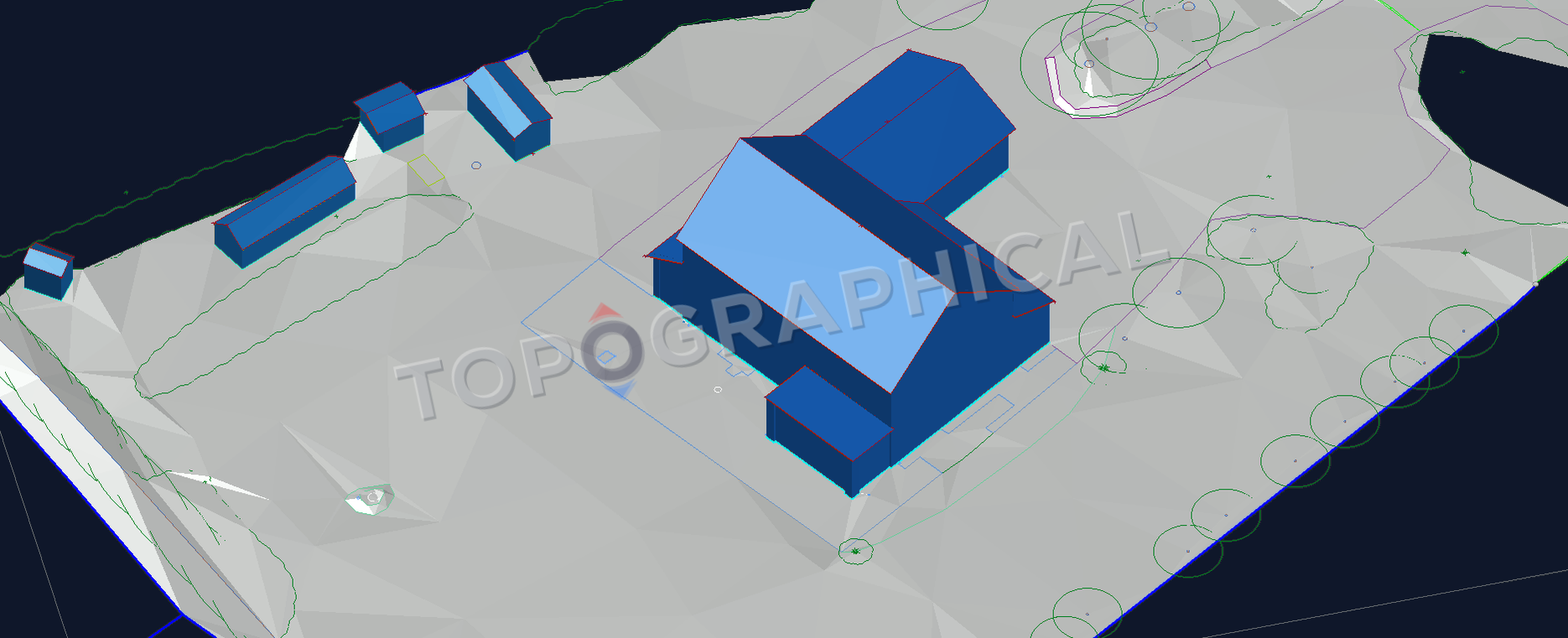
The point cloud captures the property, outbuildings, access and surrounding ground. The delivered model retains their measured relationship instead of isolating the main building from its site.
Define the output before choosing the method
Survey control
GNSS and total-station control place the work on the coordinate system and datum agreed for the commission. The method depends on satellite visibility, site geometry, and any control already available.
Drone capture
Aerial capture can add roof, stockpile, or broad surface coverage where access, permissions, and site conditions allow. It is checked within the same survey framework as the ground observations.
Surface and volume models
Where a brief requires cut, fill, or stockpile quantities, we compare defined surfaces and state the calculation basis with the result.
Connected route detail
Level continuity matters along the full route
Carriageway edges, tie-ins, roadside features and levels stay within one connected dataset, so local detail keeps its measured position along the route.
Drawing clarity
Dense sites need drawing hierarchy
Structures, hardstanding, boundaries, vegetation and access are separated into specified CAD layers, producing linework a designer can edit, query and reference.
Operating area
Find this service in your area
- Nottinghamshire
- Derbyshire
- Leicestershire
- Lincolnshire
- South Yorkshire
- West Yorkshire
- North Yorkshire
- East Riding of Yorkshire
- Rutland
- Northamptonshire
- Oxfordshire
- West Midlands
- East Midlands
- Staffordshire
- Warwickshire
- Bedfordshire
- Buckinghamshire
- Cambridgeshire
Related reading
Practical notes before you fix the brief
- Coordination Failures: When Disciplines Work from Different Bases
How uncoordinated base plans create planning, drainage, landscape, and design clashes that a shared topographic survey can prevent.
- Cut and Fill: Why Earthworks Budgets Depend on Survey Accuracy
Why small level errors can become large earthworks cost variances, and why survey-grade terrain data matters before volume calculations.
- Front-Loading the Planning Technical Package
Why planning teams should commission measured site data early so drainage, trees, levels, and design drawings share the same base.
Capture equipment
A mixed site rarely needs one instrument
GNSS works efficiently under open sky; total stations work through constrained sight lines; scanners capture dense geometry; aerial capture covers suitable open ground and roofs. The method follows the required output and site conditions, while every dataset is checked within the same survey framework.
Fixed scope, fixed price
Start with the red line and the decision it must support
Send the marked extent, intended use, access constraints, datum requirements, output standard and any project-specific accuracy requirement. We will return a fixed price with the deliverables, assumptions, exclusions and delivery programme written down.