Topographical Surveys in North Yorkshire
Our North Yorkshire topographical survey gives the appointed design team a coordinated 2D plan and 3D model of the agreed site. We confirm the authority context, measured boundary, level detail, access and file specification before quoting a fixed price.
Main centres
York, Harrogate, Scarborough, Northallerton, Skipton
Common site mix
Large rural sites, market-town infill, estate roads, moorland edges, river corridors and walled boundaries.
Our North Yorkshire topographical survey gives the appointed design team a coordinated 2D plan and 3D model of the agreed site. We confirm the authority context, measured boundary, level detail, access and file specification before quoting a fixed price.
Start with the ground that controls the design
A compact York site may depend on neighbouring eaves, windows, walls and highway levels outside the immediate works. Rural and estate sites need a different emphasis: mark the proposed access, likely drainage route and any off-site tie points, then we can place closer spot levels and breaklines around thresholds, roads, banks, ditches and changes of surface without crowding simpler ground with detail nobody will use.
Around Skipton and further into the western Dales, walls, sloping access, watercourses and narrow lanes can carry the design beyond the obvious building plot. The brief should identify the section, level route or frontage the consultant needs and who can authorise entry onto adjoining land. A large red line is not a substitute for those priorities.
Check the authority once the address is known
City of York Council deals with York, while North Yorkshire Council directs projects inside the Yorkshire Dales or North York Moors boundaries to the relevant National Park authority. That changes where the project team checks current application requirements; it does not add an automatic bundle of survey detail. The architect or specialist must turn any planning, flood, tree or heritage requirement into a marked extent and measurable features.
Make the control and access workable
Long sites need stable survey control and a level route that relates the design area to its entrance, road or stated datum. Tell us whether the consultant expects an OS coordinate basis, a site grid or a previous project's control. Walls, hedges, water, crops, livestock and third-party tracks can prevent a straight route across rural ground, so permissions and seasonal conditions belong in the access plan.
We record any safe-access limit in the handover. A feature hidden by dense vegetation or beyond land for which access has not been granted is not silently completed from mapping.
What the fixed price covers
The quotation defines the survey polygon, visible features, level density, control basis, attendance and deliverables. Unless the brief says otherwise, the design handover comprises a coordinated 2D topographical plan and 3D model in the agreed CAD formats, with PDF sheets if requested. Extra fields, revised extents or a later request for substantially different detail are treated openly as changes to scope.
We do not lift covers, measure inverts, trace buried utilities, carry out GPR or CCTV drainage surveys, or provide planning advice. Cover positions can appear as visible surface detail, but this is not evidence of pipe routes, depths or condition.
What to send us
Provide the full address, a marked boundary and design area, intended use, required coordinate system, file formats and deadline. Include the consultant's specification, existing CAD or title plan, access contact, parking or induction arrangements, hazards and landowner permissions. If the project is within York or a National Park, or flood and drainage work is expected, say who prepared the brief and what measured information they have requested.
Local references
We last checked these sources in July 2026. Planning guidance changes, so please send us the latest brief from your architect or consultant and we will price the right survey for your site.
- North Yorkshire planning and conservation (opens in a new tab)
- North Yorkshire planning authority guidance (opens in a new tab)
- North Yorkshire Council vision for Skipton (opens in a new tab)
- City of York planning application requirements (opens in a new tab)
- Environment Agency Flood Map for Planning (opens in a new tab)
Survey control
Drone capture
Surface and volume models
Example deliverable
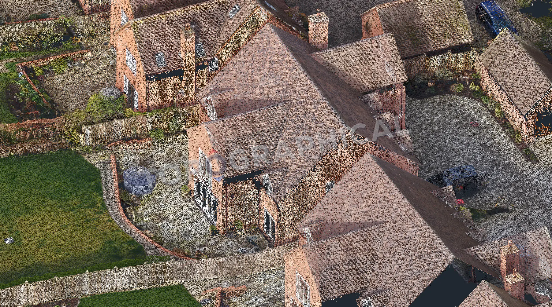
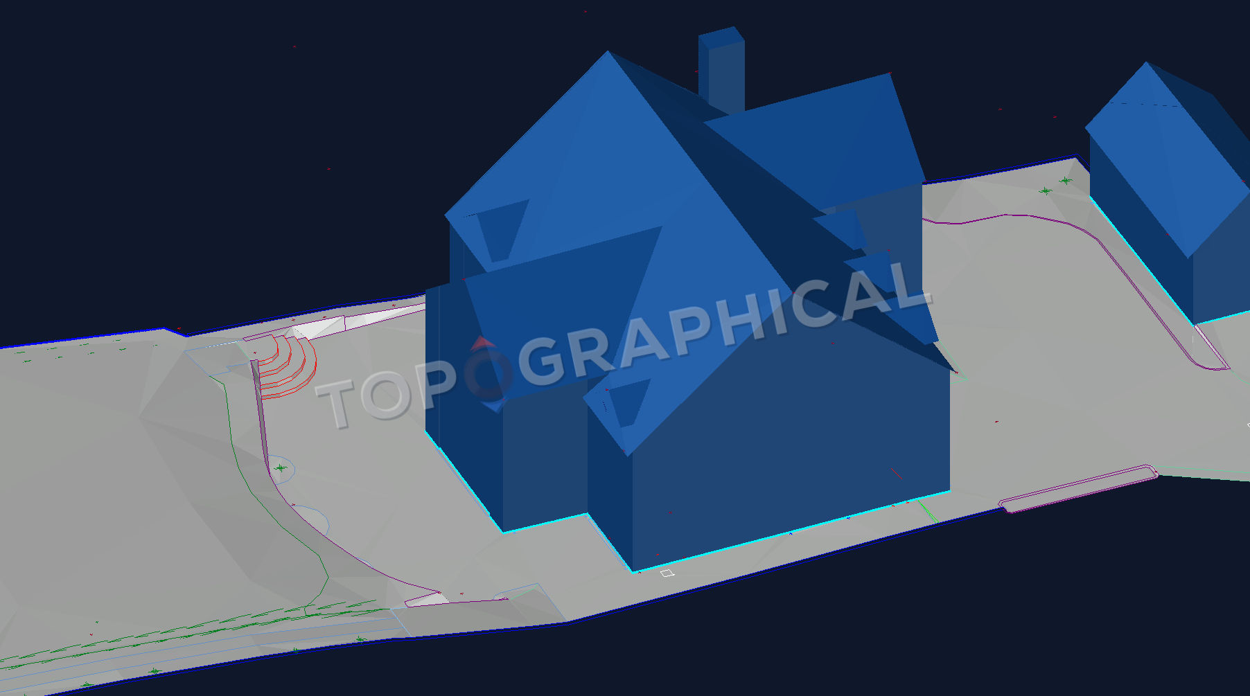
From measured site to topographical drawing
Measured terrain and building form in one 3D model
The point cloud records the property and its immediate context. The coordinated model resolves roofs, walls, ground surfaces, boundaries and visible site features into editable 3D survey data.