Measured Building Surveys in North Yorkshire
We turn 3D laser scanning of accessible building areas into the agreed 2D plans, elevations and sections, extracted from a registered point cloud. A fixed quotation states which spaces and faces are covered, which drawings will be issued and what access you must arrange.
Main centres
York, Harrogate, Scarborough, Northallerton, Skipton
Common site mix
Historic town houses, rural estates, farm conversions, hotels, schools and properties within National Park settlements.
We turn 3D laser scanning of accessible building areas into the agreed 2D plans, elevations and sections, extracted from a registered point cloud. A fixed quotation states which spaces and faces are covered, which drawings will be issued and what access you must arrange.
Buildings and access change from York to Skipton
A York townhouse may need floor levels read against a twisting stair and a section through the roof. In Skipton's historic town centre, a shop or upper-floor conversion can involve old party walls, later subdivisions, restricted rear access and a street elevation that the architect needs to see as one measured composition. A farm conversion can add thick walls, former openings and outbuildings whose relationship matters as much as the principal rooms.
North Yorkshire Council directs projects inside the Yorkshire Dales and North York Moors boundaries to the relevant National Park authority. That is a prompt to confirm the property-specific planning and heritage brief, not a reason to order every possible drawing. For a National Park property, the consultant may ask for roof form, boundary structures or wider external context that a purely internal refurbishment would not need.
Set the drawing list before capture
For plans, define the floors, scale and expected features: wall faces, doors, windows, columns, stairs, fixed fittings and levels can all be included, but their graphic treatment should follow the intended use. Elevations need named faces and an agreed extent. Sections need marked cut lines; one through a stair and roof may answer more than several arbitrary cuts across simple rooms.
The local authority material helps the design team frame that list. North Yorkshire Council publishes conservation and listed-building guidance, while City of York Council's application requirements refer to plans, elevations, site levels and supporting heritage information where relevant. We measure the requested visible fabric; the architect, heritage adviser or planning consultant interprets its significance and confirms what the application needs.
Access is part of accuracy
Give us a room schedule and identify spaces that need keys, an escort or a permit. Rural properties may have occupied dwellings beside unused barns; hotels, schools and care premises need capture arranged around their occupants. Basements, roof voids, towers, plant rooms, locked outbuildings and rear elevations over neighbouring land all require a safe route and permission.
The registered point cloud contains surfaces visible from scanner positions in areas we can enter. It cannot see through plaster, panelling, ceilings, stored items or fixed furniture. We label inaccessible rooms and significant occlusion rather than implying full coverage. Hidden fabric and structural build-up require other investigation and are not inferred.
What the fixed price covers
Your quotation records the included buildings, floors and elevations, the detail level, drawing scales, section locations, attendance and delivery formats. It includes laser-scanned capture, registration of the point cloud and extraction of the agreed 2D plans, elevations and sections. Roof plans, reflected ceiling plans, detailed schedules, external survey control or delivery of the point-cloud file must be stated if required.
What to send us
Send the full address, building use, a marked extent and a drawing schedule showing scales, formats and section lines. Add any existing plans, the proposed design use, target date and your architect's CAD standard. For attendance we need the keyholder, opening hours, occupied or sensitive rooms, induction requirements, parking, known hazards and access arrangements for lofts, basements, roofs, outbuildings and each external face.
Local references
We last checked these sources in July 2026. Planning guidance changes, so please send us the latest brief from your architect or consultant and we will price the right survey for your property.
- North Yorkshire conservation areas and listed buildings (opens in a new tab)
- North Yorkshire planning and conservation (opens in a new tab)
- North Yorkshire planning authority guidance (opens in a new tab)
- North Yorkshire Council vision for Skipton (opens in a new tab)
- City of York planning application requirements (opens in a new tab)
Laser scanning and measured drawings
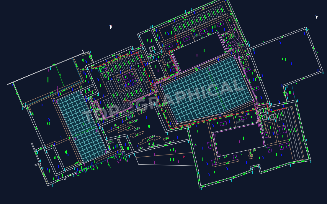
Example deliverable
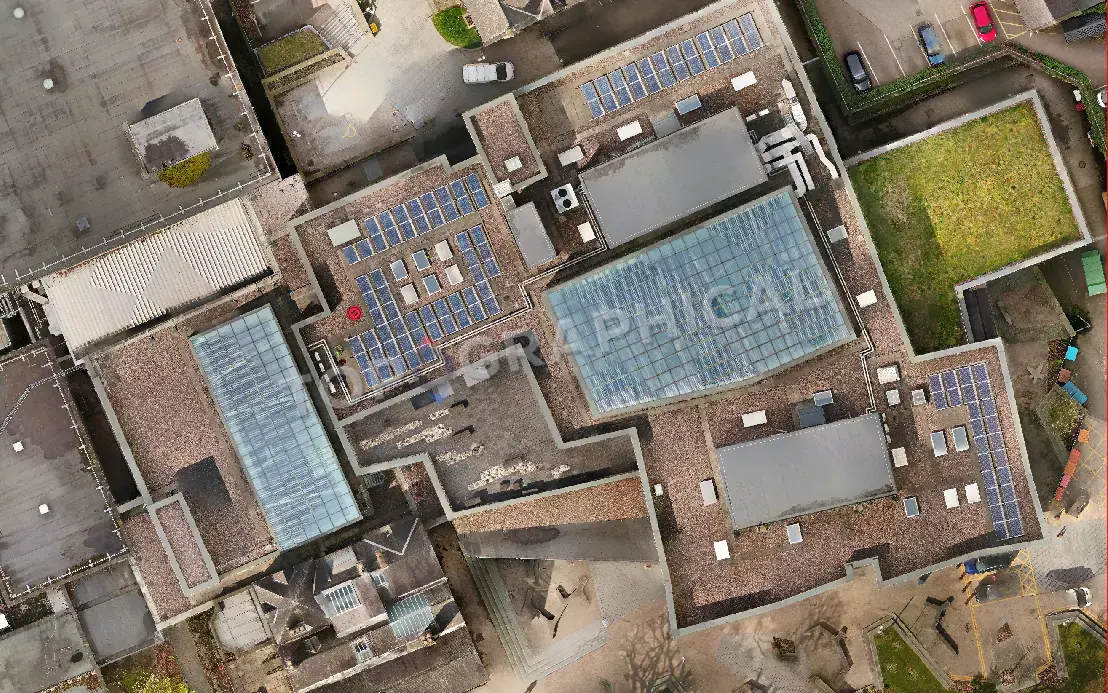
From registered scan to measured drawing
Roof detail should be specified before capture
Ridges, valleys, parapets, openings and visible plant are measured from accessible scan positions or aerial capture to the detail required for planning, retrofit or coordination.