Measured Building Surveys in South Yorkshire
A measured building survey in South Yorkshire starts with the drawings your project actually needs, not a scanner's maximum output. We use 3D laser scanning in accessible areas, register a point cloud and extract the agreed 2D plans, elevations and sections for a fixed price.
Main centres
Sheffield, Doncaster, Rotherham, Barnsley
Common site mix
Converted mills, terraced buildings, schools, civic property, workshops and occupied commercial premises.
A measured building survey in South Yorkshire starts with the drawings your project actually needs, not a scanner's maximum output. We use 3D laser scanning in accessible areas, register a point cloud and extract the agreed 2D plans, elevations and sections for a fixed price.
A converted Sheffield works may have repeated bays, later mezzanines and floor changes; a Barnsley conservation-area property may need its frontage read alongside the street; an occupied Doncaster school or Rotherham workshop may offer only short access windows. Those are different capture problems. The drawing schedule must respond to the building and its use rather than treating the county name as a standard package.
Decide what must be drawn
Plans usually establish wall positions, openings, columns, stairs, levels and fixed internal features at the agreed scale. Elevations can record facade openings, ledges, parapets, roof lines and visible material changes. Sections are most useful when their cut lines answer a design question, such as the relationship between floors, a stair, roof void or change in structure. We agree those lines before the visit rather than choosing them after capture.
Local heritage information can alter that schedule. Sheffield City Council maintains a local heritage list, while Doncaster, Barnsley and Rotherham publish guidance for historic buildings and conservation areas. Barnsley's guidance refers to buildings in their street context. For a relevant project, that may mean measuring neighbouring frontage, boundary features or a longer external elevation, but only where these are included in the brief and can be accessed.
Access sets the truthful limit
Laser scanning records visible surfaces from positions we can occupy safely. Keys, escorts, tenants, alarms and opening hours all affect room coverage. Roofs, lofts, basements, risers, plant rooms, ceiling voids and elevations facing third-party land need explicit access arrangements. Furniture, stored goods and operating machinery can obscure walls or floor junctions.
We mark inaccessible or obscured areas in the drawing record. The point cloud cannot reveal hidden fabric, concealed structure or construction behind finishes, and we do not invent it. Opening-up and intrusive investigation sit outside the measured survey unless separately organised by the project team.
What the fixed price covers
The quotation names the buildings and floors, external faces, drawing types, section locations, level of detail, scales and file formats. It includes the agreed attendance, laser-scanned capture, point-cloud registration and production of the listed 2D plans, elevations and sections. Tell us before quotation if the design team also needs roof plans, reflected ceiling plans, a registered point-cloud file or drawings tied to an external coordinate system.
What to send us
Send the address, building use, marked survey extent, required drawings and scales, preferred DWG or PDF setup, deadline and end use. Include existing plans even if they are old, but identify them as reference rather than measured truth. We also need the access contact, occupied hours, induction rules, keys or permits, parking arrangements and any asbestos or site safety information relevant to our visit.
Local references
We last checked these sources in July 2026. Planning guidance changes, so please send us the latest brief from your architect or consultant and we will price the right survey for your property.
- Sheffield local heritage assets (opens in a new tab)
- Doncaster design and conservation guidance (opens in a new tab)
- Barnsley development in conservation areas (opens in a new tab)
- Rotherham built heritage and archaeology (opens in a new tab)
- Doncaster planning application requirements (opens in a new tab)
Laser scanning and measured drawings
Example deliverable
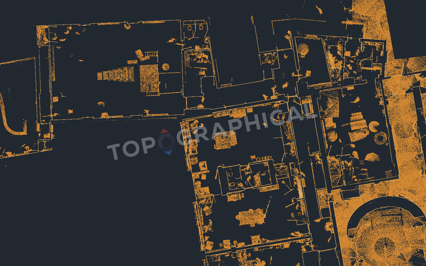
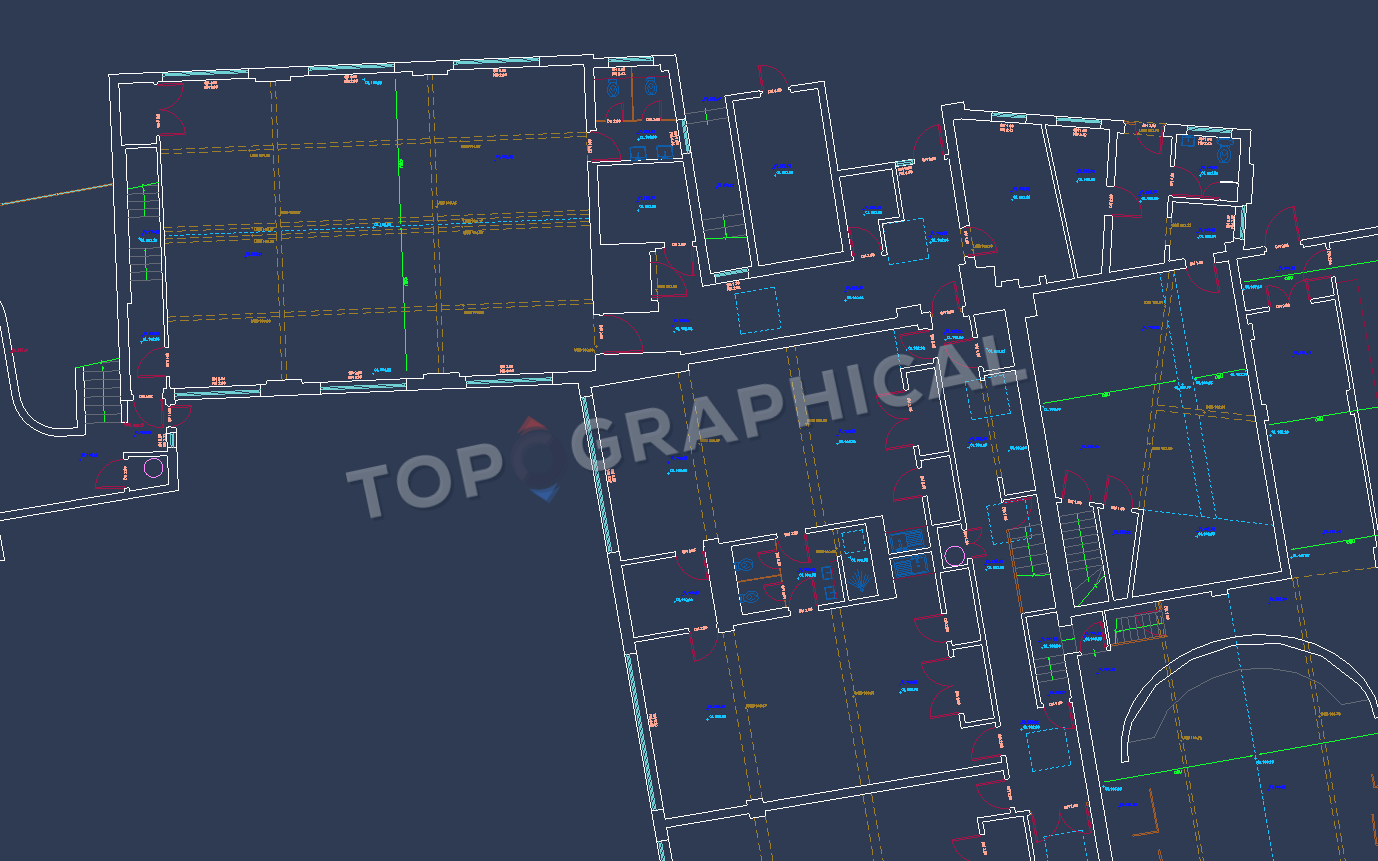
From registered scan to measured drawing
The point cloud is measured evidence; the plan is an interpretation
The registered scan records visible surfaces in 3D. The floor plan applies the specified cut plane and drawing conventions to walls, openings, circulation and fixed features.