Measured Building Surveys in Derbyshire
A Derby mill conversion, Buxton terrace and altered Matlock stone building each need a different mix of floors, external faces and section lines. We use 3D laser scanning to create a point cloud, then prepare the agreed 2D plans, elevations and sections for a fixed price.
Main centres
Derby, Chesterfield, Buxton, Matlock
Common site mix
Stone properties, listed buildings, mills, industrial premises, and multi-level interiors.
A Derby mill conversion, Buxton terrace and altered Matlock stone building each need a different mix of floors, external faces and section lines. We use 3D laser scanning to create a point cloud, then prepare the agreed 2D plans, elevations and sections for a fixed price.
A mill conversion is not a stone terrace
A conversion in a Derby mill, work to a Buxton terrace, alterations to a Matlock stone property and a fit-out in Chesterfield do not need the same record. We agree the floors, rooms, elevations, section lines, roof information, outbuildings and visible detail before attendance. If an authority or heritage consultant has issued a validation or recording request, send the exact wording rather than asking for a general conservation survey.
On site, overlapping scans are registered into the point cloud used by the drawing team. The commissioned 2D plans, elevations and sections are checked against that measured record before issue. The point cloud supports drawing production; it does not mean every object, service or concealed construction has been interpreted.
Use heritage context to choose visible detail
Derby City Council, the Derbyshire district and borough councils, and the Peak District National Park Authority each administer buildings in their own area. Before quoting, we check the address so the drawing schedule can respond to the relevant conservation, listing or application context without pretending to give planning advice.
For a building in a Derby City Council conservation area or a listed property administered by the Peak District National Park Authority, the architect may need street-facing elevations, roof forms, chimneys, boundary walls, attached structures or selected internal historic details. Those items are not added automatically. They are included when the project brief names them and access allows them to be measured.
Access, occupation and hidden fabric
Tell us whether the property is occupied, alarmed, tenanted or in use, and who can open it. Basements, lofts, roof voids, plant rooms, risers, locked units, fragile floors and elevations viewed only from neighbouring land all need an access decision. We identify inaccessible areas in the survey record rather than filling gaps by assumption.
Laser light records visible surfaces. It cannot see behind plaster, panelling, ceilings, fixed furniture or finishes, and it does not reveal hidden fabric or prove structural build-up. Opening-up, condition diagnosis, structural appraisal and material investigation sit outside a measured building survey unless another professional is separately appointed.
What the fixed price covers
The fixed price covers one agreed attendance under the stated access assumptions, registration of the scan data, and production of the named drawings at the quoted scale and detail. The quotation states the building extent, 2D formats, plans, elevations, sections, level information and any roof or external context included.
Planning or listed-building consent advice, heritage assessment, structural opinion, measured areas that cannot be entered, return visits and extra drawings are excluded unless written into the quotation. We flag omissions plainly so the design team knows where further access or investigation is needed.
What to send us
Send the property address, building use, marked survey extent, proposed work, architect's drawing list, required formats and scales, access arrangements and programme. Add existing plans, heritage correspondence and a note of any basement, roof, tenancy or neighbour-access issue. We will turn that information into a defined output schedule and fixed price.
Local references
We last checked these sources in July 2026. Planning guidance changes, so please send us the latest brief from your architect or consultant and we will price the right survey for your property.
- Derbyshire local government reorganisation (opens in a new tab)
- Peak District planning authority (opens in a new tab)
- Derby City planning application requirements (opens in a new tab)
- Derby City conservation areas (opens in a new tab)
- Peak District conservation areas (opens in a new tab)
- Peak District listed buildings (opens in a new tab)
Laser scanning and measured drawings
Example deliverable
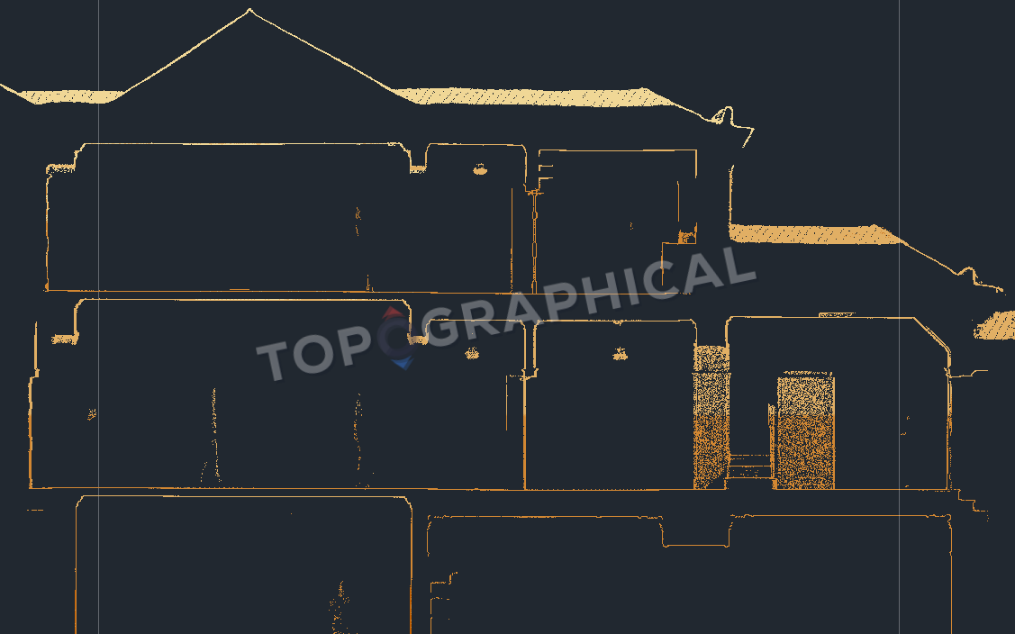
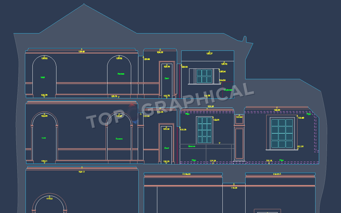
From registered scan to measured drawing
A section fixes vertical relationships on one drawing
Floor levels, openings, structure and roof heights are extracted along a specified cut line, exposing relationships a plan cannot show.