Measured Building Surveys in Staffordshire
An occupied Staffordshire factory or former pottery can be easy to scan badly: the open floor gets covered, while the roof changes, plant rooms and altered bays that matter remain inaccessible. We agree those priorities first, then use 3D laser scanning to build a registered point cloud and produce the specified 2D plans, elevations and sections for a fixed price.
Main centres
Stoke-on-Trent, Stafford, Burton upon Trent, Lichfield
Common site mix
Industrial buildings, historic town property, rural estates, schools, and mixed housing.
An occupied Staffordshire factory or former pottery can be easy to scan badly: the open floor gets covered, while the roof changes, plant rooms and altered bays that matter remain inaccessible. We agree those priorities first, then use 3D laser scanning to build a registered point cloud and produce the specified 2D plans, elevations and sections for a fixed price.
Draw the alteration history that affects the scheme
Industrial buildings around Stoke-on-Trent often contain blocked openings, added floors, repeated structural bays and roof junctions from different periods. In Burton upon Trent or Stafford, an occupied warehouse or office may also have several tenants and fit-outs. The architect should identify which columns, wall faces, level changes, facade openings and roof relationships the proposed work depends on.
The drawing schedule converts that need into outputs. Plans may cover selected floors or the whole building; elevations may be limited to altered faces; sections should pass through the stair, roof, floor change or structural bay under design. Decorative detail, reflected ceilings, services and small fittings are not implied by the scanner's presence. They are included only when named.
Make access follow the drawing list
A complete room list is more useful than a general promise of access. Tell us about production shifts, tenants, alarms, safeguarding, escorts and parking. Confirm keys and permits for basements, lofts, roof spaces, plant rooms, risers, locked units, yards and neighbour-controlled elevations. We can phase capture around occupation when that arrangement is priced in advance.
Each scan records surfaces visible from its position. The registered point cloud connects those views into a common measured reference, but it cannot reveal hidden fabric behind linings, ceilings, fixed joinery or stored goods. Concealed structure and wall build-up need opening-up by the appropriate professional. We mark inaccessible or obscured areas instead of extending repeated geometry into them.
Stoke-on-Trent City Council's conservation and Article 4 pages help the project team check whether external features may need closer attention. That check may lead the architect to add a street elevation, roof form, chimneys or boundary structures to the drawing schedule; our measured survey does not give heritage or consent advice.
Within the Peak District National Park Authority area, listed-building guidance also reminds owners that protection can apply inside as well as outside. If the heritage adviser needs selected internal features recorded, those drawing details and the rooms containing them must be named and made accessible before capture.
What the fixed price covers
The fixed price covers the stated building extent, attendance under the written access assumptions, scan registration and the drawing list named in the quotation. It records the plans, elevations, sections, formats, scales, level detail and any roof, outbuilding or external context that will be delivered.
Unentered areas, return visits, extra sheets, heritage statements, consent advice, condition surveys and structural assessment are outside that price unless specifically added. Any access gap is reported so nobody mistakes an unmeasured area for a verified one.
What to send us
Send the property address, current use, proposed work, marked extent, architect's drawing schedule, file formats, scales, access contact and deadline. Existing plans can show room names, tenancy boundaries and intended section cuts even when their dimensions are unreliable. Add the occupation timetable, induction rules and any conservation correspondence that affects the requested record.
Local references
We last checked these sources in July 2026. Planning guidance changes, so please send us the latest brief from your architect or consultant and we will price the right survey for your property.
Laser scanning and measured drawings
Example deliverable
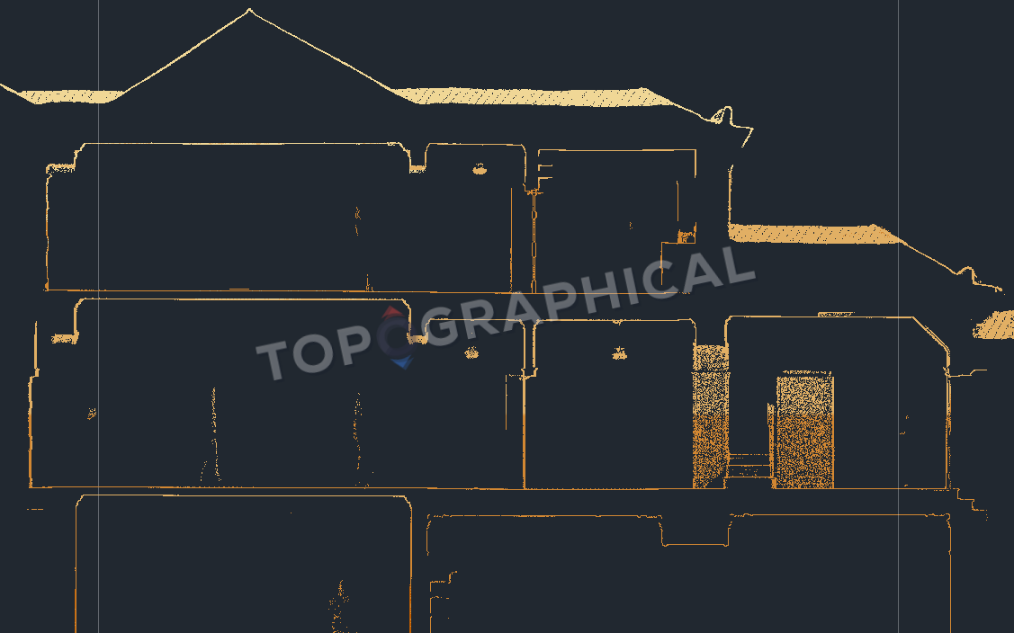
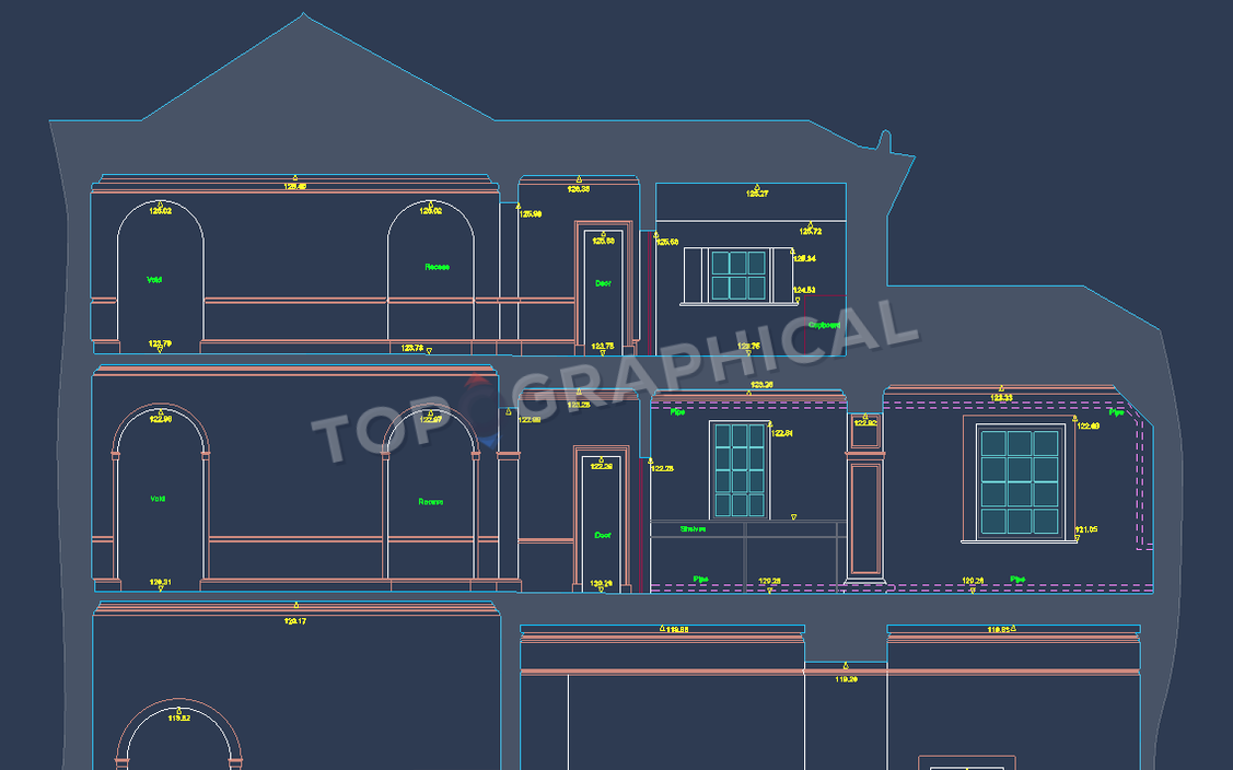
From registered scan to measured drawing
A section fixes vertical relationships on one drawing
Floor levels, openings, structure and roof heights are extracted along a specified cut line, exposing relationships a plan cannot show.