Measured Building Surveys in the West Midlands
We use 3D laser scanning in accessible areas of West Midlands buildings, register the point cloud and extract the agreed 2D plans, elevations and sections. The quotation fixes the measured extent, drawing list, access assumptions and price before the survey begins.
Main centres
Birmingham, Coventry, Dudley, Sandwell, Solihull, Walsall, Wolverhampton
Common site mix
City-centre commercial buildings, factories, schools, interwar housing, listed property and occupied mixed-use premises.
We use 3D laser scanning in accessible areas of West Midlands buildings, register the point cloud and extract the agreed 2D plans, elevations and sections. The quotation fixes the measured extent, drawing list, access assumptions and price before the survey begins.
Existing drawings often answer the wrong question. A landlord's plan may omit wall thicknesses and levels; a fire plan may simplify stairs and openings; an old construction set may not contain later fit-outs. Across Birmingham City Council, Coventry City Council, Dudley Metropolitan Borough Council, Sandwell Metropolitan Borough Council, Solihull Metropolitan Borough Council, Walsall Council and City of Wolverhampton Council areas, buildings are frequently occupied, extended or divided between users. The measured record must reflect the present visible building and identify where access prevented that record from being complete.
Specify the decisions, not just the floors
An architect planning internal alterations may need wall faces, doors, windows, columns, stairs, sanitary fittings and floor levels. Facade work may require selected elevations with openings, ledges, parapets, roof lines and visible materials. Sections should be cut through the relationships under design, such as a stair, split level, roof, atrium or change between original and added structure. We agree scales and graphic detail before capture so the output is usable in the consultant's CAD setup.
Local planning material can shape this list without replacing the design brief. Birmingham and Coventry publish heritage guidance; Dudley Metropolitan Borough Council and Sandwell Metropolitan Borough Council describe their historic areas; Walsall, Wolverhampton and Solihull maintain conservation information. Where the heritage or planning adviser wants street context, curtilage structures or neighbouring frontage, those elements need to be named in the drawing schedule and accessible. Our survey provides measurement, not a statement of significance or building condition.
Plan occupation before the scanner arrives
Give us an access schedule for every included room and external face. Commercial tenants, school sessions, secure production areas, reception procedures and alarms may dictate a phased visit. Basements, lofts, roofs, risers, plant rooms and locked stores need keys, permits or a suitable escort. Courtyard and rear elevations can depend on neighbouring access; vehicles, shelving and machinery can block lower surfaces.
The registered point cloud records visible surfaces from safe scanner positions. It does not expose hidden fabric, concealed services, wall build-ups or covered structure. We mark rooms and areas that were inaccessible or materially obscured and do not infer their geometry.
What the fixed price covers
The quotation lists the included buildings, floors, rooms and external faces, section positions, drawing scales, feature detail and output formats. It covers agreed attendance, laser scanning, point-cloud registration and extraction of the stated 2D plans, elevations and sections. Point-cloud delivery, roof plans, reflected ceiling plans, specialist schedules or work to a detailed client CAD manual are included only if written into that list.
What to send us
Send the full property address, present use, proposed work, marked extent and drawing schedule. Add required scales, DWG and PDF conventions, target date and existing plans for orientation. For access, provide the site contact, opening hours, tenant arrangements, induction rules, keys, permits, parking, relevant asbestos or safety information and the route to every loft, basement, roof and external face in scope.
Local references
We last checked these sources in July 2026. Planning guidance changes, so please send us the latest brief from your architect or consultant and we will price the right survey for your property.
- Birmingham heritage guidance (opens in a new tab)
- Coventry heritage statement guidance (opens in a new tab)
- Dudley conservation area appraisals (opens in a new tab)
- Sandwell historic areas (opens in a new tab)
- Walsall listed buildings and conservation (opens in a new tab)
- Wolverhampton conservation and heritage guidance (opens in a new tab)
- Solihull conservation areas (opens in a new tab)
- Coventry planning application checklist (opens in a new tab)
Laser scanning and measured drawings
Example deliverable
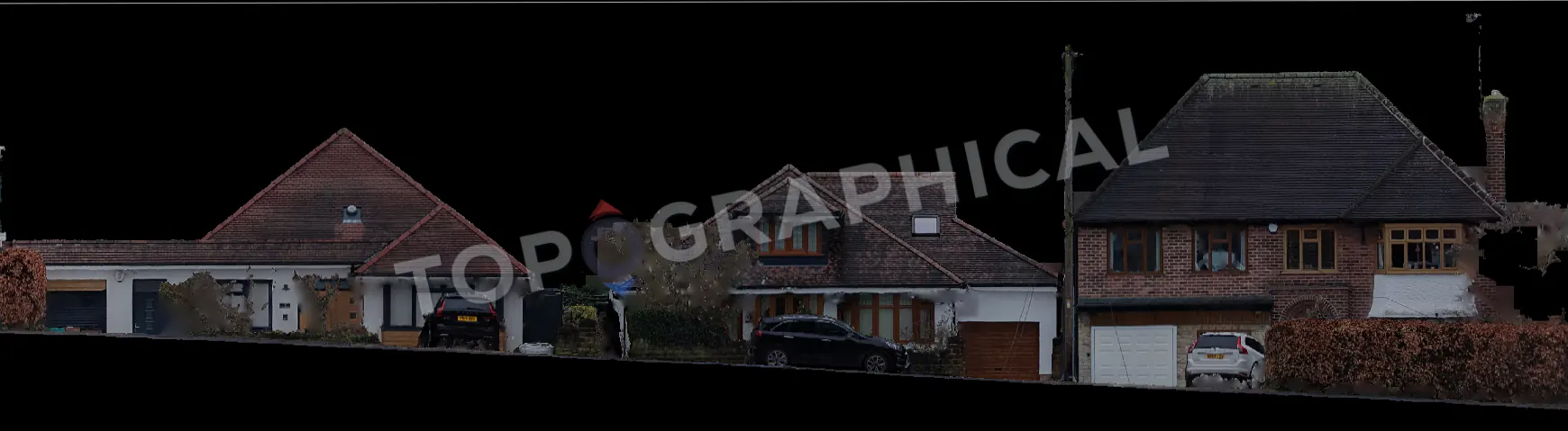
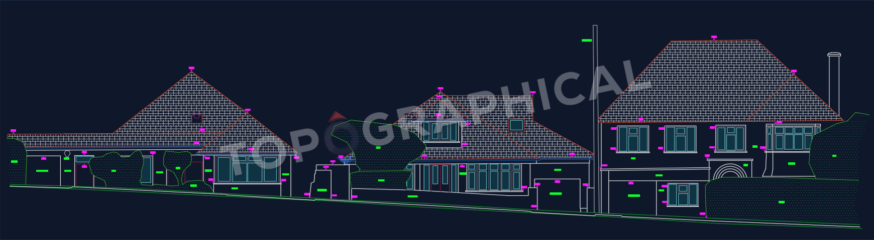
From registered scan to measured drawing
A facade is more useful when the ground comes with it
The drawing relates facade openings and heights to ground levels and adjoining buildings, so the elevation does not float without its street context.