Topographical Surveys in the West Midlands
A West Midlands topographical survey should give the design team one coordinated 2D plan and 3D model of the agreed site and its relevant edges. We set a fixed price after confirming the boundary, visible detail, level strategy, access controls and digital formats.
Main centres
Birmingham, Coventry, Dudley, Sandwell, Solihull, Walsall, Wolverhampton
Common site mix
Urban infill, brownfield land, occupied commercial sites, highway edges, canals and tightly bounded residential plots.
A West Midlands topographical survey should give the design team one coordinated 2D plan and 3D model of the agreed site and its relevant edges. We set a fixed price after confirming the boundary, visible detail, level strategy, access controls and digital formats.
The first scoping problem is usually at the edge. An urban plot can place a retaining wall, neighbour, footway, service yard and proposed entrance within a few metres. If the brief names only the development boundary, the drawing can miss the off-site relationship that controls access, drainage or massing.
Survey the edges as well as the centre
Ask the architect and engineer what must be tied to the site. Highway levels may need to follow the kerb and footway past the proposed access. Drainage design may need a continuous run through channels, thresholds and visible covers. Daylight or massing work may require adjoining ridge, eaves and window positions. Trees, boundary construction, wall tops and bases, ramps and abrupt surface changes should be specified where they affect the proposal.
Birmingham City Council, Coventry City Council, Dudley Metropolitan Borough Council, Sandwell Metropolitan Borough Council, Solihull Metropolitan Borough Council, Walsall Council and City of Wolverhampton Council each deal with planning in their own area. Their application and heritage pages help the appointed consultant identify what must be shown. Our survey brief follows that address-specific request rather than applying one metropolitan checklist.
For example, Solihull Metropolitan Borough Council's validation material refers to boundaries, adjoining buildings, roads, paths and site features, while Dudley, Sandwell and Walsall publish their own application routes. A consultant may therefore ask for a longer highway tie, more neighbour context or a particular boundary feature. That additional measurement belongs in the marked extent before we price.
Working sites need an access method
Occupied factories, retail yards, schools and car parks cannot always be treated as open ground. Tell us about inductions, escorts, reversing vehicles, loading periods, locked compounds and hours when critical surfaces are clear. For highway-side measurements, identify any traffic-management requirement. Permission for neighbouring land, internal courtyards or service roads must be settled before the visit.
We show the limit of safe access and any material obstruction. Data is not extended through buildings, dense vegetation or inaccessible operational areas as though it had been observed.
What the fixed price covers
The written quotation sets out the survey extent, feature list, level density, control basis, site attendance and file issue. Our usual design package is a coordinated 2D topographical plan and 3D model in the agreed CAD formats, with PDFs when requested. It records the coordinate and level basis and identifies survey limits, helping every consultant work from the same measured origin.
We do not lift covers, measure inverts, trace buried utilities, carry out GPR or CCTV drainage surveys, or provide planning advice. A plan symbol for a visible cover is not a utility trace or statement about the chamber below it.
What to send us
Send the precise address, marked boundary, proposed work, consultant's survey specification, output formats and deadline. Include current or old CAD, planning or title plans, the access contact, operational restrictions, hazards and third-party permissions. Mark any required off-site highway levels, neighbour elevations, drainage routes or section lines so those measurements are priced from the outset.
Local references
We last checked these sources in July 2026. Planning guidance changes, so please send us the latest brief from your architect or consultant and we will price the right survey for your site.
- Birmingham planning application requirements (opens in a new tab)
- Coventry planning application checklist (opens in a new tab)
- Dudley making a planning application (opens in a new tab)
- Sandwell planning applications (opens in a new tab)
- Solihull national validation checklist (opens in a new tab)
- Walsall planning permission applications (opens in a new tab)
- Wolverhampton conservation and heritage guidance (opens in a new tab)
- Environment Agency Flood Map for Planning (opens in a new tab)
Survey control
Drone capture
Surface and volume models
Example deliverable
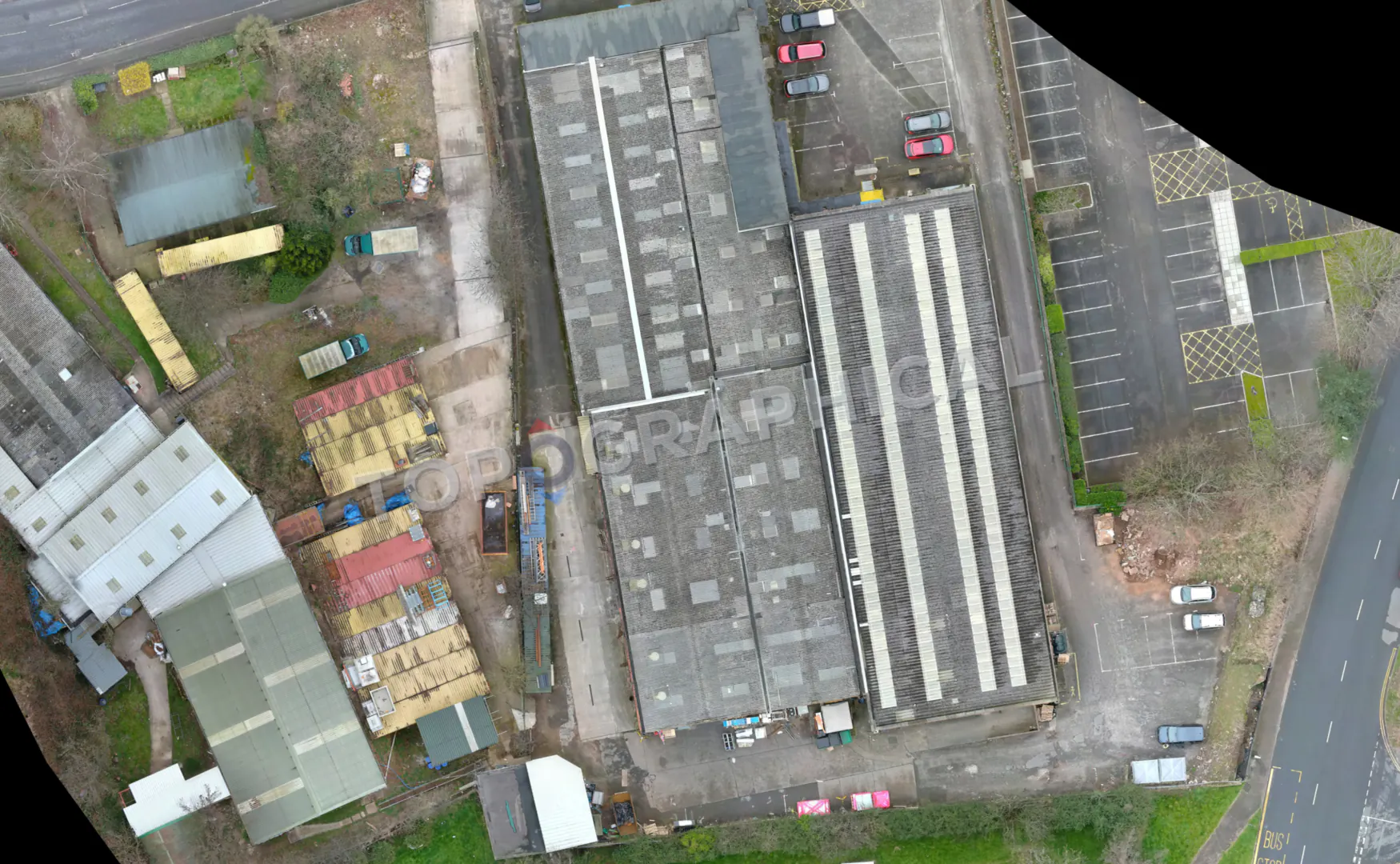
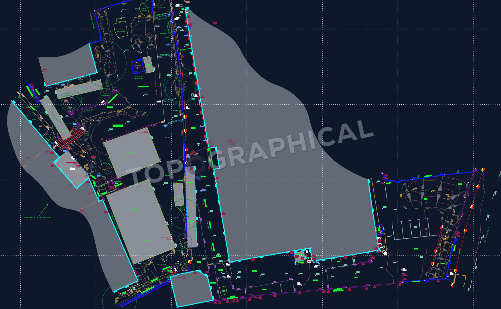
From measured site to topographical drawing
An operational site needs more than its building outline
The drawing separates structures, kerbs, hardstanding, surface changes, visible drainage covers and access routes within one coordinate and level framework.