Topographical Surveys in Northamptonshire
A Northamptonshire topographical survey has to answer the design brief across river-valley sites, former industrial land, growing settlements and busy transport corridors. We settle the survey extent, coordinated 2D plan, 3D model, access assumptions and fixed price before fieldwork starts.
Main centres
Northampton, Kettering, Corby, Wellingborough
Common site mix
Town-centre redevelopment, logistics land, residential estates, and rural edge sites.
A Northamptonshire topographical survey has to answer the design brief across river-valley sites, former industrial land, growing settlements and busy transport corridors. We settle the survey extent, coordinated 2D plan, 3D model, access assumptions and fixed price before fieldwork starts.
Follow the level route, not just the red line
The River Nene and the Upper Nene Valley run through both authority areas. Around Northampton, Wellingborough and the valley's gravel pits, drainage work may depend on the measured relationship between thresholds, low points, banks, ditches and existing outfalls. West Northamptonshire Council sets local flood-risk expectations for new development in the Upper Nene catchment. That does not make every nearby survey identical: the drainage consultant must specify the boundary, datum and features needed for the particular assessment.
Corby and Kettering bring a different mix of large industrial plots, redevelopment land and estate roads. Northampton sites near the M1, and North Northamptonshire sites influenced by the A14, may need frontage, visibility or off-site tie-in detail. Live traffic, ownership and permission decide what can be safely measured beyond the property. These issues belong in the brief before the price is fixed.
Rural sites towards Daventry or East Northamptonshire can contain banks, ridge-and-furrow, field ditches and settlement-edge level changes that broad mapping will not resolve. We use survey control and breaklines to show the actual shape of accessible ground, without presenting planning policy or third-party records as measured evidence.
Check which council issued the requirement
North Northamptonshire Council covers Corby, Kettering, Wellingborough and the former East Northamptonshire area. West Northamptonshire Council covers Northampton, Daventry, Towcester, Brackley and the surrounding villages. Their application pages ask for supporting information according to the proposal and its constraints. Your architect, engineer or planning consultant should identify whether that means site sections, existing levels, highway detail, trees, drainage features or wider context, and we will turn the written requirement into measurable items.
What the fixed price covers
- A coordinated 2D topographical plan and 3D terrain model in the agreed formats.
- The stated survey boundary, coordinate system, level datum, accuracy and programme.
- Ground levels, breaklines, buildings, hard surfaces, visible boundaries, trees and named drainage or street features.
- Agreed highway frontage or adjoining context where access, permission and safe working allow measurement.
Visible service-cover locations and top levels can be surveyed when requested. We do not lift covers, measure inverts, trace utilities, undertake GPR or CCTV drainage investigations, establish legal boundaries, write flood assessments or make below-ground inferences.
What to send us
Send the address, an extent drawing, the intended use, required file formats, access and parking information, site contacts and the latest consultant brief. Add any drainage strategy, highway sketch, tree schedule or planning note that defines information outside the obvious property boundary.
The quote will list the deliverables, assumptions, exclusions and delivery date. The price is fixed, not based on elapsed survey time.
Local references
We last checked these sources in July 2026. Planning guidance changes, so please send us the latest brief from your architect or consultant and we will price the right survey for your site.
- North Northamptonshire planning application guidance (opens in a new tab)
- West Northamptonshire planning application guidance (opens in a new tab)
- New Local Plan for North Northamptonshire (opens in a new tab)
- New Local Plan for West Northamptonshire (opens in a new tab)
- West Northamptonshire flood risks for developers (opens in a new tab)
- Environment Agency Flood Map for Planning (opens in a new tab)
Survey control
Drone capture
Surface and volume models
Example deliverable
From measured site to topographical drawing
One coordinate framework across ground, features and levels
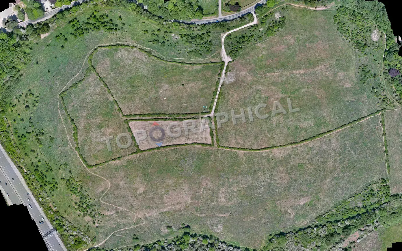
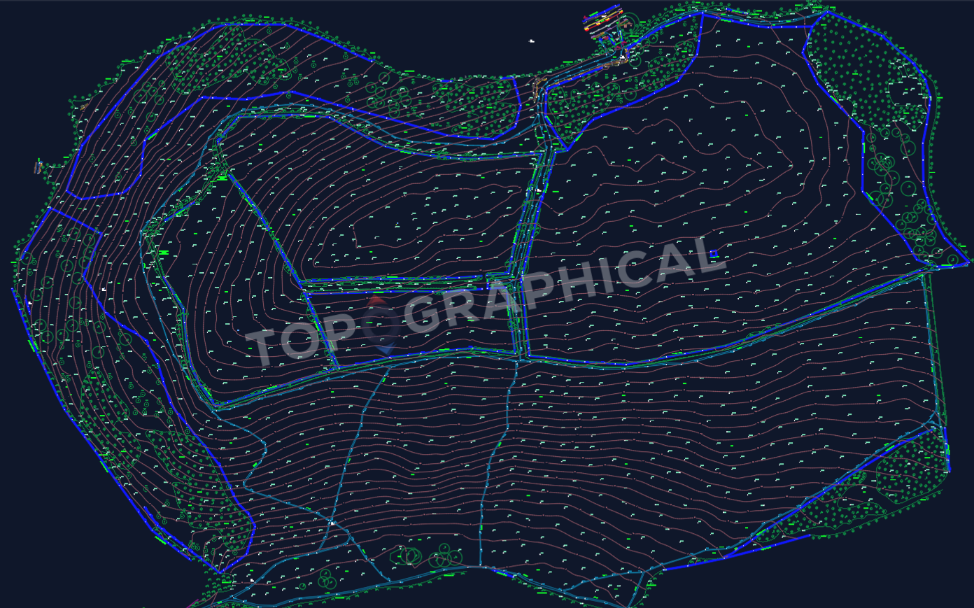
The left view is site imagery. The right shows linework and levels compiled from the full measured dataset, not traced from the photograph.