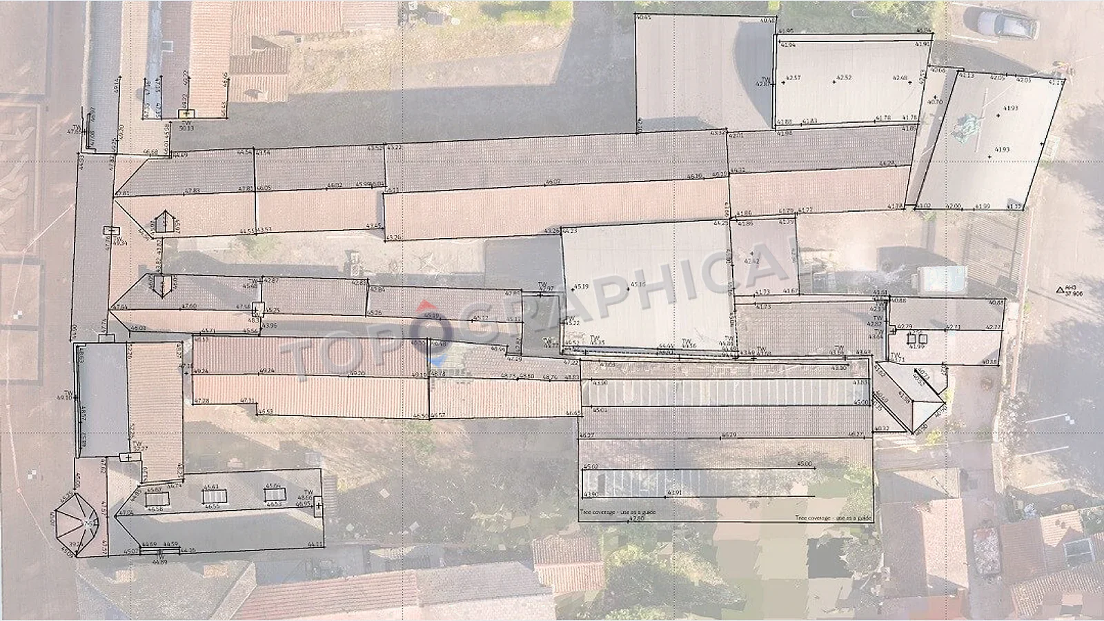
Coordination Failures: When Disciplines Work from Different Bases
How uncoordinated base plans create planning, drainage, landscape, and design clashes that a shared topographic survey can prevent.
Never let multiple disciplines generate their own uncoordinated base plans. Commission a topographic survey at project inception and mandate that the architect, arboriculturist, and drainage engineer all use it as their single spatial truth to prevent expensive downstream clashes.
The scenario is always the same. The architect produced their existing plans from a tape measure survey conducted two years ago. The arboriculturist plotted tree positions from a handheld GPS and a local baseline they established from a fence post. The drainage engineer used OS contour data for their surface water calculations. The landscape architect traced boundary positions from the title plan. And the topographic survey, commissioned late as a "planning requirement," arrives to reveal that none of these independently produced datasets agree with each other, because they were never spatially coordinated, because they were each produced in isolation on different dates with different instruments at different accuracies to different datums.
The drainage engineer's surface water flow path crosses a tree that the arboriculturist plotted 3 metres from where the topographic survey shows it. The landscape architect's planting scheme sits partially outside the boundary because the title plan extent does not match the physical fence position. The architect's existing building footprint is rotated 1.5 degrees from the surveyed position because their tape measurements accumulated a systematic angular error over the building's length. And the planning submission, which combines all of these disciplines' outputs onto a single drawing, presents a site plan that is geometrically incoherent: a composite of incompatible spatial data wearing the costume of a coordinated design.
The planning officer may or may not notice. The contractor definitely will.
Why this happens (and why it keeps happening)
The root cause is not incompetence. It is procurement sequence. On a well-managed project, the topographic survey is commissioned first, and every subsequent discipline works from that survey as their spatial base. The tree positions are plotted on the survey. The drainage strategy uses the survey levels. The architect designs from the survey plan. The landscape architect uses the survey boundaries. Everything shares a coordinate system, a datum, and a common spatial framework.
On a poorly managed project (which is to say, a normal project under budget pressure, where every discipline was appointed independently at different times by different people with different procurement priorities), each discipline generates their own base information because no shared base exists when they begin their work. The architect starts before the survey is commissioned. The arboriculturist visits site independently and creates their own coordinate framework. The drainage engineer cannot wait for the survey and uses the best available data (OS mapping). Each produces competent work within their own spatial framework. The problem emerges only when someone attempts to overlay the outputs and discovers they do not align.
The specific failures (with dimensions)
Tree positions. A handheld GPS in tree canopy achieves approximately plus or minus 2 to 5 metres horizontal accuracy. A survey-grade GNSS receiver or total station achieves plus or minus 10mm to 20mm. The difference between these accuracies means that a tree plotted by the arboriculturist using handheld GPS might be shown 3 to 4 metres from its actual position. If that tree has a root protection area of 6 metres radius, and the proposed building is designed to sit just outside the RPA based on the incorrect position, the building may in fact be within the RPA when measured against the surveyed tree position. This is not a theoretical scenario. It is the single most common reason that arboricultural impact assessments are revised post-survey.
Boundary positions. A boundary position scaled from a title plan carries an uncertainty of approximately 300mm to 500mm (depending on scale and plotting accuracy). A boundary feature measured by a surveyor with a total station carries an uncertainty of approximately 10mm to 20mm. A building designed to sit 1 metre from the boundary (based on the title plan position) may, when measured against the surveyed fence line, sit 600mm from the boundary, which may breach the local authority's minimum separation requirement or encroach on the neighbour's root protection zone.
Levels. OS contour data (derived from airborne LiDAR at 5m posting with plus or minus 150mm vertical accuracy) shows a site as essentially flat. A survey-grade topographic survey of the same site reveals a 1.2m fall from front to rear that the OS data was too coarse to resolve. The drainage strategy designed on the assumption of a flat site (requiring pumped discharge) could, with accurate levels, gravity-drain to the rear, saving the capital cost of a pumping station and the lifetime maintenance liability.
Spatial Discrepancy Matrix: When Disciplines Don't Coordinate
| Discipline / Data Source | Typical Accuracy | Consequence When Overlaid on Survey |
|---|---|---|
| Arboriculturist (Handheld GPS) | ± 2m to 5m | Trees plotted inside proposed building footprints or outside root protection areas |
| Landscape Architect (Title Plan) | ± 300mm to 500mm | Planting schemes encroaching on neighbour boundaries |
| Drainage Engineer (OS Contours) | ± 150mm vertical (coarse grid) | Gravity drainage paths incorrectly specified as requiring pumped discharge |
| Architect (Tape Measure) | Accumulating angular error | Building footprint rotation compounding over length, leading to site boundary clashes |
The financial cost of non-coordination
The cost is not measured in the discrepancy itself. It is measured in the revision required to resolve it:
- The architect revising their design to account for the actual tree positions (which are now closer to the building than they appeared on the arboriculturist's plan)
- The drainage engineer recalculating their surface water strategy because the actual site levels differ from the OS data they used
- The landscape architect adjusting their planting plan because the boundary sits 400mm from where the title plan showed it
- The planning consultant resubmitting drawings because the overlay of revised discipline outputs requires updated site plans and sections
Each revision costs professional fees and programme time. On a residential scheme of moderate complexity, the cumulative cost of post-coordination revision across all disciplines routinely exceeds £5,000 to £15,000 in abortive professional fees and programme delay (an indicative baseline based on standard industry parameters). The topographic survey that would have prevented all of it typically costs between £1,000 and £2,500.
The fix (which is also the prevention)
Commission the topographic survey before any other discipline begins their work. Provide the survey data (in CAD format, on a stated coordinate system, with a clear datum) to every discipline as their spatial base. Instruct each consultant to work from the survey rather than generating their own base information.
Specifically:
- Architect: Receives the survey as their existing site plan. Designs from it. Does not need to produce their own measurements.
- Arboriculturist: Receives the survey with tree positions already plotted to BS 5837 standard. Adds their categorisation, assessment, and recommendations to the spatial data that already exists. Does not need to re-survey tree positions.
- Drainage engineer: Receives the survey levels as their terrain model. Calculates flow paths from measured data. Does not need to approximate from OS contours.
- Landscape architect: Receives the survey boundaries and levels. Designs planting and hard works within measured constraints. Does not need to scale from the title plan.
- Flood risk consultant: Receives the survey levels in metres AOD. Produces the FRA from measured data. Does not need to state caveats about data quality.
The cost of the survey is incurred once. The benefit (spatial coordination across all disciplines, elimination of revision costs, a planning submission that is geometrically consistent) recurs at every project stage from concept to construction.
The project manager's responsibility
If you are managing a project and you have appointed an architect, a drainage engineer, a landscape architect, and an arboriculturist, and none of them are working from the same spatial base, the coordination failure is not a technical problem. It is a procurement problem, and it is yours.
The fix is a single line in the project inception meeting minutes: "Topographic survey to be commissioned this week. All disciplines to work from the survey data as their spatial base. No independent base information to be generated." That instruction costs nothing to give and prevents the entire category of spatial disagreement that plagues projects where each discipline operates in its own coordinate universe, producing internally consistent work that fails catastrophically the moment it must coexist with everyone else's.
Frequently Asked Questions (FAQ)
Why do different consultants use different base plans? Because of disjointed procurement sequences. When disciplines are appointed independently under budget pressure, they use the cheapest available data (like OS maps or title plans) rather than waiting for a coordinated topographic survey.
How much does non-coordination actually cost? The abortive professional fees, redesign time, and programme delays routinely exceed £5,000 to £15,000 on moderate schemes. The topographic survey that prevents these issues costs a fraction of that amount.
How do we enforce spatial coordination? Make it a contractual requirement at the inception meeting. State explicitly: "Topographic survey will be commissioned; all disciplines must use this data as their sole spatial base."
Ready to brief a survey?
Draw your site, define the scope, and receive a fixed-price quote.
Start a Survey Quote