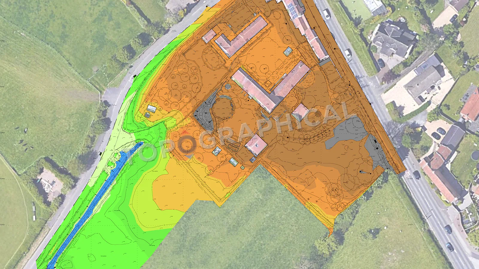
Cut and Fill: Why Earthworks Budgets Depend on Survey Accuracy
Why small level errors can become large earthworks cost variances, and why survey-grade terrain data matters before volume calculations.
Never run cut-and-fill calculations on coarse OS data or unverified base plans. A mere 50mm error in existing ground levels across a 1-hectare site creates a 500 cubic metre volume discrepancy, potentially adding tens of thousands of pounds to your muck-away costs.
At a typical muck-away rate of £20 to £40 per cubic metre for disposal, haulage, and landfill tax (an indicative baseline based on standard industry parameters), an error of 50mm in your existing ground level across a one-hectare site produces a volume discrepancy of approximately 500 cubic metres. At the lower disposal rate, that is a £10,000 variance. At the upper rate, £20,000. Arising not from a design change, not from unforeseen ground conditions, not from scope creep, but from the topographic survey being wrong by less than the height of a standard kerb.
This is the arithmetic that civil engineers live with every time they run a cut-and-fill calculation against a terrain model whose source data they did not commission and whose accuracy they cannot verify. And because the terrain model is typically inherited from the architect (who inherited it from whoever produced the site plan, which may or may not have been derived from a survey-grade source), the engineer performing the volume calculation often has no visibility of the measurement uncertainty embedded in the numbers they are working with.
How cut-and-fill calculations work (and where error enters)
The calculation itself is straightforward. You have an existing surface (derived from the topographic survey) and a proposed surface (derived from the engineer's design). The software compares the two, identifies where the proposed surface is below the existing (cut) and where it is above (fill), and computes the volumes. The result tells you how much material to remove, how much to import, and (if you are fortunate) how close the two are to balancing, which minimises off-site disposal and import costs.
Error enters at the existing surface. If the topographic survey captured levels at too sparse a grid (missing the localised high point that would have been cut, or the depression that needs less fill than the model suggests), the volume calculation is based on an interpolated surface that does not represent the actual terrain. If the levels themselves carry an uncertainty of plus or minus 50mm (which low-grade GPS data or scaled OS contours easily could), that uncertainty propagates through every cubic metre calculation as a systematic bias.
On a 10,000 square metre site, 50mm of systematic error in one direction produces a 500 cubic metre phantom volume that either exists in the calculation but not on site (you budget for disposal that never materialises), or exists on site but not in the calculation (you discover 500 cubic metres of unexpected material that needs removing and you have not priced for it).
What survey-grade accuracy means for earthworks
A topographic survey captured with a total station or survey-grade GNSS delivers spot levels with a vertical accuracy of plus or minus 15mm to 20mm. At that precision, a terrain model generated from the survey data represents the actual ground surface with a fidelity that supports engineering volume calculations without requiring the engineer to add contingency for measurement uncertainty.
The density of capture matters as much as the accuracy of individual points. A sparse grid (levels every 20m on a site with significant terrain variation) will miss features that a denser grid captures: the ridge between two low points, the localised hollow where a soakaway has collapsed, the ramp where the ground rises sharply at a boundary retaining wall. Every missed feature is a volume discrepancy between the model and reality, discovered only when the excavator operator reports that the ground is not at the level the drawing said it would be.
For earthworks-critical projects, the topographic survey specification should reflect the engineering requirement: adaptive grid density (closer spacing in areas of terrain variation, relaxed spacing on uniform ground), breaklines at every change of gradient, and sufficient density to generate a triangulated surface model that faithfully represents the ground without excessive interpolation between sparse data points.
The coordination between surveyor and engineer
The civil engineer designing the earthworks strategy and the surveyor capturing the existing terrain should be in communication about:
Grid density and breakline requirements. The engineer knows where the critical earthworks interfaces are (platform edges, road corridors, retaining wall lines) and can specify that the survey captures additional density at those locations. A surveyor working to a standard topographic specification will capture a site-wide grid appropriate for general design purposes, but may not provide the additional density along a specific corridor where the engineer needs sub-decimetre surface accuracy for a drainage fall calculation.
Datum and coordinate system. The design model and the survey model must share a coordinate system and a vertical datum. This sounds obvious, but the scenario where the architect's design is in one coordinate system, the surveyor's data is in another, and the volume calculation produces results that are systematically offset by the transformation error, is not rare. Agree the datum at the outset. Use the same datum throughout. State it on every drawing and every model.
Deliverable format. The engineer running the volume calculation needs the survey data in a format their software can consume directly: a DTM (digital terrain model) or a set of points and breaklines that their package (Civil 3D, n4ce, MX, or equivalent) can surface without manual reworking. A survey delivered only as a 2D plan with spot levels printed as text annotations requires the engineer to manually re-enter those levels into their model, which is both time-consuming and error-prone.
What the topographic survey should deliver for earthworks purposes
For any project where cut-and-fill calculations will drive design decisions, cost estimates, or contractor pricing, the survey should provide:
- A 3D model (triangulated surface or point/breakline dataset) in a format compatible with the engineer's design software
- Spot levels at adaptive density reflecting terrain variation, with breaklines at all changes of gradient
- Levels at all boundary interfaces (top and bottom of retaining walls, top and toe of embankments, surface level at every point where the site meets adjacent land)
- Stated vertical accuracy so the engineer can quantify the measurement uncertainty in their volume calculations
The fixed-price quote for the survey reflects this specification. It does not cost more because you asked for a 3D model rather than a 2D plan (the 3D model is generated from the same field data; it is a processing output, not additional fieldwork). It may cost more if the density requirement is significantly higher than a standard topographic specification, because denser capture requires more time in the field, but that additional cost is trivially small relative to the earthworks budget it protects.
Terrain Data Accuracy vs. Earthworks Risk
| Data Source | Vertical Accuracy | Typical 1-Hectare Volume Error | Financial Risk Profile |
|---|---|---|---|
| OS Contours / LiDAR | ± 150mm | ~1,500 cubic metres | Critical (Massive budget variance likely) |
| Architect's Interpolated Plan | Unknown | Unknown | High (Dependent on unverified assumptions) |
| Sparse Topo Survey (20m grid) | Misses local features | ~200-500 cubic metres | Moderate (Hidden variations cause site surprises) |
| Survey-Grade Topo (Adaptive density + breaklines) | ± 15mm | Negligible | Zero (Provides factual baseline for exact pricing) |
The contractor's perspective
When a contractor prices earthworks from a bill of quantities derived from a volume calculation, they are pricing risk. If the existing ground model is survey-grade (accurate, dense, professionally certified), the contractor knows that the volumes are reliable and can price tightly. If the model is derived from sparse data or unknown-quality sources, the contractor has two options: price a contingency (which the client pays for regardless of whether it is needed) or price without contingency and submit a variation when the actual volumes differ from the billed quantities (which the client pays for after the fact, with less control and more acrimony).
A survey-grade topographic survey removes that pricing uncertainty. The volumes are what they are, within a stated tolerance. The contractor can price with confidence. The client receives competitive tenders rather than contingency-padded ones. And the QS managing the project can reconcile interim valuations against measured progress with the assurance that the baseline is correct.
The survey costs a fraction of a percent of the earthworks budget it informs. The contingency a contractor adds when they do not trust the ground model costs a percentage of the earthworks budget, recurring on every measured item, throughout the contract. The arithmetic recommends the survey.
Frequently Asked Questions (FAQ)
Why can't engineers just use OS contour data for earthworks calculations? OS data is derived from airborne LiDAR with a vertical accuracy of around ± 150mm. Across a large site, that translates into hundreds of cubic metres of "phantom" cut or fill that will devastate your earthworks budget.
What makes a topographic survey "survey-grade" for earthworks? It requires spot levels with a vertical accuracy of ± 15mm to 20mm, adaptive grid density that captures localised hollows, and breaklines at every change of gradient, delivered as a 3D digital terrain model.
Does a 3D terrain model cost more than a 2D survey? No, a 3D model is generated from the exact same field data as a 2D plan; it is merely a processing output. You are paying for the accuracy and density of the capture, not the file format.
Ready to brief a survey?
Draw your site, define the scope, and receive a fixed-price quote.
Start a Survey Quote