Measured Building Surveys
The building as measurednot as assumed
Measured building surveys
Today's dimensions need current evidence
A measured building survey records the accessible property as it stands, including irregularities that archive drawings may omit or simplify. We laser-scan the building to create a registered 3D point cloud, then extract the agreed 2D floor plans, elevations and sections from that measured record.
Before capture, the drawing schedule fixes scale, cut locations, visible detail, external context, accessible areas and file standards. We quote that scope at a fixed price. A longer visit changes our diary, not the agreed invoice.
Plans
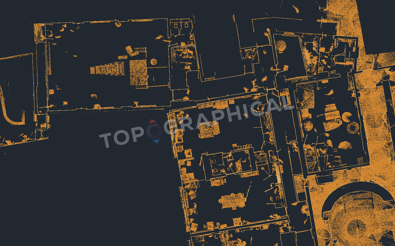
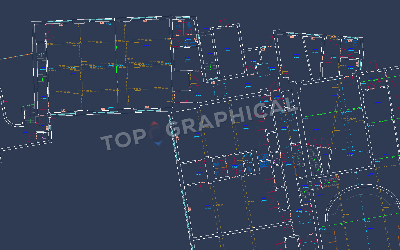
The point cloud is measured evidence; the plan is an interpretation
The registered scan records visible surfaces in 3D. The floor plan applies the specified cut plane and drawing conventions to walls, openings, circulation and fixed features.
Specify the drawings before the scanning
Sections resolve split levels
A floor plan describes horizontal arrangement at a chosen cut plane: wall faces and thicknesses, openings, stairs, columns and specified fixed features. Where floors, roofs, voids or structural levels must be understood together, the brief needs sections placed across those relationships.
Section lines are set with the architect or engineer who will use them. Two useful cuts through the design problem beat six evenly spaced sections through nothing in particular.
Sections
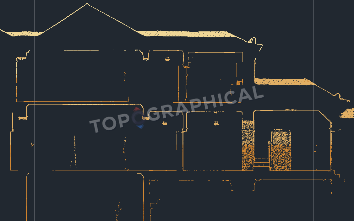
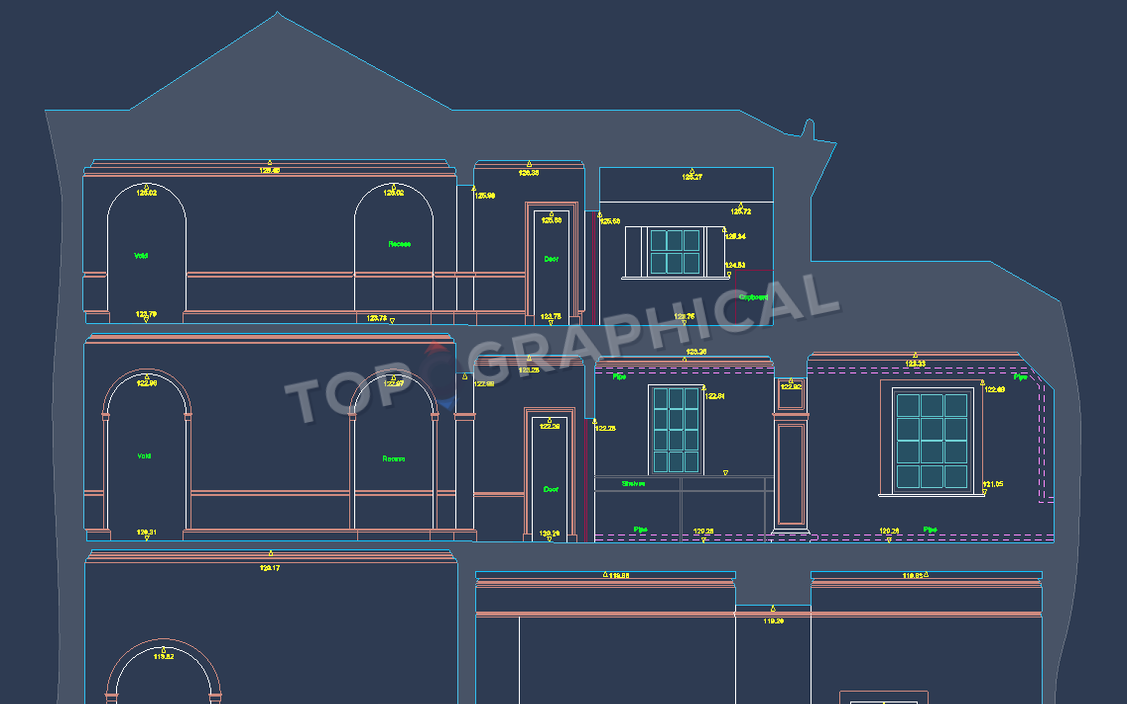
A section fixes vertical relationships on one drawing
Floor levels, openings, structure and roof heights are extracted along a specified cut line, exposing relationships a plan cannot show.
Measured drawings stop at the observable surface
Locked rooms, occupied spaces, missing keys, plant areas, risers, basements, roof access and neighbouring land determine what the scanner can observe. Inaccessible areas are identified in the issue information; hidden fabric is not inferred and presented as survey data.
Registration brings scans from separate positions into one measured record. Before issue, we review that registration, compare the drawn walls, openings and levels with the point cloud, and check that the plans, elevations and sections agree with one another. Access or visibility limits remain stated on the drawing instead of being hidden by clean linework.
Roofs and upper levels
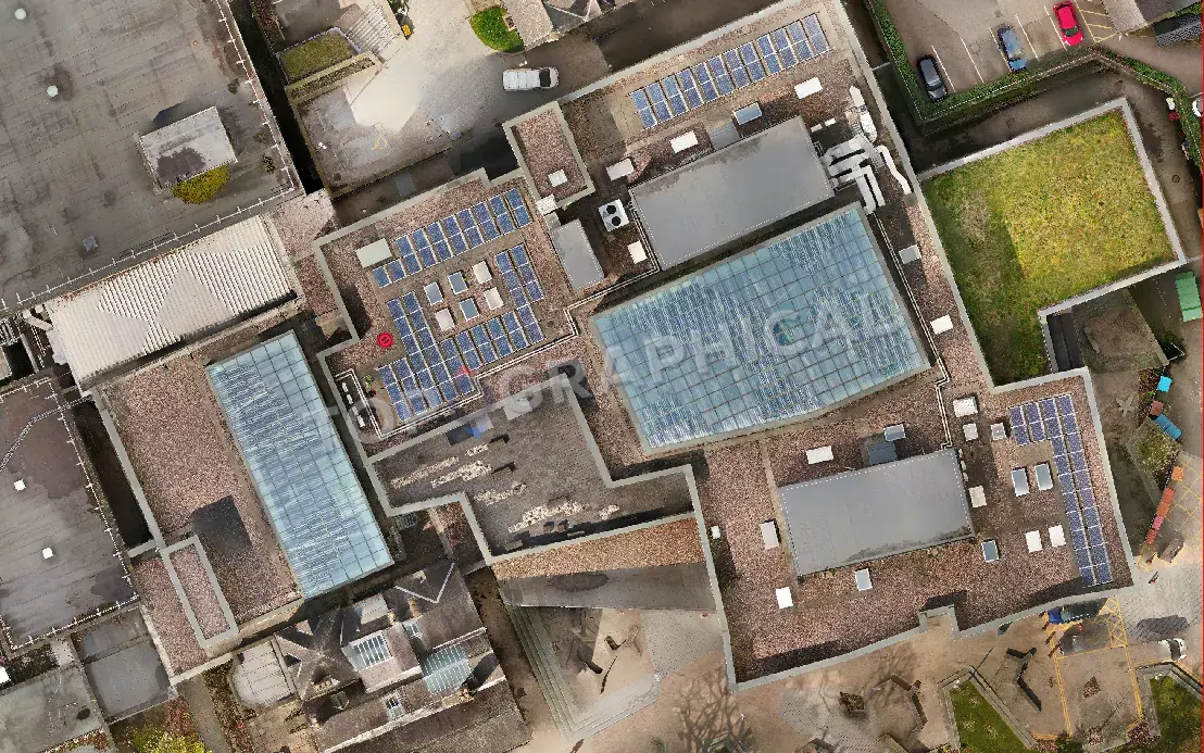
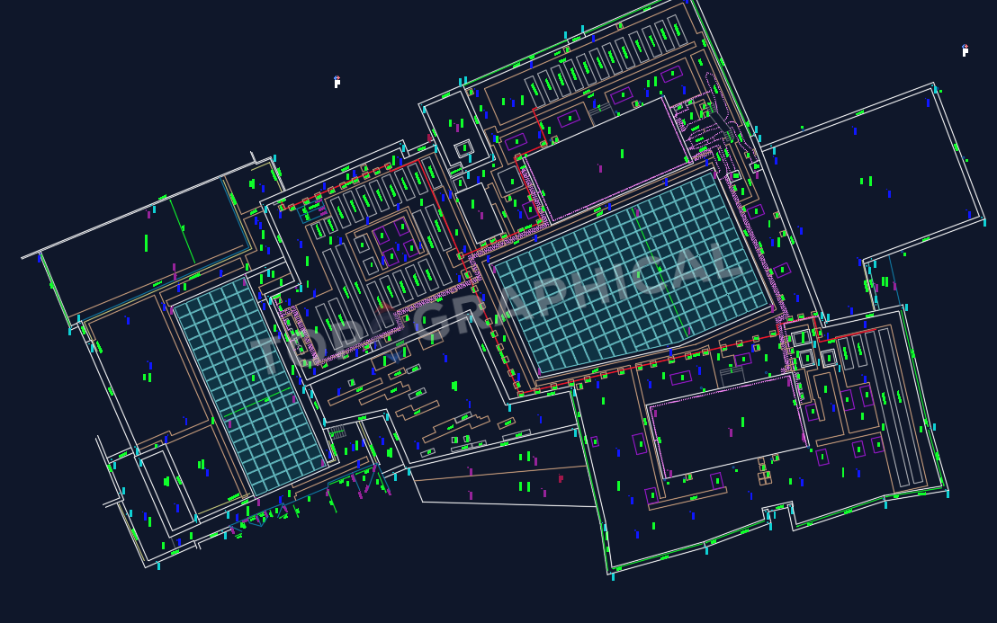
Roof detail should be specified before capture
Ridges, valleys, parapets, openings and visible plant are measured from accessible scan positions or aerial capture to the detail required for planning, retrofit or coordination.
Elevations and street context
Set the facade detail before capture
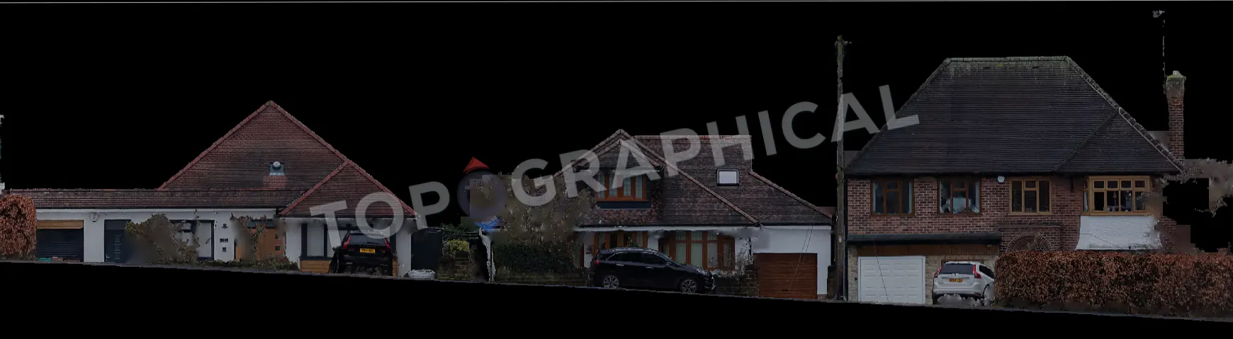
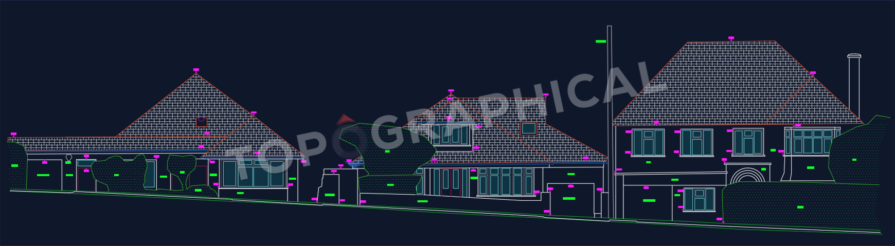
An early planning elevation may stop at principal openings, eaves and ridge heights; heritage or construction work may require profiles, joints, and visible departures from line or plumb at the stated drawing scale. Where the street scene matters, adjoining facades and ground levels are tied into the same measured view when access permits.
Elevations
A facade is more useful when the ground comes with it
The drawing relates facade openings and heights to ground levels and adjoining buildings, so the elevation does not float without its street context.
Issued drawings
The point cloud is measured once; the drawings are specified deliberately
- 2D floor plans, elevations and sections extracted from the registered 3D laser-scanned point cloud at the specified scales and cut positions.
- Roof plans compiled from accessible scan positions and agreed aerial capture where the commission requires it.
- The agreed DWG or DXF issue files, plus PDF sheets, organised to the stated layer and drawing standards.
- Visible structure, openings, stairs, fixed fixtures and visible service features when specifically included. We draw their positions; we do not trace or test the systems.
- A point-cloud export for coordination or specialist follow-on work only when it is included in the commission.
The survey is non-intrusive. Structural appraisal, opening-up, destructive inspection and investigation of concealed fabric require separate specialist commissions.
Scanning is the source; drawings are the deliverable
Laser scanning and measured drawings
We register scans of accessible surfaces into a 3D point cloud, then extract the agreed 2D plans, elevations, and sections from that measured record.
Operating area
Find this service in your area
- Nottinghamshire
- Derbyshire
- Leicestershire
- Lincolnshire
- South Yorkshire
- West Yorkshire
- North Yorkshire
- East Riding of Yorkshire
- Rutland
- Northamptonshire
- Oxfordshire
- West Midlands
- East Midlands
- Staffordshire
- Warwickshire
- Bedfordshire
- Buckinghamshire
- Cambridgeshire
Related reading
Practical notes before you fix the brief
- Architects: Stop Designing from Estate Agent Plans
Why inherited drawings, estate agent plans, and client sketches should be replaced with measured building survey data before design work starts.
- Commercial Fit-Out: Why CAT A Handover Needs a Measured Survey
Why CAT A handover is the right moment to verify floor plates, cores, services, and perimeter conditions before CAT B design starts.
- Lease Plans and the Land Registration Act
Why compliant lease plans need measured building survey data, clear extents, and properly scaled drawings for registration.
Capture equipment
The scanner records surfaces; the surveyor decides the drawing
Terrestrial laser scanning supplies the 3D measured record. Total station observations connect external detail where required, while supplementary imagery helps identify visible fabric during drawing. None of those instruments chooses the cut plane, line hierarchy or level of detail.
Fixed scope, fixed price
Send the drawing schedule, not just the address
Tell us which plans, elevations and sections are required, at what scale and level of detail, together with the intended use and access constraints. If no drawing schedule exists, we can draft one for your consultant to approve. The fixed-price quote confirms the output, access assumptions and delivery programme.