Measured Building Surveys in Buckinghamshire
Whether the property is a flint house above High Wycombe, an Aylesbury shop or a Milton Keynes office, its measured record begins with a drawing schedule. We use 3D laser scanning to capture the accessible fabric and extract the named 2D plans, elevations and sections for a fixed price agreed before the visit.
Main centres
Aylesbury, High Wycombe, Milton Keynes
Common site mix
Historic market-town buildings, Chiltern houses, rural estates, modern Milton Keynes property, schools, offices, and industrial premises.
Whether the property is a flint house above High Wycombe, an Aylesbury shop or a Milton Keynes office, its measured record begins with a drawing schedule. We use 3D laser scanning to capture the accessible fabric and extract the named 2D plans, elevations and sections for a fixed price agreed before the visit.
Rear elevations are often the hard part
In the older centres of Aylesbury and High Wycombe, narrow plots, occupied upper floors, rear service yards and elevations against neighbouring land can restrict scanner positions. In Milton Keynes, large offices, schools and logistics buildings may be easier to circulate but harder to capture in one attendance because of security zones, plant areas, tenants or roof-access controls. Olney's Article 4 direction is a planning control, not a promise that every external feature has been measured.
Before attendance, we agree keys, escorts, working hours, rooms, external faces, roof access and any landowner permission needed for adjoining views. Unreached areas are listed clearly on the issue information.
Put heritage detail into the drawing schedule
Buckinghamshire Council maintains conservation areas across Aylesbury, High Wycombe, the Chiltern villages and the former district areas. Milton Keynes includes both historic settlements and planned local centres in its conservation guidance. A designation may make roof form, street-facing detail, boundary walls, materials or adjoining buildings relevant to an application, but it does not tell us where to cut a section or which floors the architect needs.
A heritage statement interprets significance; a measured building survey records accessible geometry. Where a conservation architect needs a complete principal elevation, window profiles at a stated level of detail or the junction between a listed building and later additions, those items go into the drawing schedule and fixed quote.
What the fixed price covers
- Registered 3D laser-scan capture of the accessible building areas and external faces stated in the brief.
- The agreed 2D floor plans, elevations and sections extracted from the measured point cloud.
- Roof plans, outbuildings, site levels, reflected ceiling information or neighbouring context only when specifically commissioned.
- Named DWG or DXF files and PDF sheets using the approved scales, layer conventions and drawing references.
The commission does not include structural diagnosis, a Heritage Impact Assessment, opening-up work or investigation of hidden construction. The point cloud records visible surfaces, so concealed fabric remains outside the measured evidence.
What to send us
Send the property address, building use, available drawings, required floors and elevations, section locations, output standards, access arrangements and the architect's or consultant's latest brief. Tell us about tenants, alarms, keys, fragile roofs, lofts, basements, plant rooms and any elevation that can only be viewed from someone else's land.
The quote will identify what is scanned, what is drawn, every stated exclusion and the issue date. Billing is fixed-price, with no hourly rate or day rate waiting in the small print.
Local references
We last checked these sources in July 2026. Planning guidance changes, so please send us the latest brief from your architect or consultant and we will price the right survey for your property.
- Buckinghamshire conservation areas (opens in a new tab)
- Buckinghamshire plans and diagrams guidance (opens in a new tab)
- Buckinghamshire Heritage Service (opens in a new tab)
- Milton Keynes planning application forms and checklists (opens in a new tab)
- Milton Keynes conservation areas (opens in a new tab)
- Milton Keynes Article 4 directions (opens in a new tab)
Laser scanning and measured drawings
Example deliverable
From registered scan to measured drawing
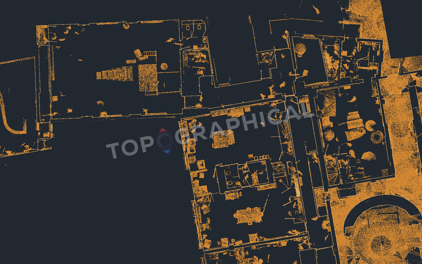
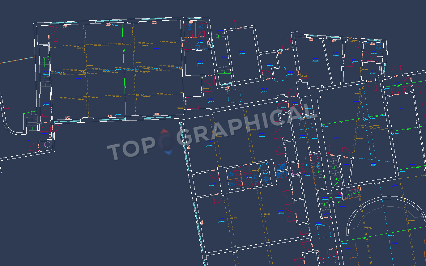
The point cloud is measured evidence; the plan is an interpretation
The registered scan records visible surfaces in 3D. The floor plan applies the specified cut plane and drawing conventions to walls, openings, circulation and fixed features.