Measured Building Surveys in Bedfordshire
A Bedford cellar, live Luton workplace or extended village house can leave gaps in the drawing set if access is not planned room by room. We capture the accessible building with 3D laser scanning, then extract the agreed 2D plans, elevations and sections for a fixed price settled before attendance.
Main centres
Bedford, Luton, Dunstable
Common site mix
Bedford historic buildings, Luton commercial and industrial property, village houses, logistics buildings, schools, and modern estates.
A Bedford cellar, live Luton workplace or extended village house can leave gaps in the drawing set if access is not planned room by room. We capture the accessible building with 3D laser scanning, then extract the agreed 2D plans, elevations and sections for a fixed price settled before attendance.
Rooms, roofs and rear elevations need an access plan
A Bedford town-centre building may have occupied upper floors, a cellar and a rear elevation visible only from another property. A Luton industrial or commercial building can add security zones, live work areas and plant spaces. Village houses across Central Bedfordshire often combine older fabric with later extensions, uneven floor levels, lofts and outbuildings. Each condition affects where the scanner can stand and which drawings can be supported by measured evidence.
Before attendance, tell us who holds the keys and whether escorts or timed access are required. Roofs, lofts, basements, plant rooms, risers, locked tenancies, rear yards and elevations reached from adjoining land all need an honest access answer. Any area we cannot reach is listed in the issue information so the project team knows where the measured record stops.
Put the required fabric into the drawing schedule
Bedford Borough's historic-area guidance, Central Bedfordshire's conservation pages and Luton's conservation information can make the existing building more important to the design case. In Luton's High Town Road or Plaiters' Lea, for example, an architect may need the principal facade, roof form and relationship with neighbouring buildings recorded alongside the internal plans. The same reasoning can apply to a listed or conservation-area property elsewhere in Bedfordshire.
Central Bedfordshire's current application guidance discusses existing and proposed floor plans, elevations, roof plans, site sections and levels. Bedford Borough and Luton publish their own application and conservation guidance. None of those pages can decide where your architect wants a section cut, whether a rear elevation must include the neighbour, or whether the roof is safely accessible. A council list identifies a possible requirement. A professional brief fixes the deliverable.
We can help turn an intended use into a draft drawing schedule, but the architect, planning consultant or conservation adviser should approve it before capture begins.
What the fixed price covers
- 3D laser scanning and registration of the accessible rooms, circulation areas and agreed external faces.
- The named 2D floor plans, elevations and sections extracted from the registered point cloud.
- Roof plans, site levels, outbuildings, neighbouring elevations or detailed features only where the schedule includes them.
- Agreed DWG or DXF files and PDF sheets, using the stated scales, naming and issue standards.
The survey records visible, accessible fabric. It does not include a structural appraisal, Heritage Impact Assessment, opening-up work or investigation behind finishes. Hidden or concealed construction is not invented from the point cloud and presented as measured fact.
What to send us
Send the property address, intended use, available drawings, required floors and external faces, proposed section lines, output formats, access arrangements and the latest professional brief. Your quote will state what we will scan, what we will draw, any exclusions and the delivery date. The price is fixed, not billed by the hour or day.
Local references
We last checked these sources in July 2026. Planning guidance changes, so please send us the latest brief from your architect or consultant and we will price the right survey for your property.
- Bedford Borough historic areas and buildings (opens in a new tab)
- Bedford Borough planning application forms overview (opens in a new tab)
- Central Bedfordshire planning application guidance (opens in a new tab)
- Central Bedfordshire conservation area guidance (opens in a new tab)
- Luton conservation areas (opens in a new tab)
- Luton listed buildings (opens in a new tab)
Laser scanning and measured drawings
Example deliverable
From registered scan to measured drawing
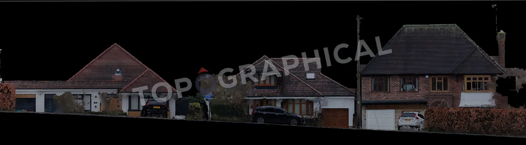
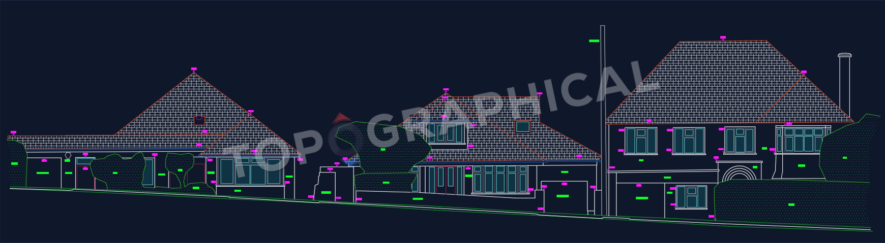
A facade is more useful when the ground comes with it
The drawing relates facade openings and heights to ground levels and adjoining buildings, so the elevation does not float without its street context.