Measured Building Surveys in Cambridgeshire
A Cambridgeshire measured building survey should begin with the drawings the architect needs and an honest account of which spaces can be entered. We capture accessible fabric with 3D laser scanning, then produce the agreed 2D plans, elevations and sections from the registered point cloud for a fixed price.
Main centres
Cambridge, Peterborough, Ely, Huntingdon
Common site mix
University buildings, science facilities, historic city property, and village homes.
A Cambridgeshire measured building survey should begin with the drawings the architect needs and an honest account of which spaces can be entered. We capture accessible fabric with 3D laser scanning, then produce the agreed 2D plans, elevations and sections from the registered point cloud for a fixed price.
Historic fabric and working buildings
Cambridge contains college, university and city buildings where old fabric, later alterations and controlled access can meet in the same instruction. If the design affects a conservation area or listed building, the architect may need existing elevations, roof form, adjoining context and sections through particular changes in level. Cambridge City Council directs planning work through its shared service, but the approved drawing schedule must still identify the views and section lines required for the property.
Ely and the villages of East Cambridgeshire contain listed and historic buildings where the protected fabric can extend beyond the principal facade. Cambridgeshire County Council's Historic Environment Record covers listed buildings, standing structures and other heritage evidence across the county. That makes the scope decision practical: outbuildings, boundary walls, roof spaces and external faces should be named if the heritage adviser needs them recorded.
Huntingdonshire conservation guidance asks applicants to explain effects on an area's character and setting. In Peterborough, conservation areas range from the cathedral city centre to villages such as Thorney and Wansford. For either authority, a generic internal plan is rarely enough when the proposal changes an elevation, roof or historic room arrangement. We measure what the design team specifies and show where inaccessible areas prevent a complete record.
Agree access before the visit
Science facilities, occupied offices and university buildings can require inductions, escorts, room bookings or work outside normal occupation. Houses may have locked lofts, cellars, attached garages or rear elevations reached only through neighbouring land. Tell us about those conditions before quotation. They affect the capture plan and may decide whether a return visit is needed, but they do not become an unexplained extra charge after instruction.
What the fixed price covers
- 3D laser scanning and registration of the accessible rooms, circulation areas and agreed external faces.
- The named 2D plans, elevations and sections extracted from the registered point cloud.
- Roof plans, reflected ceiling detail, outbuildings or neighbouring context only where the drawing schedule includes them.
- Agreed DWG or DXF files and PDF sheets at the stated scales and issue standard.
The survey records visible, accessible building fabric. It does not include structural appraisal, opening-up work, a Heritage Impact Assessment or investigation behind finishes. Hidden or concealed construction is not guessed from the point cloud and drawn as measured information.
What to send us
Send the property address, intended use, available drawings, required levels and external faces, proposed section lines, output formats and access arrangements. Include the latest brief from the architect, conservation adviser or facilities team, plus any restrictions on photography, security or working times.
The quote will name the capture area, drawing list, exclusions and delivery date. The price is fixed before attendance.
Local references
We last checked these sources in July 2026. Planning guidance changes, so please send us the latest brief from your architect or consultant and we will price the right survey for your property.
- Cambridge City planning and building control (opens in a new tab)
- Cambridgeshire Historic Environment Record (opens in a new tab)
- Huntingdonshire conservation areas (opens in a new tab)
- Huntingdonshire listed building consent guidance (opens in a new tab)
- Peterborough conservation areas (opens in a new tab)
- Peterborough listed building consent requirements (opens in a new tab)
Laser scanning and measured drawings
Example deliverable
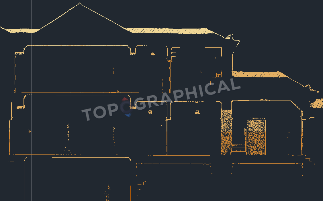
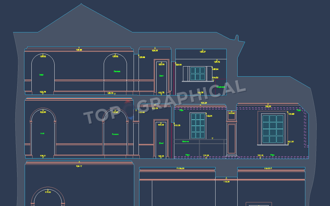
From registered scan to measured drawing
A section fixes vertical relationships on one drawing
Floor levels, openings, structure and roof heights are extracted along a specified cut line, exposing relationships a plan cannot show.