Measured Building Surveys in Lincolnshire
A Lincolnshire building cannot be reduced to a floor-plan request when the proposed work depends on its elevations, level changes, roof junctions or historic fabric. We register a laser-scanned point cloud of accessible surfaces, then draw the agreed 2D plans, elevations and sections at a fixed price.
Main centres
Lincoln, Grantham, Stamford, Sleaford
Common site mix
Lincoln historic and university property, Stamford stone buildings, Grantham commercial premises, Sleaford town-centre buildings, schools, farms, and industrial units.
A Lincolnshire building cannot be reduced to a floor-plan request when the proposed work depends on its elevations, level changes, roof junctions or historic fabric. We register a laser-scanned point cloud of accessible surfaces, then draw the agreed 2D plans, elevations and sections at a fixed price.
Level changes and adjoining walls need more than one plan
In Lincoln, a multi-level building can connect steep streets, cellars and upper-floor entrances in ways that a single plan will not explain. Work in the Stamford Conservation Area often depends on complete street elevations, window and door patterns, chimneys, boundary walls and the junction between neighbouring stone buildings. Grantham commercial property may have several rounds of subdivision behind one facade. In the Sleaford Conservation Area, the building's relationship with its street can be as relevant as the internal arrangement.
None of those facts tells us which drawings to produce. The architect must list the floors, outward faces, sections and detail needed for the proposed decision. City of Lincoln Council, South Kesteven District Council and North Kesteven District Council publish their own conservation information. Where local controls make a feature relevant, the survey schedule should name it.
Plan the access before the scanner arrives
Occupied hotels, schools, shops, farm buildings and industrial premises need different access arrangements. Tell us which rooms are tenanted, which doors require an escort, whether machinery will remain in use, and whether roofs, towers, basements, roof voids or plant spaces can be entered. Externally, confirm access to rear yards and neighbouring land if a full elevation cannot be seen from the subject property.
Scanner positions record visible surfaces. A locked room leaves a hole in the measured evidence; a boarded opening does not disclose what lies behind it; a ceiling does not reveal the structure above. We list inaccessible areas and qualify affected drawings. Hidden fabric is not reconstructed from symmetry or from an owner's recollection.
What the fixed price covers
- 3D laser scanning and registration of the accessible building areas identified at quotation stage.
- Agreed 2D plans, elevations and sections extracted from the registered point cloud.
- The visible openings, walls, columns, stairs, floor changes and architectural detail specified for those drawings.
- File formats, sheet or model scales, naming requirements, survey limits and issue date confirmed in writing.
Detailed mouldings, reflected ceiling plans, roof plans, area schedules and extra sections need their own entries in the quotation. The survey does not expose concealed construction, certify structure, inspect condition, test services or determine asbestos. Open-up records supplied by another consultant can be referenced, but they do not become measured observations.
What to send us
Send the property address, current use, project purpose and any existing plans, however old. Add a marked drawing schedule, CAD standard, floor naming, access contact, security or induction rules and delivery date. For listed or conservation-area work, include the heritage statement or architect's feature schedule so decorative and external detail is captured deliberately rather than added after the first issue.
Local references
We last checked these sources in July 2026. Planning guidance changes, so please send us the latest brief from your architect or consultant and we will price the right survey for your property.
- City of Lincoln conservation areas (opens in a new tab)
- City of Lincoln Article 4 directions (opens in a new tab)
- City of Lincoln listed buildings (opens in a new tab)
- South Kesteven conservation and listed buildings (opens in a new tab)
- South Kesteven conservation-area appraisals (opens in a new tab)
- North Kesteven conservation-area reviews (opens in a new tab)
Laser scanning and measured drawings
Example deliverable
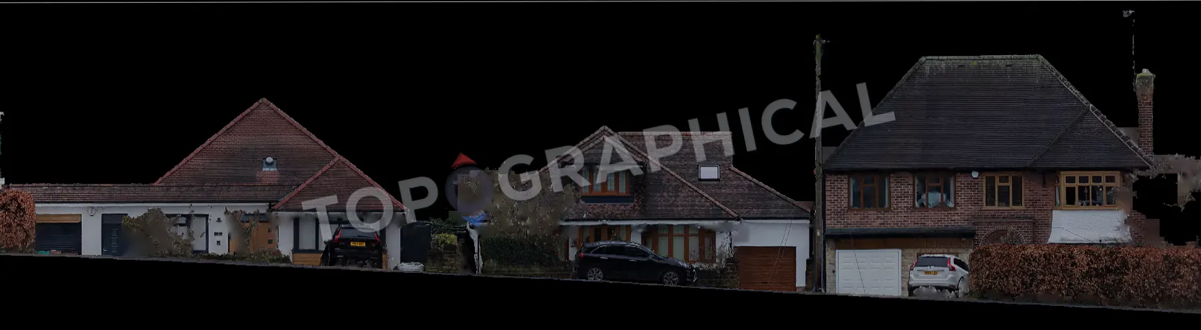
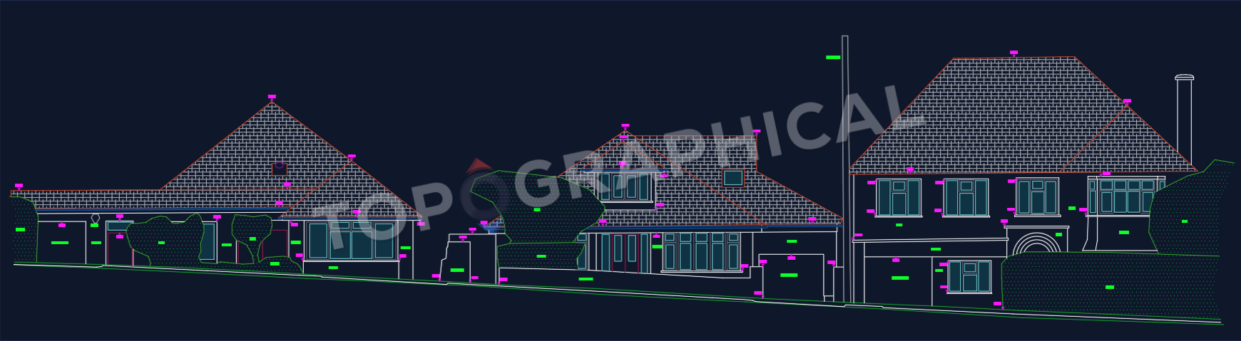
From registered scan to measured drawing
A facade is more useful when the ground comes with it
The drawing relates facade openings and heights to ground levels and adjoining buildings, so the elevation does not float without its street context.