Topographical Surveys in Bedfordshire
In Bedfordshire, a survey brief that works for a level town-centre plot can fail on a river corridor, chalk slope or expanding settlement edge. We agree the measured extent, control, coordinated 2D plan, 3D model and fixed price before anyone arrives on site.
Main centres
Bedford, Luton, Dunstable
Common site mix
River Great Ouse corridors, Bedford claylands, Dunstable chalk slopes, dense urban sites, growth areas, and logistics land.
In Bedfordshire, a survey brief that works for a level town-centre plot can fail on a river corridor, chalk slope or expanding settlement edge. We agree the measured extent, control, coordinated 2D plan, 3D model and fixed price before anyone arrives on site.
Follow the levels beyond the red line
Around Bedford and the River Great Ouse, a drainage or flood brief may require continuous levels between thresholds, low points, highway edges, ditches and the wider fall of the land. Near Dunstable, where the ground meets the chalk escarpment, short horizontal distances can contain level changes that a sparse spot-height grid would disguise. In Luton, the difficulty is often different: live roads, tight rear access and adjoining buildings can control where survey stations go and which elevations or boundary faces can be observed.
These conditions do not change the quoted price after instruction. They change the questions we settle before the price is fixed: where the model must extend, which level route matters, and what can be observed from land we are allowed to enter.
Match the survey to the live brief
Bedford Borough, Central Bedfordshire and Luton are separate planning authorities with their own policy and application guidance. For a buyer, the practical issue is not the administrative boundary itself. It is whether the architect, engineer or planning consultant has asked for site sections, access geometry, tree positions, parking detail or levels beyond the application site.
Central Bedfordshire's application guidance identifies several of those items as information that may be required. Bedford Borough and Luton publish their own routes. We do not turn council lists into an inflated survey package. Send the current professional request and we will translate it into a measured boundary and feature schedule for the project team.
What the fixed price covers
- A coordinated 2D topographical plan and 3D terrain model in the agreed file formats.
- The stated survey boundary, adjoining context, coordinate system, level datum and accuracy requirement.
- Ground levels, breaklines, buildings, hard surfaces, visible boundaries, trees and specified street or drainage features.
- Agreed highway frontage or off-site detail where access, visibility and permission allow it to be measured.
Visible service-cover positions and top levels can be recorded when they are named in the brief. We do not lift covers, measure inverts, trace buried utilities, carry out GPR or CCTV drainage work, determine legal boundaries, prepare flood assessments or provide planning advice. Those tasks need separate specialist instructions.
What to send us
Send the site address, a red-line or extent plan, the intended use of the survey, required DWG or other file formats, access details and the latest written brief from the project team. If the work concerns drainage, highways, trees, planning validation or a fixed datum, include the relevant note rather than asking us to infer it from the postcode.
Your quote will state the measured extent, deliverables, assumptions, exclusions and delivery date. The price is fixed, not billed by the hour or day.
Local references
We last checked these sources in July 2026. Planning guidance changes, so please send us the latest brief from your architect or consultant and we will price the right survey for your site.
- Bedford Borough Local Plan (opens in a new tab)
- Bedford Borough planning application forms overview (opens in a new tab)
- Central Bedfordshire planning policy (opens in a new tab)
- Central Bedfordshire planning application guidance (opens in a new tab)
- Luton Local Plan (opens in a new tab)
- Environment Agency Flood Map for Planning (opens in a new tab)
Survey control
Drone capture
Surface and volume models
Example deliverable
From measured site to topographical drawing
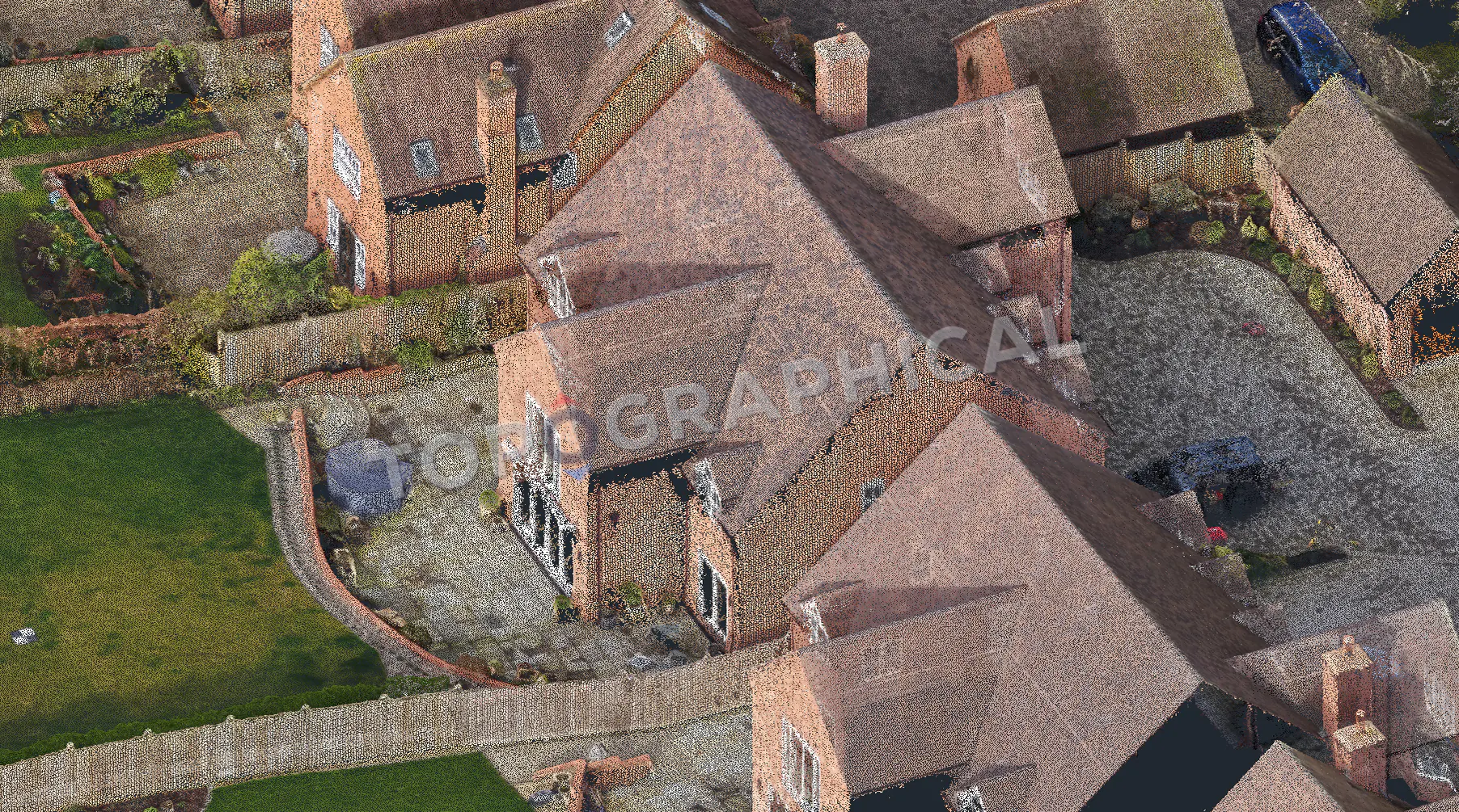
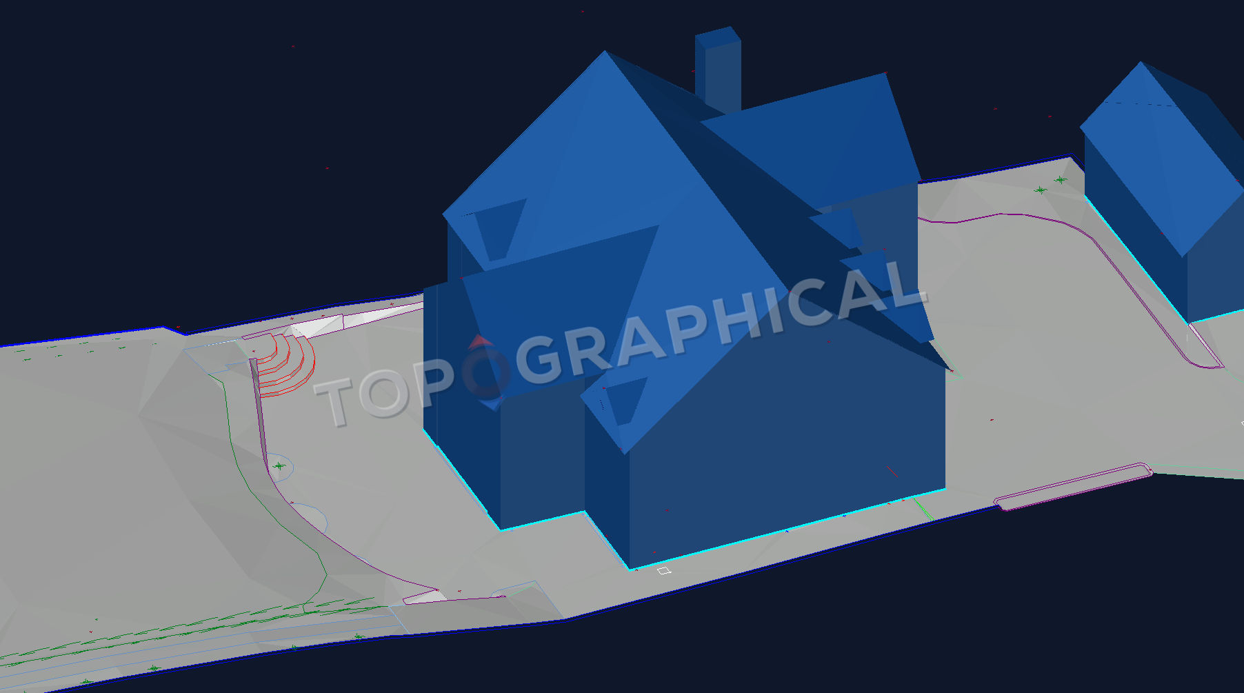
Measured terrain and building form in one 3D model
The point cloud records the property and its immediate context. The coordinated model resolves roofs, walls, ground surfaces, boundaries and visible site features into editable 3D survey data.