Measured Building Surveys in East Midlands
A regional programme goes wrong when every building is ordered with the same drawing schedule, regardless of how it will be altered. We agree the useful outputs property by property, capture accessible surfaces with 3D laser scanning, and extract the specified 2D plans, elevations and sections from a registered point cloud.
Main centres
Nottingham, Derby, Leicester, Lincoln, Northampton, Oakham
Common site mix
City-centre commercial property, industrial buildings, rural estates, schools, and mixed housing.
A regional programme goes wrong when every building is ordered with the same drawing schedule, regardless of how it will be altered. We agree the useful outputs property by property, capture accessible surfaces with 3D laser scanning, and extract the specified 2D plans, elevations and sections from a registered point cloud.
Give each building its own drawing decision
A Nottingham office conversion may need tenancy plans and selected cores. A Derby workshop may depend on structural bays and roof changes; a Leicester terrace on wall thickness and neighbour relationships; a Lincoln townhouse on its street elevation; and a Rutland property on the connection between the main building and an outbuilding. In Northamptonshire, a large estate building may need a phased access plan before any drawing list is credible.
The field method can be consistent while the output varies. Before attendance, we agree the included structures, storeys and rooms; elevation faces and section lines; roof or reflected ceiling information; drawing scales; and file formats. A larger point cloud does not cure a missing section through the junction under design.
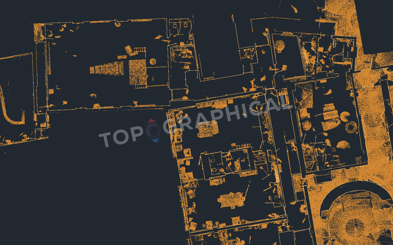
The point cloud is built by registering overlapping 3D laser scans taken through and around the accessible property. It gives the drawing team a consistent measured reference for walls, openings, floors, roofs and facade features that were visible from a scan position. It does not turn every captured point into a promised drawing item. The quotation states the detail we will interpret and annotate.
The region is not one heritage context
East Midlands Combined County Authority covers Derbyshire and Nottinghamshire, while East Midlands Councils represents a wider area. This service coverage also reaches Leicestershire, Lincolnshire, Northamptonshire and Rutland. Neither regional body sets one survey or drawing requirement, so planning and heritage checks remain address-specific.
City of Lincoln Council and Rutland County Council publish their own conservation guidance, as do the authorities in Nottingham, Derby, Leicester and Northamptonshire. That information may lead the architect to request facade detail, roof form, chimneys, shopfronts, boundary walls or attached structures. Our measured survey records the visible features named in the drawing brief; it does not assess heritage significance.
Access and visibility set the honest limit
For each address, tell us about occupation, tenants, working hours, keys, escorts, alarms, parking and neighbour access. Basements, lofts, roof spaces, plant rooms, risers, locked units, fragile areas and separate outbuildings must be opened safely if they are to be measured. We record inaccessible areas as omissions, not estimated geometry, and can price a return visit when access will follow later.
Scanning also stops at the visible surface. Hidden fabric behind plaster, ceilings, panelling, fixed furniture and finishes is not measured, and the point cloud cannot establish structural condition or material build-up. Opening-up, condition surveys, structural appraisal, planning advice and heritage assessment are separate professional services.
What the fixed price covers
The fixed price covers the stated property extent, attendance under the written access assumptions, point-cloud registration and production of the agreed 2D plans, elevations and sections. Formats, scales, level annotations, roof information, outbuildings and external context are included only where the output schedule names them.
Extra drawings, inaccessible spaces, repeat visits and professional advice outside measurement are excluded unless added to the quotation. Each site in a portfolio receives its own scope, so a closed room in one building cannot disappear inside a regional total.
What to send us
Send a full address for every property, its current use, proposed work, marked measured extent, architect's drawing schedule, required scales and formats, access contact and deadline. Add existing plans, tenancy information and any conservation or validation correspondence. We will confirm the deliverables, access assumptions, exclusions, programme and fixed price before booking fieldwork.
Local references
We last checked these sources in July 2026. Planning guidance changes, so please send us the latest brief from your architect or consultant and we will price the right survey for your property.
- East Midlands Combined County Authority area (opens in a new tab)
- East Midlands Councils membership (opens in a new tab)
- Nottinghamshire local government structure (opens in a new tab)
- Leicestershire district planning responsibilities (opens in a new tab)
- City of Lincoln conservation areas (opens in a new tab)
- Rutland conservation areas (opens in a new tab)
- North Northamptonshire unitary services (opens in a new tab)
- West Northamptonshire unitary services (opens in a new tab)
- North Northamptonshire conservation areas (opens in a new tab)
- West Northamptonshire conservation areas (opens in a new tab)
Laser scanning and measured drawings
Example deliverable
From registered scan to measured drawing
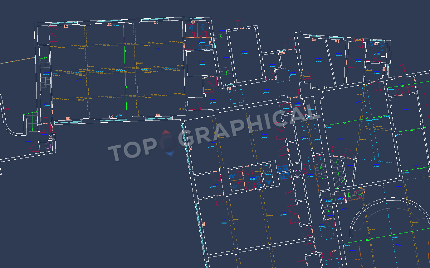
The point cloud is measured evidence; the plan is an interpretation
The registered scan records visible surfaces in 3D. The floor plan applies the specified cut plane and drawing conventions to walls, openings, circulation and fixed features.