Measured Building Surveys in Leicestershire
Long industrial bays, occupied teaching rooms and altered town-centre properties can all defeat a vague request for existing plans. We laser-scan the accessible building, register the point cloud and extract the agreed 2D plans, elevations and sections for a fixed price.
Main centres
Leicester, Loughborough, Hinckley, Melton Mowbray
Common site mix
Leicester commercial buildings, Loughborough institutions, hosiery and industrial premises, market-town property, schools, and rural estates.
Long industrial bays, occupied teaching rooms and altered town-centre properties can all defeat a vague request for existing plans. We laser-scan the accessible building, register the point cloud and extract the agreed 2D plans, elevations and sections for a fixed price.
Record how the building has changed
Leicester, Loughborough, Hinckley and Melton Mowbray contain markedly different building stock, but age alone does not determine scope. A Leicester commercial conversion may need every stair, party-wall return and street elevation tied across several floors. A Loughborough teaching building under Charnwood Borough Council may demand phased access. A former hosiery or engineering building near Hinckley may contain long bays, later insertions and blocked openings that need to read consistently across plans and sections.
The decisive facts are occupation, construction, access and the proposed work. We agree which floors, stairs, voids, external faces and section lines matter before capture, so later alterations are recorded where they affect the design rather than treated as background clutter.
Access determines what can be measured
Before attendance, tell us whether the building is occupied and who can unlock each floor, roof, basement, plant room, riser, yard and detached structure. Schools may require escorted or out-of-hours work; warehouses may need a site induction and separation from moving plant; tenanted buildings may need a room-by-room programme. For external elevations, adjoining land, narrow yards, parked vehicles and scaffolding can be as limiting as a locked door.
We record inaccessible rooms and elevations as exclusions. The registered point cloud contains only surfaces captured from available scanner positions, so concealed structure, hidden fabric and closed voids are not invented in the drawings. If intrusive investigation or opening-up is required, the client appoints the relevant specialist and supplies the findings separately.
Add heritage detail deliberately
Leicester City Council identifies Article 4 directions in parts of the city, Hinckley and Bosworth publishes separate conservation guidance, and Melton Borough Council records conservation areas and listed buildings. A Melton property or protected Leicester frontage may need window patterns, shopfronts, chimneys, roof junctions, boundary walls or selected internal features shown.
Those controls do not add a standard heritage package to every measured building survey. The architect or heritage consultant must name the visible detail needed for the project, and we include it in the drawing schedule and fixed price.
What the fixed price covers
- 3D laser scanning of the accessible areas named in the quotation and registration into a project point cloud.
- The agreed 2D floor plans, elevations and sections, at the scales and file formats specified before instruction.
- Visible walls, openings, level changes, stairs, structural positions and fixed features required by the drawing brief.
- A written record of survey limits, inaccessible areas and any output-specific assumptions.
Roof plans, reflected ceiling plans, lease areas, detailed facade drawings and additional sections are included only when listed. We do not claim to identify concealed construction, wall build-ups, structural capacity, asbestos, services behind finishes or legal ownership boundaries.
What to send us
Provide the full address, building use, proposed project, available drawings and the exact schedule of plans, elevations and sections. Add floor access, key-holder details, security rules, known hazards, required CAD standard and delivery date. If listed-building or conservation work is involved, include the heritage consultant's brief rather than asking the surveyor to guess which architectural details matter.
Local references
We last checked these sources in July 2026. Planning guidance changes, so please send us the latest brief from your architect or consultant and we will price the right survey for your property.
- Leicester City conservation-area guidance (opens in a new tab)
- Charnwood Borough conservation areas (opens in a new tab)
- Hinckley and Bosworth conservation guidance (opens in a new tab)
- Hinckley and Bosworth work in conservation areas (opens in a new tab)
- Melton Borough conservation areas (opens in a new tab)
- Melton Borough listed buildings (opens in a new tab)
Laser scanning and measured drawings
Example deliverable
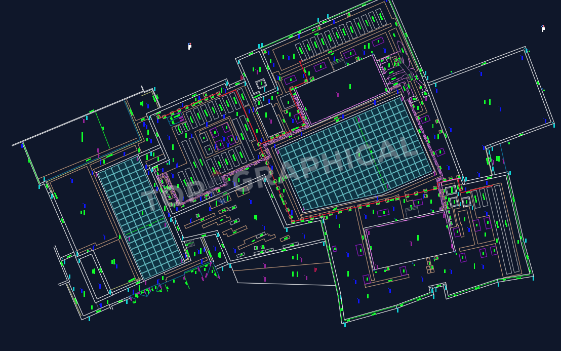
From registered scan to measured drawing
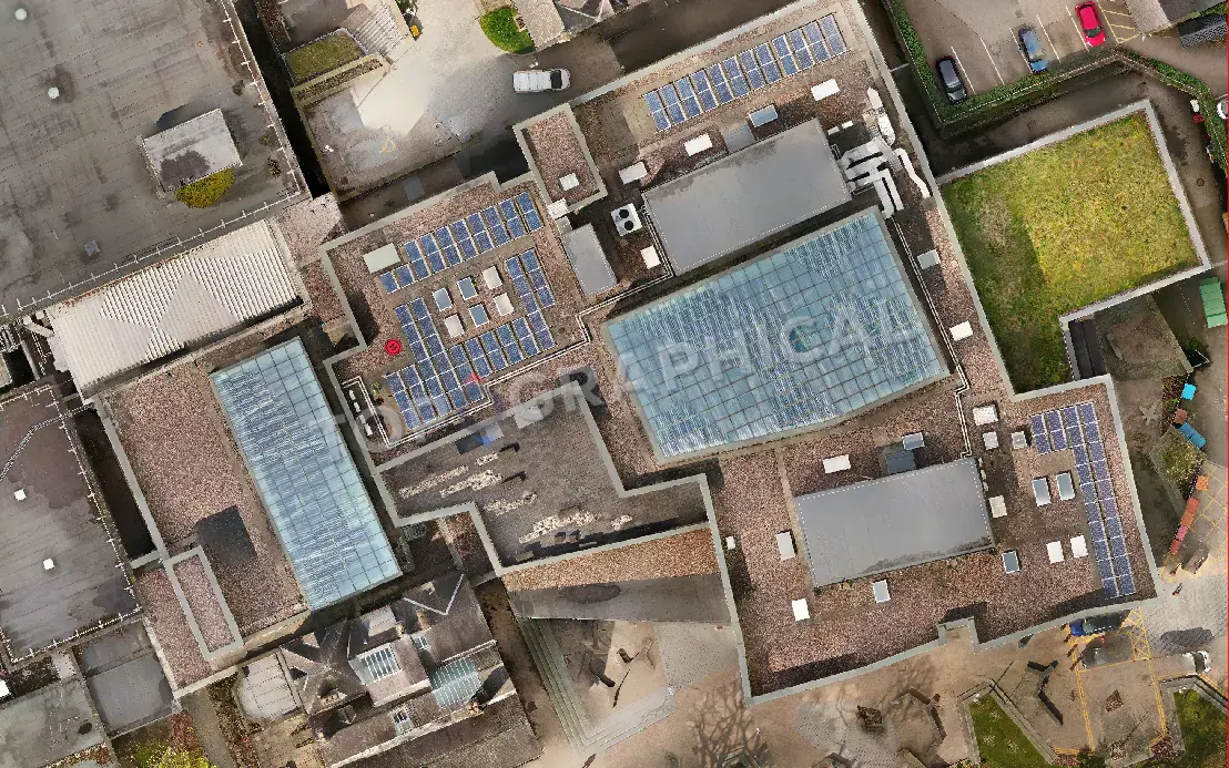
Roof detail should be specified before capture
Ridges, valleys, parapets, openings and visible plant are measured from accessible scan positions or aerial capture to the detail required for planning, retrofit or coordination.