Topographical Surveys in Leicestershire
A tight Leicester yard, a Soar Valley drainage route and an open logistics parcel need different measured boundaries even when the requested output has the same name. We fix the extent, survey control, coordinated 2D plan, 3D model and price before a surveyor attends.
Main centres
Leicester, Loughborough, Hinckley, Melton Mowbray
Common site mix
Dense city plots, Soar Valley sites, market-town edges, logistics land, villages, quarries, and mixed development parcels.
A tight Leicester yard, a Soar Valley drainage route and an open logistics parcel need different measured boundaries even when the requested output has the same name. We fix the extent, survey control, coordinated 2D plan, 3D model and price before a surveyor attends.
Drainage routes and working sites set the boundary
For major development, Leicestershire County Council acts as Lead Local Flood Authority and reviews surface-water drainage proposals. If that work requires levels between thresholds, road channels, ditches, watercourse margins or a proposed outfall, those features must be named in the brief and included in the measured boundary. The same rule applies to access design: kerbs, footways, opposing highway edges, visibility obstructions and tie-in levels are surveyed only where the agreed extent reaches them and lawful access is available.
City yards, occupied logistics premises, fenced compounds and rural land each present different access questions. Tell us about gate procedures, traffic management, livestock, vegetation, locked areas and any frontage that can only be seen from third-party land. We will state what can be captured safely and what depends on access being arranged.
Use the authority request for this address
Leicestershire County Council deals with minerals, waste and its own developments, while the borough and district councils determine most housing, commercial and householder applications. Leicester City Council sits outside that arrangement. Loughborough falls under Charnwood Borough Council, Hinckley under Hinckley and Bosworth Borough Council, and Melton Mowbray under Melton Borough Council. That tells the survey buyer which current planning brief to send with the enquiry.
That difference becomes measurable only when it changes the live brief. A Leicester urban scheme may need street relationships, retained trees or adjoining buildings. A Charnwood or Hinckley site may need a longer highway frontage, while work near quarry or waste land can involve the county council. We do not interpret policy. We convert the architect's, engineer's or planning consultant's written requirement into lines, levels and stated deliverables.
What the fixed price covers
- Survey control tied to the coordinate system and level datum agreed for the project.
- A coordinated 2D plan and 3D model in the file formats stated in the quotation.
- Ground levels, breaklines, hard surfaces, buildings, visible boundaries, trees and the other surface features listed in the brief.
- Highway, ditch, bank or adjoining detail where it is specifically included and can be reached or observed lawfully.
We do not lift covers, measure inverts, trace utilities, carry out GPR or CCTV work, or provide planning advice. Visible covers and drainage features can be shown at surface level when requested; anything below a cover or below ground is a separate specialist commission.
What to send us
Send the red-line boundary, site address, intended use, consultant's specification, required formats, coordinate and datum requirements, access contact and delivery date. Mark any off-site frontage, water feature, tree belt or level route that the receiving designer expects to use. Your quotation will record the extent, outputs, assumptions, exclusions and fixed price, so the cost does not change into an hourly or day-rate calculation after instruction.
Local references
We last checked these sources in July 2026. Planning guidance changes, so please send us the latest brief from your architect or consultant and we will price the right survey for your site.
- Leicestershire County Council planning responsibilities (opens in a new tab)
- Leicester City adopted planning policy (opens in a new tab)
- Charnwood Local Plan 2021 to 2037 (opens in a new tab)
- Hinckley and Bosworth Local Plan review (opens in a new tab)
- Melton Borough planning policy (opens in a new tab)
- Leicestershire surface-water drainage guidance (opens in a new tab)
Survey control
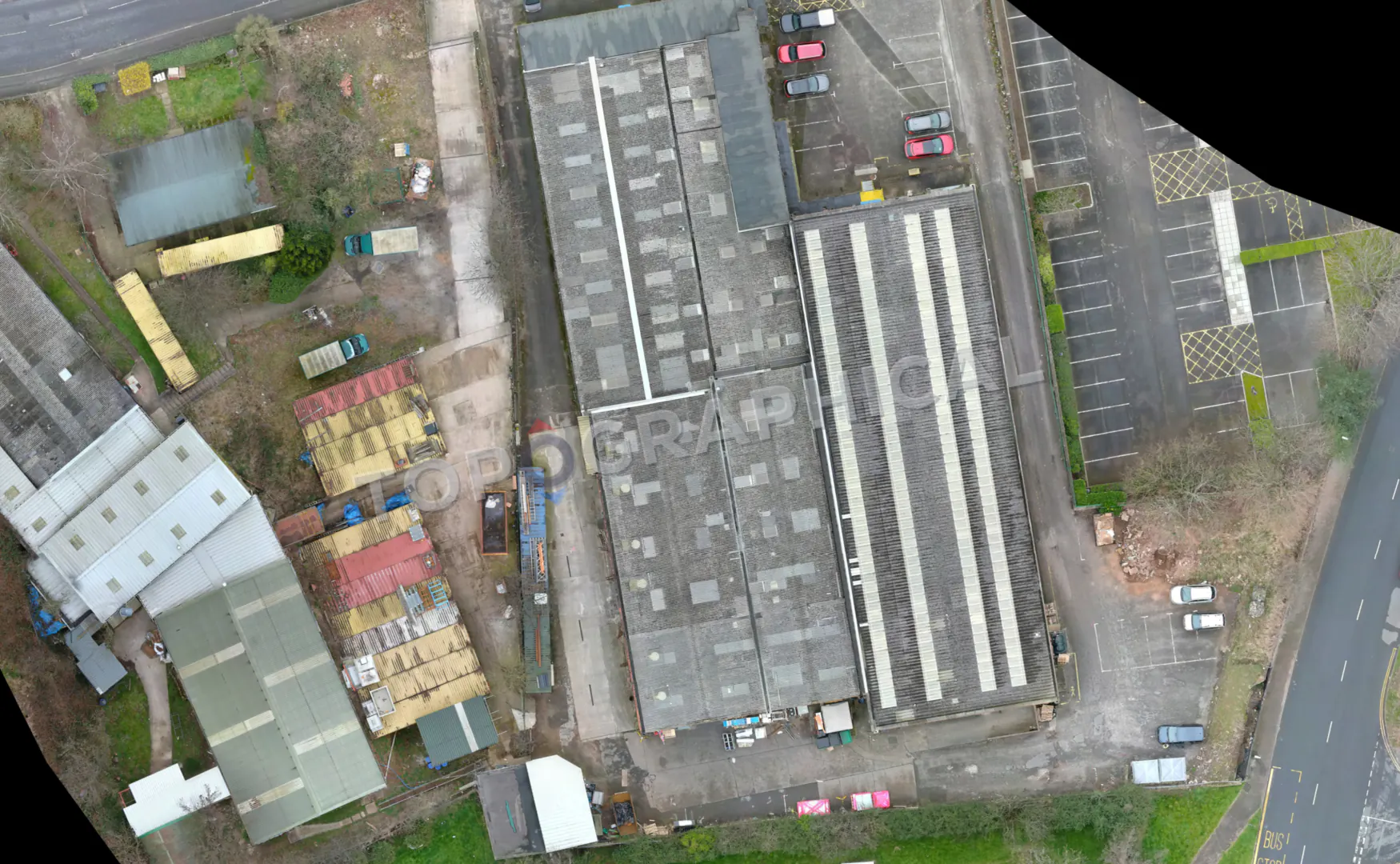
Drone capture
Surface and volume models
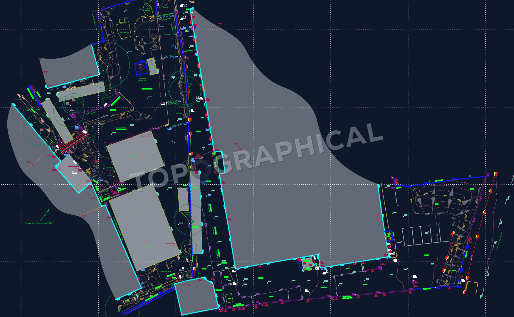
Example deliverable
From measured site to topographical drawing
An operational site needs more than its building outline
The drawing separates structures, kerbs, hardstanding, surface changes, visible drainage covers and access routes within one coordinate and level framework.