Topographical Surveys in Nottinghamshire
A constrained Nottingham frontage, Trent Valley level route and former coalfield site can each push the measured extent beyond an obvious red line. We agree the boundary, control, 2D plan, 3D model and fixed price before fieldwork begins.
Main centres
Nottingham, Mansfield, Newark-on-Trent, Worksop
Common site mix
Dense urban sites, former coalfield areas, Trent Valley land, market towns, industrial sites, and rural estates.
A constrained Nottingham frontage, Trent Valley level route and former coalfield site can each push the measured extent beyond an obvious red line. We agree the boundary, control, 2D plan, 3D model and fixed price before fieldwork begins.
Measure the route the design depends on
For flood or drainage design, continuous levels may be needed from building thresholds through highway edges, embankments, ditches or watercourse margins. An access design may require extended frontage, opposite kerbs, footways, crossfalls and visibility obstructions. A conservation or tree-led scheme may need boundary walls, facade lines, street furniture and mature vegetation beyond the red line. Those items enter the fixed scope when the project needs them.
Mining risk is also address-specific. A topographical survey cannot locate workings or replace a Coal Mining Risk Assessment. If a ground or mining specialist supplies verified surface markers, we can coordinate those positions into the project grid. We do not infer underground features from the shape of the ground.
Use the brief for the address
Nottingham City manages its own planning and highway matters. Mansfield, Newark-on-Trent and Worksop sit within separate district planning authorities, while Nottinghamshire County Council retains highway responsibilities outside the city and deals with minerals, waste and certain county developments. A phrase such as "required for planning in Nottinghamshire" is too vague to price and too vague to survey.
Nottingham City, Mansfield, Newark and Sherwood, and Bassetlaw publish separate planning and validation information. That matters only when the project team turns it into a measurable requirement, such as flood levels, highway context, trees or heritage detail. The current written brief, not the county name, controls what we survey.
What the fixed price covers
- A coordinated 2D plan and 3D terrain model in the agreed file formats, coordinate system and level datum.
- Ground levels, breaklines, hard surfaces, buildings, visible boundary features, trees and other specified surface detail.
- Visible cover positions and top levels, plus visible drainage features where included in the brief.
- Agreed adjoining or highway detail where access and sight lines allow it to be measured.
We do not lift covers, measure inverts, trace buried utilities, carry out GPR or CCTV drainage work, determine legal boundaries, prepare flood assessments or provide planning advice. Those are separate specialist commissions.
What to send us
Send us the site red line, intended use, required file formats, access details, any project-specific accuracy requirement and any written requirements from the authority or project consultant. Your quote will state what we will survey, what we will deliver, any exclusions and the delivery date. The price is fixed, not billed by the hour or day.
Local references
We last checked these sources in July 2026. Planning guidance changes, so please send us the latest brief from your architect or consultant and we will price the right survey for your site.
- Nottinghamshire County Council apply for planning permission (opens in a new tab)
- Nottingham City Local Plan review (opens in a new tab)
- Mansfield Local Plan review (opens in a new tab)
- Newark and Sherwood new Local Plan (opens in a new tab)
- Bassetlaw new Local Plan timetable (opens in a new tab)
- Bassetlaw local validation requirements (opens in a new tab)
- Newark and Sherwood planning application requirements (opens in a new tab)
- Mining Remediation Authority planning guidance (opens in a new tab)
- Environment Agency Flood Map for Planning (opens in a new tab)
Survey control
Drone capture
Surface and volume models
Example deliverable
From measured site to topographical drawing
One coordinate framework across ground, features and levels
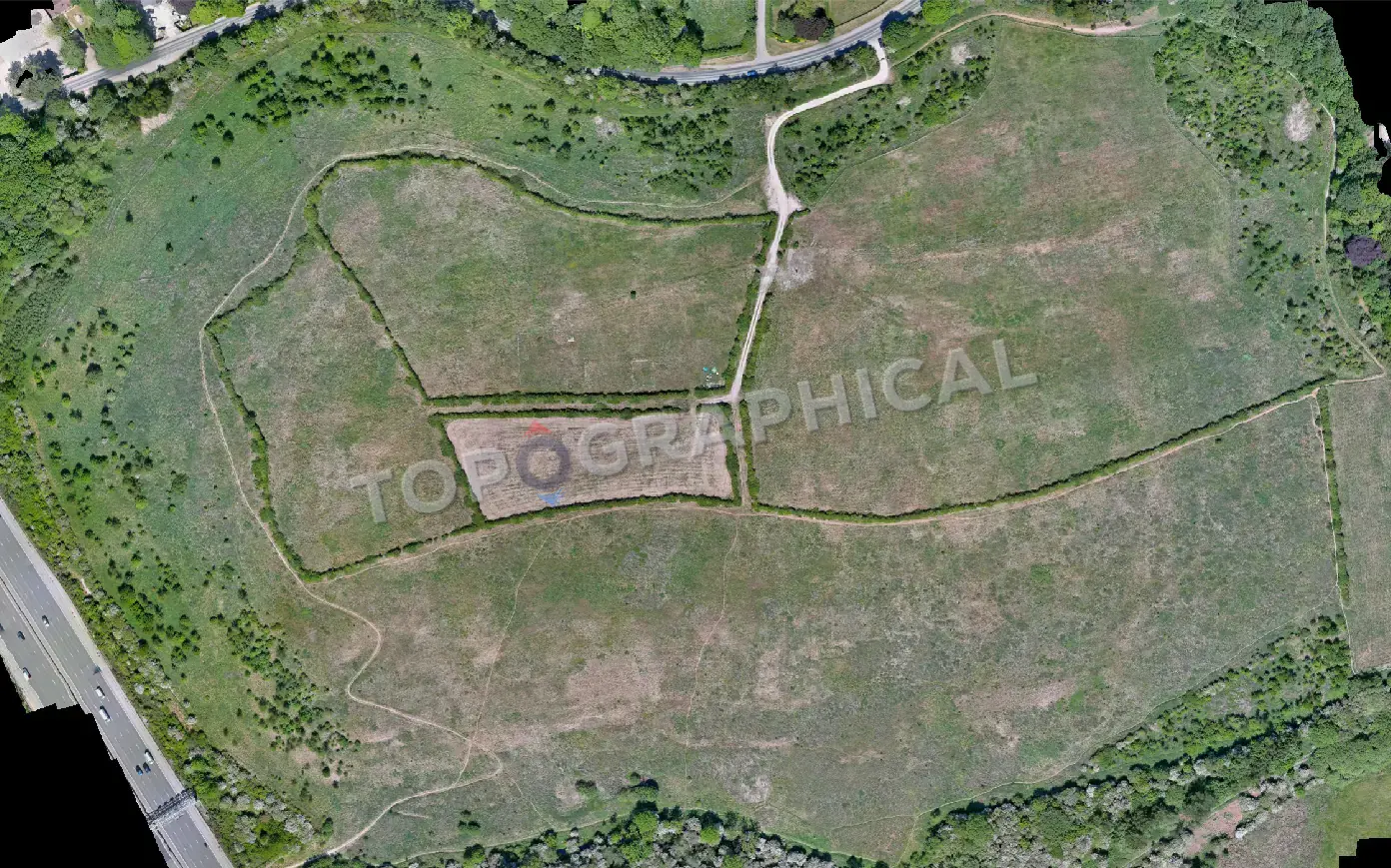
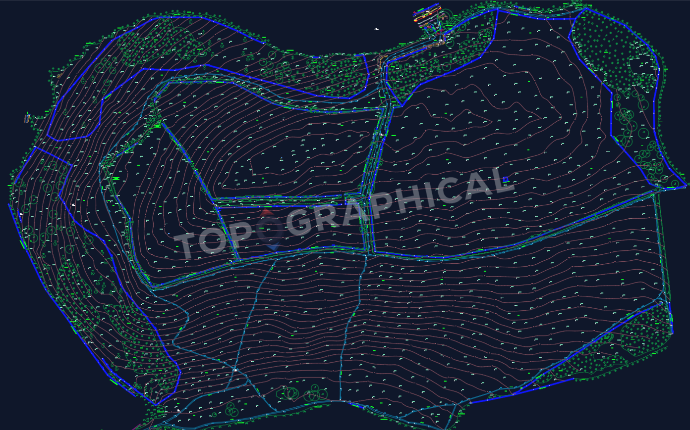
The left view is site imagery. The right shows linework and levels compiled from the full measured dataset, not traced from the photograph.