Topographical Surveys in Rutland
On a compact Rutland site, the measurement that decides the design is often just beyond the obvious boundary: an opposite kerb, ditch outlet, wall base or neighbouring threshold. We agree that wider extent first, then provide a fixed price for one coordinated 2D plan and 3D model.
Main centres
Oakham, Uppingham
Common site mix
Market-town infill, limestone villages, rural holdings, sloping settlement edges, reservoir catchments, and compact development sites.
On a compact Rutland site, the measurement that decides the design is often just beyond the obvious boundary: an opposite kerb, ditch outlet, wall base or neighbouring threshold. We agree that wider extent first, then provide a fixed price for one coordinated 2D plan and 3D model.
The expensive omission is often outside the red line
An Oakham infill plot may need a street section that reaches the opposite channel, plus ridge, eaves and window positions on adjoining property. Around Uppingham, walls, gates, mature trees and sharp changes of level can crowd a small plot. The survey brief should name those relationships while they can still be captured during one visit, not after the drainage or access design has started.
Village work brings a different risk. A hedge may hide a bank and ditch; a proposed entrance may depend on levels along a narrow lane; a consultant may need the visible route towards a watercourse rather than a patch of spot heights inside the site. Where the work reaches beyond the client's land, access permission is part of the scope.
Follow one useful chain of levels
Rutland County Council publishes planning, neighbourhood and water evidence for the area, while neighbourhood plans in places such as Edith Weston add address-specific context. Those sources help the appointed consultants decide what they need. Our survey then follows their question through the site: thresholds to low points, low points to channels, and channels towards the nominated visible outlet.
That distinction matters. We measure surface geometry and connected falls; we do not make a flood-risk assessment or decide whether a drainage proposal is acceptable. If a highway consultant needs a verge, carriageway edge or visibility feature, it must be marked in the same way. Legal highway and boundary positions still come from the relevant records, not from appearance on site.
Access can be the real constraint on rural commissions. Locked paddocks, livestock, standing crops, dense vegetation, water margins and third-party gardens can interrupt the requested level route. Tell us what can be entered safely and who will provide keys or an escort. Any unmeasured area is identified rather than filled with assumed data.
What the fixed price covers
The quotation states the survey polygon, off-site ties, coordinate system, level datum, visible feature list and output formats. The fixed price covers fieldwork within that extent, survey control, processing, and issue of the agreed 2D plan and 3D model. It also records any assumption about vegetation, road access or neighbouring land.
Visible cover positions and top levels can be plotted when requested. We do not lift covers, measure inverts, trace utilities, undertake GPR or CCTV work, determine legal boundaries, design drainage or give planning advice. Those tasks need the relevant specialist appointment.
What to send us
Send the full address, a marked measured extent and a sentence explaining the design decision the survey must support. Add the consultant's specification, file formats, grid and datum instructions, access contact and required date. Mark highway ties, drainage routes, tree information, neighbour elevations and any feature outside the ownership boundary. Existing CAD is helpful even when it is known to be incomplete.
Local references
We last checked these sources in July 2026. Planning guidance changes, so please send us the latest brief from your architect or consultant and we will price the right survey for your site.
Survey control
Drone capture
Surface and volume models
Example deliverable
From measured site to topographical drawing
Tight residential sites still need complete external context
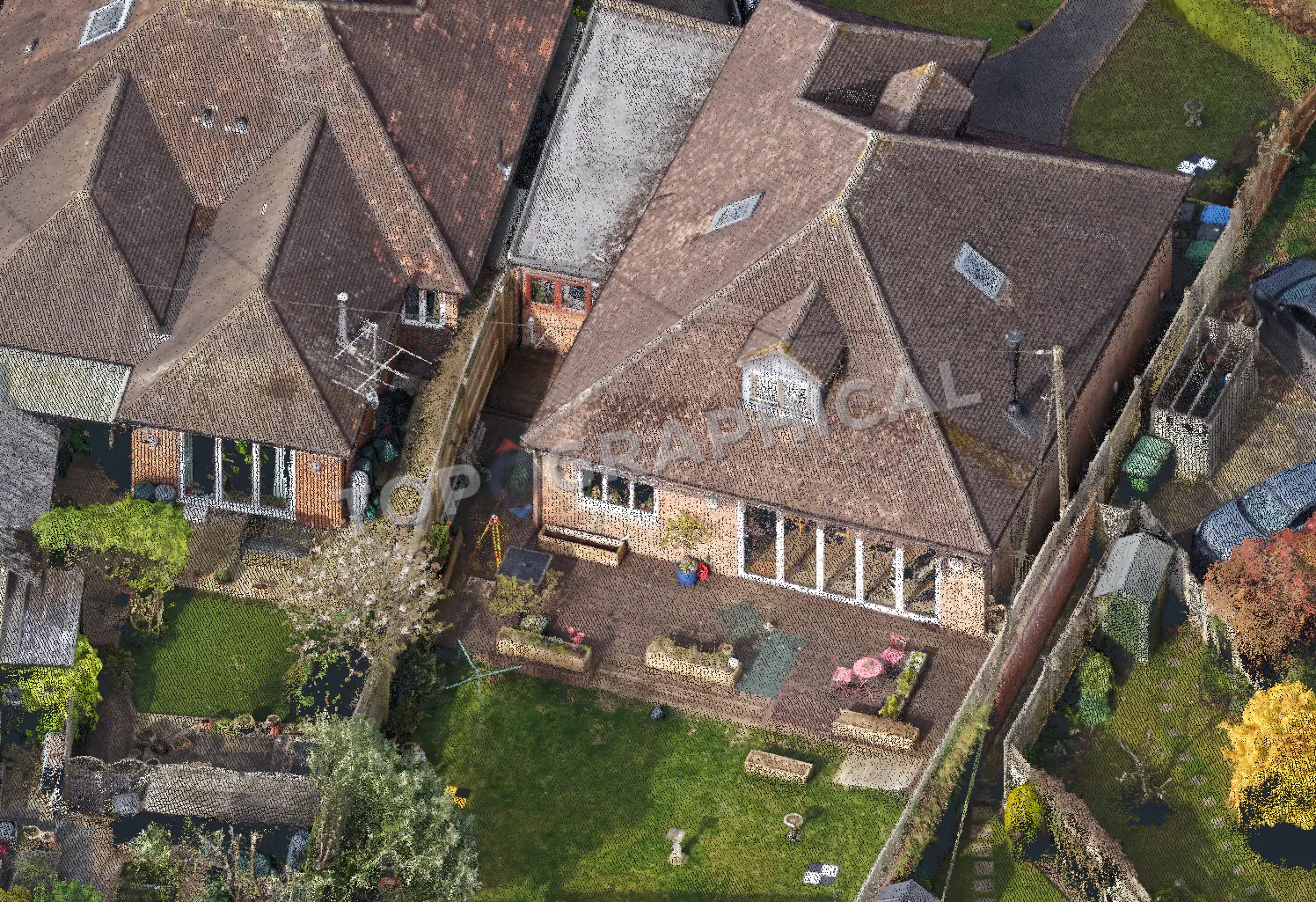
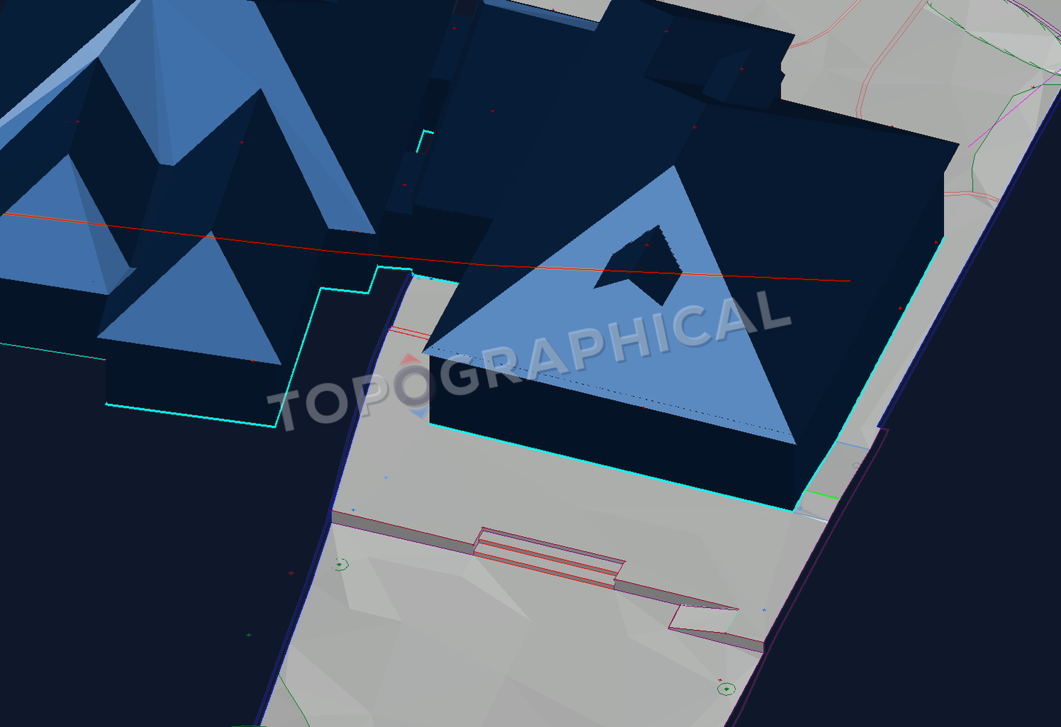
The registered point cloud records roofs, extensions, boundaries, gardens and level changes. The 3D survey model turns that dense context into coordinated surfaces and building forms for design.