Topographical Surveys in Warwickshire
We provide a coordinated 2D topographical plan and 3D model of the agreed Warwickshire site, measured for the architect or engineer who will use it. The survey boundary, connected levels, detail, control, access and formats are settled before we issue a fixed price.
Main centres
Warwick, Leamington Spa, Stratford-upon-Avon, Rugby, Nuneaton
Common site mix
Village edges, estate roads, river and drainage corridors, historic town plots, employment land and rural access.
We provide a coordinated 2D topographical plan and 3D model of the agreed Warwickshire site, measured for the architect or engineer who will use it. The survey boundary, connected levels, detail, control, access and formats are settled before we issue a fixed price.
A rural entrance or town-edge plot can look self-contained until the engineer asks where the levels go next. The useful survey may need to leave the ownership boundary and connect thresholds or low points to a road channel, footway, ditch or visible outlet. That route must be marked and accessible before the quotation is fixed.
Connect the site to its outlet and entrance
A consultant designing vehicle access may ask for kerb, channel, footway, verge and road levels over a stated distance, plus visibility-related features. A drainage engineer may need continuous levels from thresholds and low points to ditches, channels or visible chambers. On village and rural edges, banks, hedges, walls and changes in surface need breaklines rather than a loose scattering of spot heights. Ask each designer to mark their required tie points before quotation.
Warwickshire County Council's Design Guide addresses development and highway design, and its flood guidance covers planning and sustainable drainage. Those pages help the project team identify supporting work and its survey consequence. We record the specified physical site and do not advise on policy, drainage design or application strategy.
Warwick District Council, Stratford-on-Avon District Council, Nuneaton and Bedworth Borough Council and Rugby Borough Council publish their own application information. Any resulting request for highway levels, a connected drainage route or a site section belongs in the brief for the address, not in a county-wide default.
Resolve land access early
Surveying beyond the red line needs permission. Confirm who controls private roads, adjoining fields, river banks and neighbour land, and whether highway work needs traffic management. Tell us about livestock, crops, water, locked gates, occupied yards and known ground hazards. Seasonal vegetation can hide ditches and wall bases, so photographs taken when the brief is prepared are useful.
If a location cannot be reached safely, the handover identifies the resulting limit. We do not present mapped or assumed geometry as field observation.
What the fixed price covers
The quotation defines the survey polygon and off-site ties, required visible detail, level density, survey control, attendance and output. It includes a coordinated 2D plan and 3D model in the agreed CAD formats, together with PDF sheets when listed. The coordinate and vertical basis are shown so highway, drainage and architectural teams can relate their work to the same control.
We do not lift covers, measure inverts, trace buried utilities, carry out GPR or CCTV drainage surveys, or provide planning advice. Visible covers can be surveyed at surface level, but below-ground route, depth and condition require separate investigation.
What to send us
Send the address, marked site and off-site extent, proposed use, consultant's specification, required CAD formats and deadline. Add existing plans or models, coordinate requirements, access contact, land permissions, induction or traffic arrangements and known hazards. Mark highway tie points, drainage routes, proposed sections and any neighbouring level or elevation needed by the design team.
Local references
We last checked these sources in July 2026. Planning guidance changes, so please send us the latest brief from your architect or consultant and we will price the right survey for your site.
- Warwickshire Design Guide (opens in a new tab)
- Warwickshire flood risk guidance for development (opens in a new tab)
- Warwick District planning application process (opens in a new tab)
- Stratford-on-Avon planning application process (opens in a new tab)
- Nuneaton and Bedworth local validation checklist (opens in a new tab)
- Rugby Borough Council validation checklist (opens in a new tab)
Survey control
Drone capture
Surface and volume models
Example deliverable
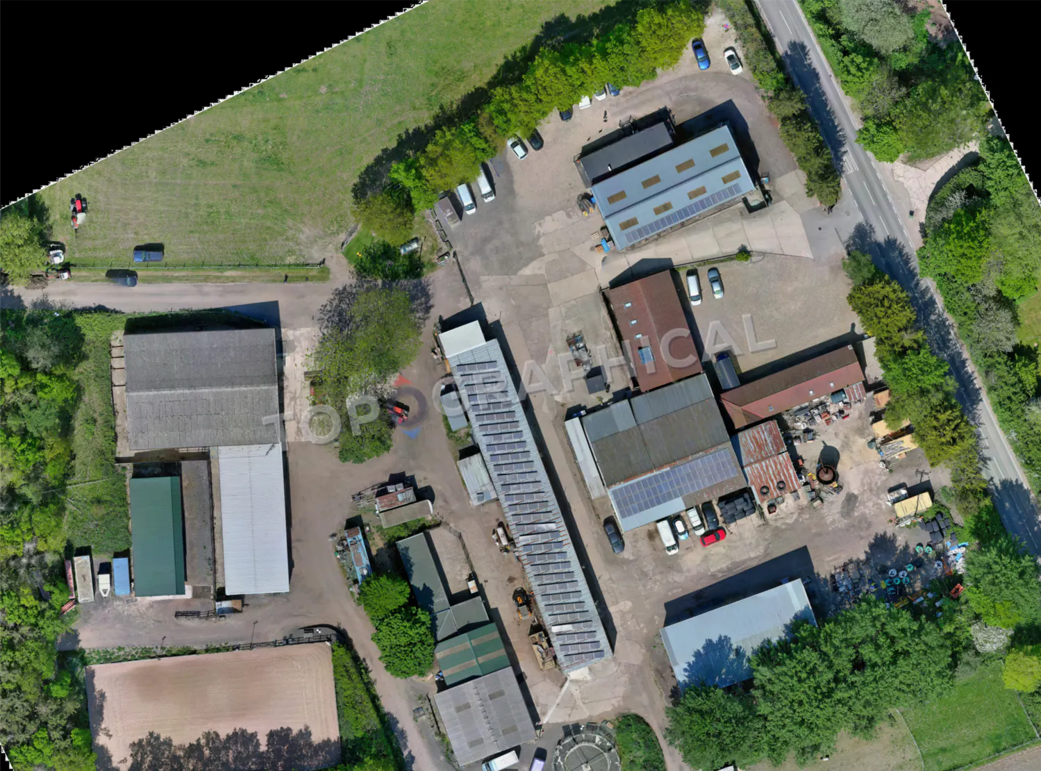
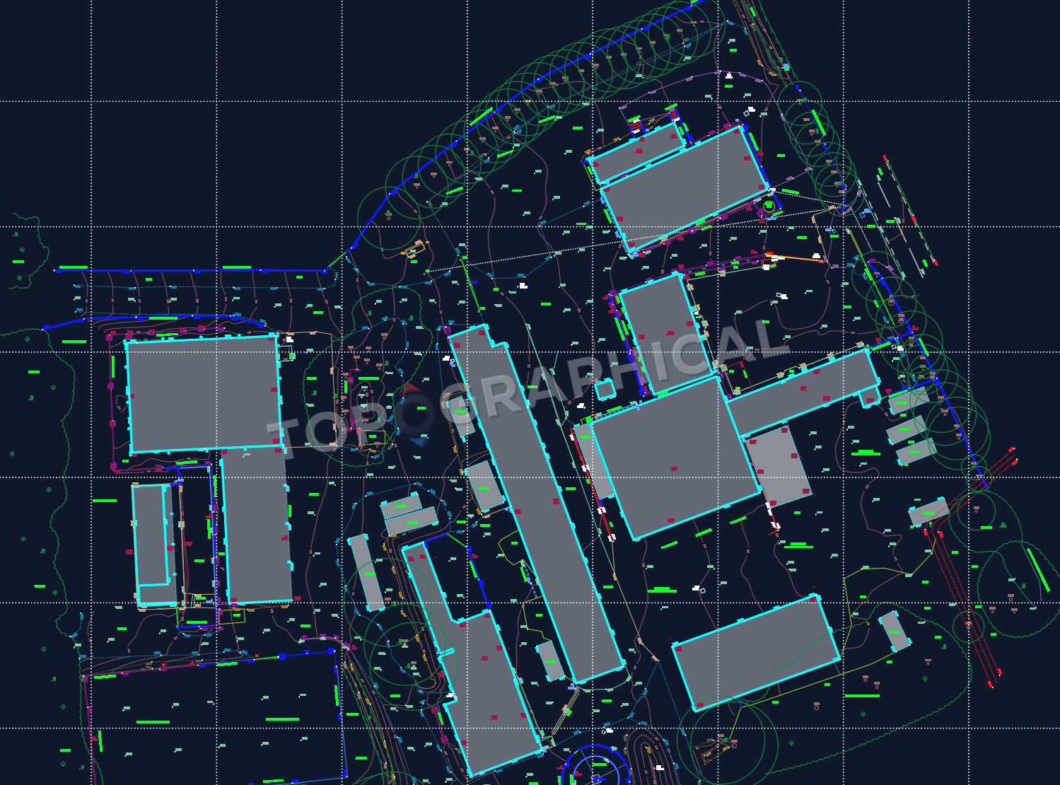
From measured site to topographical drawing
Dense sites need drawing hierarchy
Structures, hardstanding, boundaries, vegetation and access are separated into specified CAD layers, producing linework a designer can edit, query and reference.