Topographical Surveys in East Riding of Yorkshire
We survey an agreed East Riding or Hull site and issue a coordinated 2D plan and 3D model ready for the appointed designer's software. The extent, connected levels, visible features, access and formats are written into a fixed-price quotation before fieldwork.
Main centres
Hull, Beverley, Bridlington, Goole, Driffield
Common site mix
Low-gradient development land, port and industrial sites, coastal plots, village edges and agricultural access.
We survey an agreed East Riding or Hull site and issue a coordinated 2D plan and 3D model ready for the appointed designer's software. The extent, connected levels, visible features, access and formats are written into a fixed-price quotation before fieldwork.
Hull City Council and East Riding of Yorkshire Council are separate planning authorities, despite the close physical relationship between their areas. That distinction is worth resolving at the address, especially where a project team is following a validation list or planning constraint. The survey brief then has to deal with the site itself: a low-gradient plot near Goole can make small level differences important to drainage, while a Hull yard or coastal property may have hard boundaries, live access and off-site relationships to capture.
Preserve a continuous level route
Flat-looking ground is not level ground. For drainage, access or flood-related design, the engineer may need close spot levels and breaklines along channels, kerbs, thresholds, banks, ditches and surface changes, connected to an agreed datum and beyond the immediate building footprint. Ask them to mark the route and any off-site tie points. A dense but isolated patch of levels is less useful than a measured chain that reaches the feature controlling the design.
East Riding of Yorkshire Council publishes a strategic flood risk assessment covering different sources of flood risk and provides a planning constraints map. Hull City Council has its own application forms and validation route, while the Environment Agency's national Flood Map for Planning provides address-based context. These resources can tell the consultant which specialist questions to ask. A topographical survey records dimensions and visible levels; it is not a flood risk assessment and does not determine planning acceptability.
Plan around working land
Port-related and industrial premises may need escorts, inductions, vehicle separation or visits outside operating peaks. Rural sites can be divided by ditches, crops, livestock, locked tracks or boundaries whose ownership is unclear. Coastal weather and vegetation can also affect what is safely visible on the day. Give us those facts before quotation, together with permission for any neighbouring or highway-side measurements.
Any inaccessible section is shown as a limit or omission. We do not join data across an unseen area and present it as observed survey information.
What the fixed price covers
The quotation lists the measured polygon, features, spot-level or breakline detail, survey control, attendance and files. The normal design issue is a coordinated 2D topographical plan and 3D model in agreed CAD formats; PDFs can be included for simple review. We state the coordinate and vertical basis on the deliverables and price additional site phases separately if they are known at enquiry.
We do not lift covers, measure inverts, trace buried utilities, carry out GPR or CCTV drainage surveys, or provide planning advice. Visible covers and drainage furniture may be surveyed as surface features, but no below-ground connectivity or condition is implied.
What to send us
Send the full address, marked red line, purpose of the survey, consultant's detail specification, file formats, coordinate requirements and deadline. Include existing CAD or plans, the access contact, inductions, working hours, known hazards and third-party permissions. If drainage, flood, highway or coastal work has driven the instruction, attach the specialist's requested points and section lines.
Local references
We last checked these sources in July 2026. Planning guidance changes, so please send us the latest brief from your architect or consultant and we will price the right survey for your site.
- East Riding planning application validation (opens in a new tab)
- East Riding strategic flood risk assessment (opens in a new tab)
- East Riding planning constraints map (opens in a new tab)
- Hull planning application forms and validation (opens in a new tab)
- Environment Agency Flood Map for Planning (opens in a new tab)
Survey control
Drone capture
Surface and volume models
Example deliverable
From measured site to topographical drawing
A rural site model keeps buildings and terrain connected
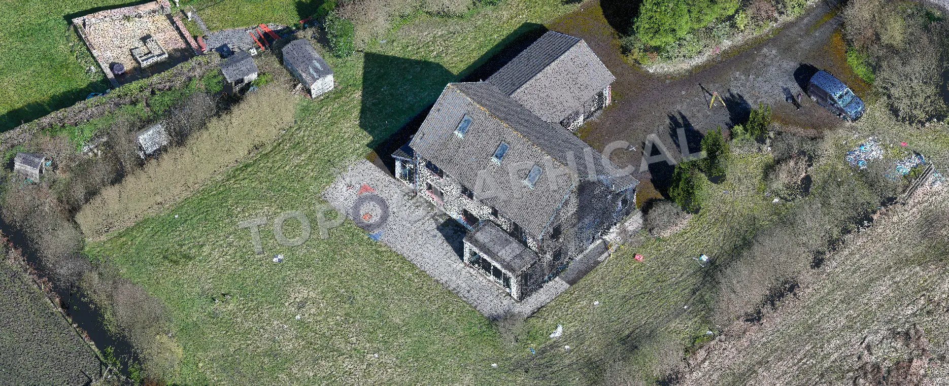
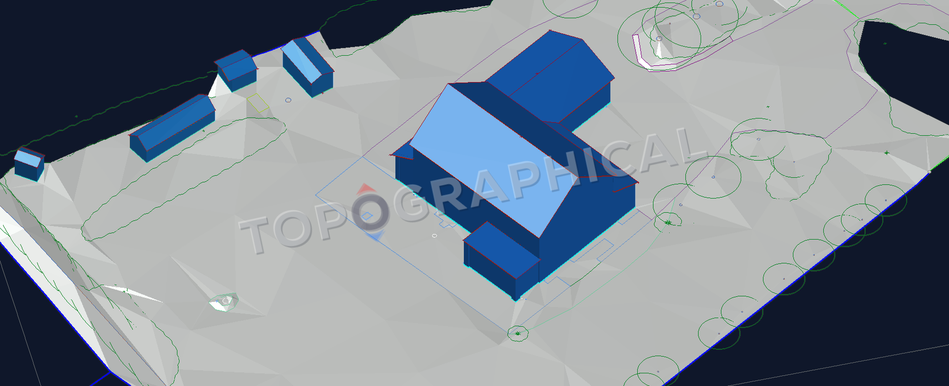
The point cloud captures the property, outbuildings, access and surrounding ground. The delivered model retains their measured relationship instead of isolating the main building from its site.