Topographical Surveys in West Yorkshire
We provide West Yorkshire design teams with a coordinated 2D topographical plan and 3D model based on an agreed, site-specific brief. The fixed price is set once the boundary, required features, level density, access and output formats are clear.
Main centres
Leeds, Bradford, Wakefield, Huddersfield, Halifax
Common site mix
Pennine slopes, mill sites, dense urban plots, retaining walls, river corridors and constrained road frontages.
We provide West Yorkshire design teams with a coordinated 2D topographical plan and 3D model based on an agreed, site-specific brief. The fixed price is set once the boundary, required features, level density, access and output formats are clear.
West Yorkshire can expose a weak survey brief very quickly. Across the City of Bradford Metropolitan District Council and Kirklees Council areas, levels may cross walls, banks, yards and stepped access over a short horizontal distance. In Leeds or Wakefield, a compact redevelopment site may put the proposed works beside public highway, neighbouring buildings, mature trees and active premises. Around Halifax, Calderdale Council's steep urban ground can make wall tops, wall bases and connected access levels central to the model. A single contour interval does not explain which relationship the designer needs to test.
Follow the levels that matter
For a sloping site, we agree where tighter spot levels and breaklines are needed: wall tops and bases, thresholds, kerb channels, ramps, steps, banks and changes of surface. Where drainage is under review, the engineer may ask for connected levels from the site to visible highway or watercourse features. Where massing or access is the issue, ridge and eaves heights, boundary construction and adjacent ground may matter more than a dense grid elsewhere.
Leeds City Council's validation guidance deals with boundaries, adjoining structures, access and site levels on sloping land. Wakefield Council, Kirklees Council and Calderdale Council publish their own planning material, while the City of Bradford Metropolitan District Council adds a specific habitat context around the South Pennine Moors. These sources help your planning consultant identify what an application might need. Our part is to measure the agreed physical facts; we do not decide the planning case or ecological scope.
Boundaries and access need names
A red line is much safer than a postcode. Mark whether the survey stops at a fence, title edge, kerb, watercourse or stated offset, and identify any off-site levels or elevations the consultant needs. Confirm permission for neighbouring land, locked yards and private tracks before attendance. On steep or overgrown ground, the field team also needs to know about unsafe walls, water, livestock and concealed drops.
If traffic management, an escort or out-of-hours work is required, it belongs in the quotation. Areas that cannot be reached safely are reported as gaps, not completed from guesswork.
What the fixed price covers
The price covers the stated field extent, agreed visible detail, survey control, processing and delivery of a coordinated 2D plan and 3D model in the named formats. We set out the coordinate and level basis on the drawing and can add PDFs for review. Revisions caused by a later increase in boundary or detail are treated as a scope change, so it pays to involve the drawing's end user before we quote.
We do not lift covers, measure inverts, trace buried utilities, carry out GPR or CCTV drainage surveys, or provide planning advice. Visible chamber covers can be included as surface features, but their presence does not describe the buried network.
What to send us
Send the address, a marked survey boundary, proposed use, consultant's specification, CAD and PDF requirements, deadline and any existing site drawing. Add the access contact, working-hour restrictions, hazards and locations that need third-party consent. If flood, highways, trees, habitat or a particular section has prompted the survey, say so: that lets us price the measurements your specialist expects without taking over their role.
Local references
We last checked these sources in July 2026. Planning guidance changes, so please send us the latest brief from your architect or consultant and we will price the right survey for your site.
- Leeds planning application validation requirements (opens in a new tab)
- Bradford South Pennine Moors planning requirements (opens in a new tab)
- Wakefield planning application requirements (opens in a new tab)
- Kirklees planning guidance and validation (opens in a new tab)
- Calderdale planning policy (opens in a new tab)
- Environment Agency Flood Map for Planning (opens in a new tab)
Survey control
Drone capture
Surface and volume models
Example deliverable
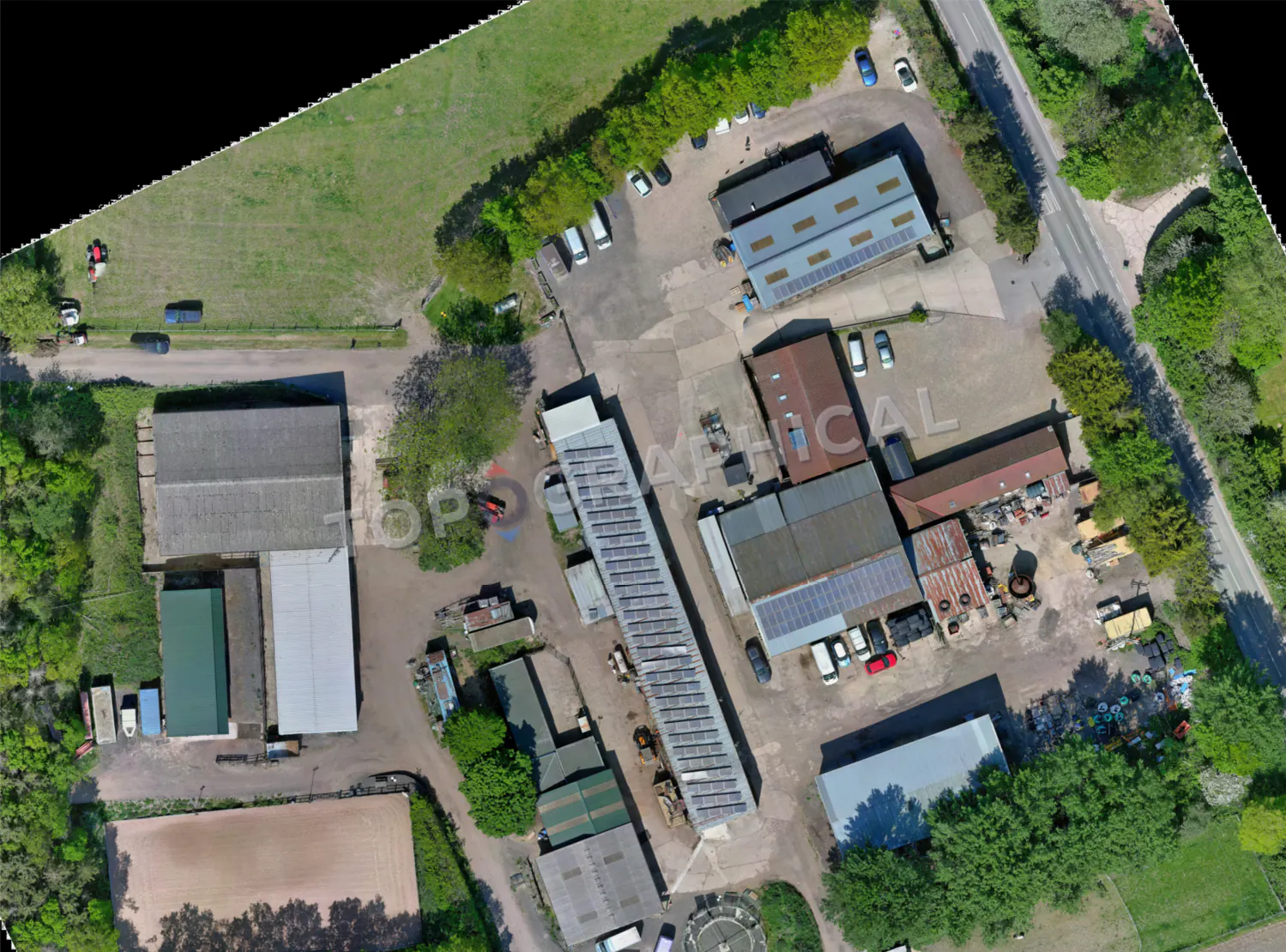
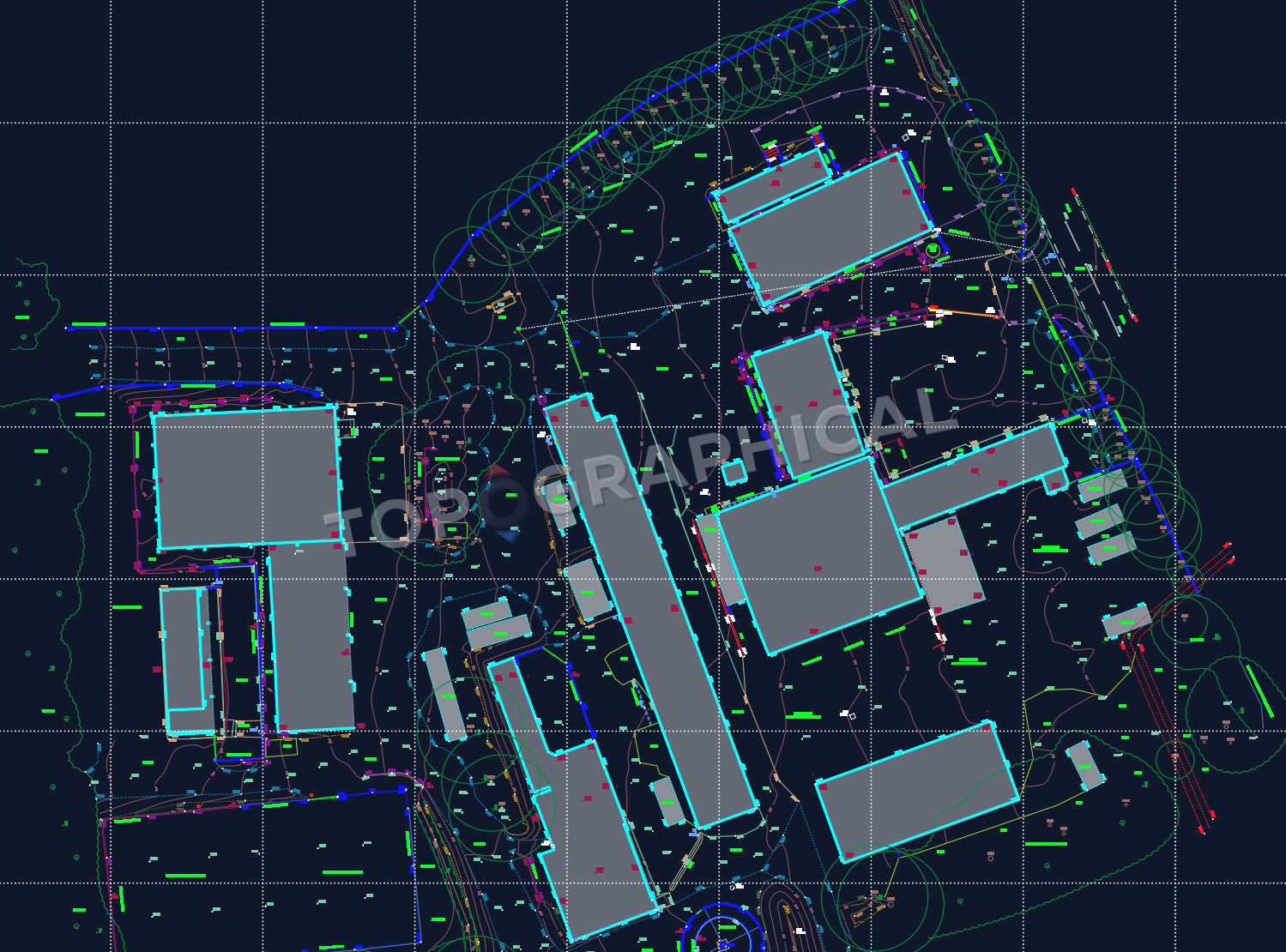
From measured site to topographical drawing
Dense sites need drawing hierarchy
Structures, hardstanding, boundaries, vegetation and access are separated into specified CAD layers, producing linework a designer can edit, query and reference.