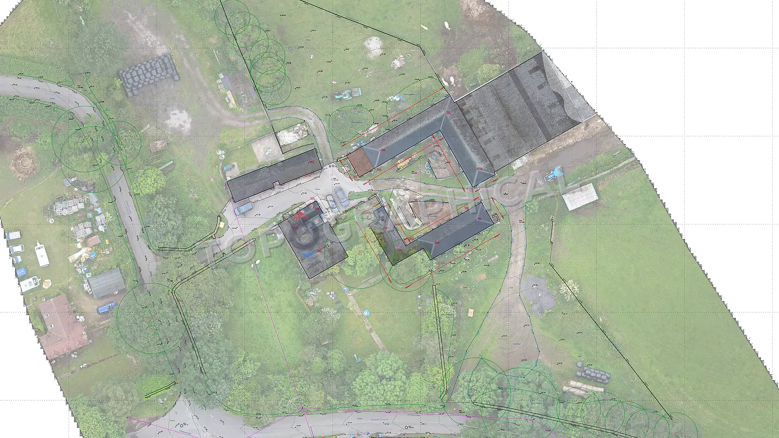
Topographic Surveys for Solar Farms
Why large solar sites need measured terrain data for panel layout, drainage, cable routes, access tracks, and planning evidence.
Don't design solar arrays on an assumed "flat" 50-hectare site. Commission a drone-based topographic survey to map every dip and ridge, preventing millions in lost yield from row-shading and saving engineering teams from catastrophic trenching clashes.
The planning consultant's site description says "gently undulating agricultural land." The developer's feasibility model assumes a uniform gradient. The landowner, who has farmed the field for thirty years, describes it as "basically flat." And the topographic survey, when it arrives, reveals that the site falls 15 metres from its northern boundary to its southern, contains a shallow valley running east-west through the centre, has a drainage ditch along the western edge whose bank levels sit 2 metres below the adjacent field surface, and includes a pronounced local ridge in the northeast quadrant where a medieval field boundary once ran, now ploughed flat but still registering at 800mm above the surrounding terrain.
None of these features are visible from a car window. None of them appear on OS mapping at publicly available resolution. All of them affect the engineering design of a ground-mounted solar array, because solar panels are mounted on frames driven into the ground at a calculated height and angle, and if the ground is not where the design assumed it was, the frames are either too tall (wasting material and increasing wind loading) or too short (panels shadowing adjacent rows on the lower ground), or the entire row alignment requires redesign to follow the actual contours rather than the fictional flat plane the feasibility model was built on.
Why solar farms need topographic data
Panel array design. Ground-mounted solar panels are arranged in rows oriented to maximise solar exposure (typically south-facing in the UK, at a tilt angle of 10 to 35 degrees depending on latitude and panel technology). The spacing between rows is calculated to avoid inter-row shading, and that calculation depends on the ground gradient. On a slope, the effective height difference between rows increases or decreases depending on whether the slope runs with or against the row direction, which means row spacing must be adjusted to maintain the same shading-free geometry that would apply on flat ground. Without measured gradients, the designer either over-spaces (wasting capacity) or under-spaces (causing shading losses that reduce yield for the life of the installation).
Cable routing and trenching. The cables connecting panel strings to inverters, and inverters to the grid connection point, run underground in trenches. The routing of those trenches follows the terrain to minimise cut depth and avoid crossing the drainage infrastructure that keeps the land productive. A topographic survey showing existing drainage ditches, field drains, watercourse positions, and ground levels along potential cable corridors allows the electrical designer to route efficiently rather than discovering, during construction, that the proposed trench line crosses a ditch that was not on the drawings.
Surface water drainage and flood risk. A solar farm on 50 hectares of agricultural land does not significantly increase impermeable area (the panels are elevated above ground, and rainfall passes through to the soil beneath), but the access tracks, inverter housings, battery storage compounds, and substation bases do represent impermeable surfaces that must be drained. The FRA submitted with the planning application requires site levels in metres AOD, cross-sections, and surface water flow paths, all of which derive from the topographic survey.
Access track design. The internal access tracks serving the array for maintenance must follow the terrain at gradients that allow vehicle access. On a site with significant topography, track routing is a design decision that requires measured levels to avoid gradients that exceed vehicle capability or require earthworks to flatten.
Landscape and visual impact assessment. The LVIA submitted with the planning application assesses the visual effect of the development from surrounding viewpoints. The height of the panels above ground level, combined with the existing terrain profile, determines what is visible from where. Measured site levels allow the landscape consultant to produce accurate cross-sections showing panel heights relative to boundary vegetation, adjacent properties, and public rights of way.
The scale of the survey (and why drones are the rational methodology)
A typical ground-mounted solar farm in the UK occupies between 20 and 100 hectares. At that scale, a conventional ground-based topographic survey (surveyor walking the site with a total station or GNSS rover) would require weeks of fieldwork and cost accordingly. The rational methodology for open agricultural land at this scale is drone-based capture (either photogrammetric or LiDAR, depending on vegetation conditions), which can cover 50 hectares in a single day of flying and produce a point cloud and digital terrain model at a density and accuracy that satisfies the engineering design requirement.
For solar farm sites, the specification typically requires:
- Spot levels at a density sufficient to generate contours at 0.5m or 1.0m intervals (depending on terrain variation)
- A digital terrain model (DTM) representing the bare-earth surface for import into the array design software
- Boundary features, hedgerows, ditches, and existing infrastructure in measured position
- Levels along watercourses and drainage features for FRA and drainage design purposes
- Access point levels at the highway interface
The fixed-price quote for a 50-hectare solar farm topographic survey (drone capture with ground control, DTM, contour plan, and feature identification) reflects the efficiency of the aerial methodology at this scale. The per-hectare cost for a large open site is a fraction of what the same data would cost using ground-based methods, which is why drone survey exists as a service: for precisely this type of project where coverage matters more than sub-centimetre precision, and where the engineering tolerance of the solar array design (typically plus or minus 50mm on ground levels) sits comfortably within what aerial survey delivers.
The fixed-price quote for a 50-hectare solar farm topographic survey (drone capture with ground control, DTM, contour plan, and feature identification) reflects the efficiency of the aerial methodology at this scale. The per-hectare cost for a large open site is a fraction of what the same data would cost using ground-based methods, which is why drone survey exists as a service: for precisely this type of project where coverage matters more than sub-centimetre precision, and where the engineering tolerance of the solar array design (typically plus or minus 50mm on ground levels) sits comfortably within what aerial survey delivers.
The Cost of "Assuming It's Flat" on a 50ha Site
| Impact Area | Unsurveyed / Assumed Flat | Topographically Surveyed |
|---|---|---|
| Panel Spacing | Uniform rows (risks major shading losses) | Optimized to gradient, maximizing MWh yield |
| Cable Trenching | Blind to ditches and watercourses | Efficient routing avoids expensive obstacles |
| Flood Risk (FRA) | OS data risks application rejection | Accurate AOD levels guarantee EA compliance |
| Capture Method | Weeks of expensive ground surveying | Rapid drone photogrammetry/LiDAR in one day |
When to commission (relative to the solar farm project timeline)
The topographic survey sits at the same position in the solar farm timeline as it does in any development project: before design. Specifically:
- Before feasibility/yield modelling: The array design software requires terrain data to calculate actual yield (accounting for terrain-induced shading, row spacing adjustments, and inverter string length optimisation). A yield model built on assumed flat terrain will over-predict output on a site with significant topography.
- Before planning submission: The FRA, LVIA, drainage strategy, and ecological baseline all require measured site data. Commissioning the survey before these assessments begin allows all technical consultants to work from the same base simultaneously.
- Before detailed engineering design: Frame heights, pile lengths, cable trench depths, and access track profiles all derive from the terrain model. The engineering design package that goes to the EPC contractor must be based on measured ground data to avoid construction-stage variations.
A solar farm topographic survey commissioned at the right time feeds every downstream discipline simultaneously. A survey commissioned late (after the yield model has been submitted to investors based on assumed terrain, or after the planning application has been submitted with an FRA based on OS data) creates either a credibility problem (the yield model was optimistic) or a validation problem (the FRA data is inadequate), both of which cost more to rectify than the survey cost to commission.
The emerging sector argument
The UK government's Solar Roadmap targets a tripling of solar capacity by 2030. Ground-mounted solar will account for approximately sixty to sixty-five percent of installed capacity under current policy scenarios. The volume of solar farm planning applications is increasing, and local authorities are becoming more rigorous in their validation requirements as they gain experience with the application type.
The developer who submits a solar farm application with survey-grade topographic data, an FRA built on measured levels, and a landscape assessment supported by accurate cross-sections, is submitting an application that validates first time, satisfies the Environment Agency without further information requests, and provides the case officer with the confidence to recommend approval without requesting additional technical detail.
The developer who attempts to reduce upfront costs by relying on LiDAR data scraped from the Environment Agency's open-access DTM (which has a vertical accuracy of plus or minus 150mm and a resolution that misses features smaller than 2m) discovers that saving on the survey costs time on the consenting programme, which costs money on the grid connection timeline, which costs yield on the energy generation forecast.
The survey is cheap. The delay is expensive. The arithmetic has not changed since the first solar farm was built, and it will not change for the next thousand.
Frequently Asked Questions (FAQ)
Can't we just use free Environment Agency LiDAR data for solar farms? No. Open-source EA LiDAR has a vertical accuracy of ±150mm and misses features under 2m. Using it risks massive errors in panel mounting heights and row shading calculations.
Why use drones instead of traditional surveyors for solar? Scale. A 50-hectare site takes weeks to survey on foot. A drone captures survey-grade photogrammetry or LiDAR in a single day, drastically cutting costs while meeting the required ±50mm engineering tolerances.
When should the developer commission the survey? Before yield modelling and planning submission. Yield models built on assumed flat terrain will over-predict generation, causing major financial discrepancies later.
Ready to brief a survey?
Draw your site, define the scope, and receive a fixed-price quote.
Start a Survey Quote