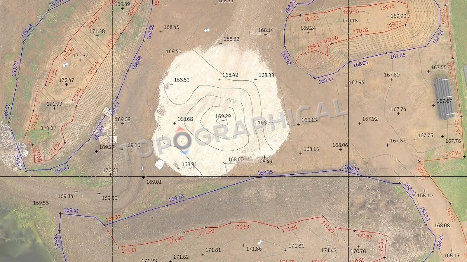
How Long Is a Topographic Survey Valid?
A practical guide to when topographic survey data remains reliable, when it needs updating, and what site changes invalidate it.
A topographic survey does not have a regulatory expiration date; it is valid exactly as long as the site remains physically unchanged. If construction, earthworks, or adjacent developments alter the site, the survey immediately expires in the affected areas and requires a partial update.
A topographic survey does not expire. There is no regulatory date stamp, no best-before label, no professional standard that declares the data invalid after a fixed period. What there is, instead, is a simpler and less comforting principle: a topographic survey is valid for exactly as long as the site it describes remains unchanged, and the moment someone digs a trench, fells a tree, builds a wall, erodes a bank, extends a building, or alters a surface within the survey area, the data no longer represents reality at that location, and any decision predicated on its accuracy at that point carries the risk of being wrong.
This is not a deficiency of the survey. It is a property of physical reality: things change, and measurements describe a moment in time.
What "unchanged" actually means in practice
For a greenfield site (no construction activity, no earthworks, stable vegetation, no adjacent development affecting boundaries or access), a topographic survey captured two or three years ago is likely to remain representative of current conditions, because open land does not spontaneously rearrange itself. Vegetation grows (hedges expand, trees add canopy), but the hard infrastructure (levels, boundaries, structures, road positions) is stable. A survey of this type has a practical shelf life of several years, provided no development activity has taken place.
For an urban site, or a site adjacent to active development, or a site where construction has occurred since the survey date, the shelf life is shorter and less predictable. A neighbouring development might have altered the boundary fence line, modified the road level at the access point, or deposited material against your boundary. Construction activity on your own site (demolition, excavation, temporary works) will have altered ground levels in areas the survey previously described.
For a building (measured building survey), the data remains valid until someone physically alters the building: knocking through a wall, adding a partition, dropping a ceiling, extending a room. For buildings in active occupation without works, a measured building survey from three or four years ago is likely still accurate. For a building that has undergone any refurbishment since the survey date, the data in the affected areas is obsolete.
When specific disciplines require current data
Planning applications. There is no national planning requirement that a topographic survey must be less than a certain age. However, if the site has changed since the survey was captured (and the planning officer can see from aerial imagery or a site visit that it has), the officer may request updated information. Submitting a survey that shows a building that has since been demolished, or vegetation that has since been cleared, raises questions about whether the design responds to current site conditions.
Flood risk assessments. The Environment Agency does not specify a maximum age for topographic data, but the flood risk consultant signing the FRA must be satisfied that the levels represent current ground conditions. If earthworks have altered the site profile since the survey, the FRA calculations based on the original levels are invalid regardless of the survey's quality at the time of capture.
Construction. A contractor pricing earthworks needs levels that describe the ground as it is now, not as it was eighteen months ago before the enabling works package regraded the access road. For construction purposes, the survey must reflect the site at the point where the pricing or design decision is being made.
Property transactions. A solicitor or lender requiring a survey as part of due diligence will typically expect data captured within the last twelve months, though there is no statutory requirement specifying this.
The practical rules of thumb
Under two years, no site changes: Almost certainly still valid for design and planning purposes. Check aerial imagery for obvious changes; if the site looks the same, the data is the same.
Two to five years, no site changes: Probably valid for the hard infrastructure (levels, structures, boundaries) but vegetation data (tree canopy spreads, hedge extents) may have changed. Worth a desktop review against current aerial imagery before relying on it.
Over five years: Even on an apparently stable site, the accumulation of minor changes (fence replacements, surface resurfacing, tree growth, adjacent development) means the data should be treated as indicative rather than definitive. A re-survey is likely more efficient than attempting to verify the existing data against current conditions.
Any site where construction or earthworks have occurred since the survey date: The data is invalid in the affected areas, regardless of age. A partial re-survey of the changed areas (tied into the original control network so the new data is spatially consistent with the unchanged portions) is the appropriate response.
Survey Shelf Life: Practical Rules of Thumb
| Age of Survey | Site Condition | Validity Status | Recommended Action |
|---|---|---|---|
| Under 2 Years | No visible changes | Valid | Proceed with design and planning. |
| 2 to 5 Years | Stable hard infrastructure, vegetation growth | Partially Valid | Desktop review against current aerial imagery; verify boundaries. |
| Over 5 Years | Accumulation of minor changes | Indicative Only | Commission a full re-survey to establish current conditions. |
| Any Age | Construction or earthworks occurred | Invalid | Commission a partial re-survey tied to the original control network. |
Why the point cloud changes this calculation
For measured building surveys produced from laser scan data, the point cloud persists as a permanent three-dimensional record of the building at the time of capture. If the building has not been altered in the area of interest, the point cloud remains a valid source for additional extractions regardless of its age. A five-year-old point cloud of an unaltered building is as dimensionally accurate today as it was on the day of capture.
This is one of the structural advantages of the laser scanning methodology: the initial capture creates a complete record, and the cost of re-extraction (answering a new dimensional question from existing data) is office processing, not a return to site. The survey "expires" only at the locations where physical change has occurred, and even then, the unchanged portions remain valid.
What to do if you have an old survey
If you possess a topographic survey from a previous project stage and you are uncertain whether it remains current:
- Review the survey date against your knowledge of site changes. Has anything been built, demolished, excavated, or planted since capture?
- Compare the survey against current aerial imagery (Google Earth, Bing Maps). Are the features shown on the survey still visible and in the same positions?
- If the site appears unchanged, the survey is likely valid for your current purpose. If you are uncertain about specific areas, ask your surveyor to review the data against current imagery and advise on whether a partial update is warranted.
- If the site has clearly changed (new structures, demolished buildings, altered levels), commission a re-survey of the affected areas, tied into the original coordinate system so the new data integrates with the unchanged portions.
A partial re-survey (updating only the areas that have changed) costs less than a full re-survey and produces a current, consistent dataset. This is possible because the original survey established a coordinate system and control network that persists even when the features within it change. We tie new data into old control, and the result is a unified plan that is current throughout.
The cost of assuming old data is still valid
An architect who designs an extension based on a three-year-old survey of a building that has since had its ground floor reconfigured discovers, at construction stage, that the wall they were tying into is no longer where the survey showed it. A developer who prices earthworks based on a two-year-old topo of a site that has since been used for material storage discovers that the ground levels have risen by 500mm across the storage area, adding unexpected disposal costs.
In both cases, the old survey was accurate on the day it was captured. It was not accurate on the day the decision was made, because the site had changed in the interim. The survey did not expire. The site moved on without it.
The question is not "how old is the survey?" The question is "has the site changed?" If the answer is no, the data is valid regardless of its age. If the answer is yes, the data needs updating, and the cost of that update is trivially small compared to the cost of the decision it protects.
Frequently Asked Questions (FAQ)
Does a topographic survey legally expire for planning applications? There is no national statutory expiration date. However, if a planning officer detects from a site visit or aerial imagery that the site has changed since the survey, they will demand updated information.
Do I need a completely new survey if only part of my site has changed? No. A surveyor can conduct a partial re-survey of the altered areas and tie the new data into the original coordinate system, creating a unified, current plan at a lower cost.
How does laser scanning affect survey validity? The raw point cloud from a laser scan is a permanent 3D record. If an area of a building remains unaltered, that portion of the point cloud remains perfectly valid and can be re-extracted for new information years later without a site visit.
Ready to brief a survey?
Draw your site, define the scope, and receive a fixed-price quote.
Start a Survey Quote