When to Use a Drone Survey
Where drone survey capture helps, where it does not, and why the deliverable should drive the method.
Drones dominate open-site surveying by covering huge areas in a fraction of the time, but they cannot penetrate dense tree canopy or survey building interiors. Stop asking for "a drone survey" and start specifying your required deliverables, then let the surveyor choose the optimal tool.
The drone, considered as a survey instrument rather than a consumer gadget, solves one specific problem with exceptional efficiency: it covers large areas of open terrain faster than any ground-based method, producing dense three-dimensional surface data from which topographic deliverables (contour plans, digital terrain models, orthomosaic imagery) can be extracted at a cost-per-hectare that makes terrestrial surveying look like an artisanal craft. For a ten-hectare greenfield site with clear sight lines and no airspace restrictions, a drone survey can capture the entire surface dataset in a single flight of twenty to thirty minutes, where a surveyor with a total station or GNSS rover would require two to three days of walking the same ground.
That efficiency gain is real, it is substantial, and it is the reason we use drones as part of our standard toolkit. It is also, however, bounded by physics, by regulation, and by accuracy thresholds that make the drone the wrong tool for a surprisingly large number of scenarios that clients (understandably) assume it would excel at.
Where drones excel (and what the deliverable looks like)
Large open sites for topographic survey. Anything above about half a hectare of open, relatively flat terrain with good GNSS visibility is drone territory. The aerial capture produces a photogrammetric point cloud or (with LiDAR-equipped platforms) a directly measured point cloud, from which we extract contours, spot levels, and surface features. Accuracy with ground control points and RTK/PPK positioning sits comfortably within plus or minus 30mm to 50mm, which satisfies the specification for the majority of topographic survey purposes including planning applications, feasibility, and preliminary design.
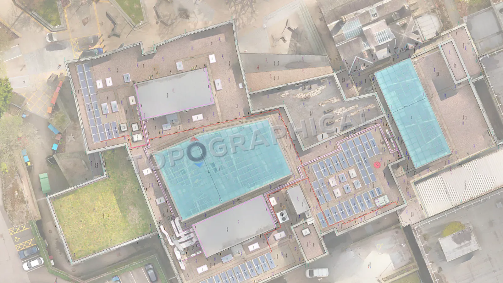
Roof surveys and inaccessible elevations. A building whose roof geometry, chimney positions, or upper elevations cannot be captured from ground level (because there is no vantage point, or because scaffolding and cherry-pickers represent a disproportionate cost for the data required) is a natural drone subject. The aerial imagery provides measurements of ridge lines, valley positions, roof plant, and material boundaries that would otherwise require either expensive access equipment or triangulated observations from the ground with diminishing accuracy.
Site context and visual documentation. An orthomosaic (a geometrically corrected aerial photograph, stitched from overlapping drone images, where every pixel has a known coordinate) is not a survey in itself, but it provides context that a line drawing cannot: the colour and condition of surfaces, the extent of vegetation, the relationship between the site and its surroundings from an angle that no ground photograph can replicate.
Volumetric surveys and earthworks monitoring. Comparing a drone-derived surface model against a design surface, or against a previous drone capture, produces cut-and-fill volumes with a speed and coverage that makes periodic progress monitoring economically viable on projects where weekly or monthly volume reconciliation is required.
Volumetric surveys and earthworks monitoring. Comparing a drone-derived surface model against a design surface, or against a previous drone capture, produces cut-and-fill volumes with a speed and coverage that makes periodic progress monitoring economically viable on projects where weekly or monthly volume reconciliation is required.
Surveying Equipment: Drones vs. Ground Methods
| Scenario | Best Tool | Why? |
|---|---|---|
| Open 10-Hectare Field | Drone (Photogrammetry/LiDAR) | Maximum speed and cost-efficiency |
| Inaccessible Roofs | Drone (Photogrammetry) | Captures heights without expensive scaffolding |
| Dense Woodland | Ground-based (Total Station) | Drones map the canopy; surveyors measure the ground |
| Sub-Centimetre Accuracy | Ground-based (Laser Scanner) | Drones cannot hit ±5mm tolerances |
Where drones do not work (and what we use instead)
Under tree canopy. A camera-based drone sees the top of the canopy. It does not see the ground beneath it. Photogrammetric processing will faithfully model the surface of the tree crowns and produce a beautiful, utterly useless terrain model of a forest that appears to be a gently undulating solid surface at approximately eight metres above where the actual ground is. LiDAR-equipped drones can penetrate canopy to some degree (depending on density and leaf-on/leaf-off conditions), but for sites with dense woodland, the ground-based surveyor with a total station, walking between the trees and measuring the terrain directly, remains the only reliable method for producing a bare-earth model at the accuracy a designer needs.
Building interiors. Drones cannot fly inside most buildings. (They technically can fly inside very large industrial spaces, warehouses, and atriums, but for a standard building survey of rooms, corridors, and staircases, the method is terrestrial laser scanning, not aerial anything.)
Urban sites with airspace restrictions. Within controlled airspace, near airports, in flight restriction zones, or above congested areas where overflight permissions are complex or impossible to obtain within the project timeline, the drone is a regulatory problem rather than a survey solution. In these scenarios, ground-based methods are not a fallback; they are the primary methodology.
Sub-centimetre accuracy requirements. For building interface details, structural monitoring, or any application where plus or minus 5mm matters, drone-derived data does not meet the specification. Terrestrial laser scanning or total station measurement remains the tool for precision work, and no amount of post-processing will overcome the fundamental accuracy ceiling imposed by aerial platform stability, camera geometry, and GNSS positioning error.
The hybrid approach (which is what most projects actually need)
For sites that combine open land with buildings, boundaries with mature trees, and a specification that requires both topographic coverage and building detail, the efficient methodology is a combination: drone for the open terrain (speed, coverage, cost efficiency) and terrestrial instruments for the areas where aerial capture cannot deliver the required accuracy or penetration.
This is not a compromise or a workaround. It is the rational allocation of each tool to the task it performs best, and the result is a unified deliverable (single coordinate system, consistent accuracy, seamless coverage) that the client receives as a single dataset regardless of which instrument captured which portion.
The fixed-price quote reflects the methodology we determine to be appropriate for your site. You do not need to specify "I want a drone survey" or "I want a total station survey." You describe the site, the purpose, and the deliverable, and the capture methodology is our decision, made on the basis of which combination of instruments delivers your specification most efficiently within the quoted price.
What a drone cannot tell you
A drone photographs surfaces. It does not identify what those surfaces are in the way that a surveyor standing next to a feature can. A drone image might show a circular object at ground level; the surveyor on foot identifies it as a manhole cover, a tree stump, or a discarded tyre. The interpretation of features from aerial imagery requires either sufficient resolution to make identification unambiguous, or supplementary ground-truthing by a person with eyes and professional judgement.
For topographic surveys where feature identification matters (and it usually does, because a contour plan without feature annotation is a mathematical abstraction rather than a useful design tool), drone capture is supplemented by ground-level observation. The two are not alternatives. They are complementary components of a single methodology, and the deliverable you receive reflects both.
Frequently Asked Questions (FAQ)
Can a drone see the ground through trees? Photogrammetry drones only see the top of the tree canopy. While LiDAR drones can penetrate some foliage, ground-based surveying remains the only reliable way to map terrain under dense woodland.
Are drone surveys less accurate than traditional surveys? Drone surveys typically achieve ±30mm to 50mm accuracy, which is perfect for masterplanning, volume calculations, and topographic mapping, but insufficient for ultra-precise structural monitoring.
Do I need to tell the surveyor to use a drone? No. You only need to specify your site and deliverables. The surveyor will automatically deploy a drone if it is the most efficient and cost-effective way to hit your required accuracy.
Ready to brief a survey?
Draw your site, define the scope, and receive a fixed-price quote.
Start a Survey Quote