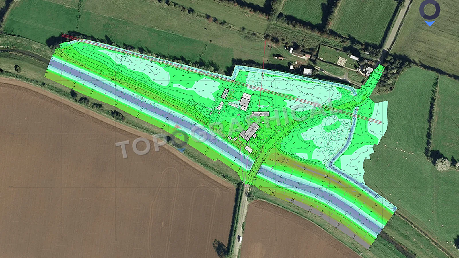
Topographic Surveys for Planning Applications
What planning teams need from a topographic survey, and why missing levels or unverified site data can delay validation.
Failing to provide measured site levels will result in your planning application being instantly invalidated. A topographic survey provides the undeniable 3D evidence the planning officer needs to approve ridge heights, earthworks, and visual impact.
A planning application that arrives at the local authority without adequate levels information does not get refused. It gets something worse: it gets invalidated. The distinction matters. A refusal is a decision, against which you can appeal, and which at least confirms that someone assessed the proposal on its merits. An invalidation means the application never entered the system. The fee sits in administrative limbo. The eight-week determination clock never starts. And the applicant receives, after a delay that varies by authority from three days to three weeks, a letter requesting "existing and proposed site levels related to a fixed datum point," which is the planning system's polite way of saying: come back when you have a topographic survey.
What the validation checklist actually says
Every local planning authority in England maintains a local validation list (reviewed, per NPPF requirements, at least every two years) specifying what documents must accompany an application for it to be registered. The national requirements (set out in the Town and Country Planning (Development Management Procedure) Order 2015) mandate only a location plan, the application form, the fee, and ownership certificates. Everything else sits on the local list, which is where topographic data appears.
The typical local validation requirement, drawn from a sample of adopted checklists current to 2025, reads substantially as follows:
"Existing and proposed site sections and finished floor and site levels are required for all applications which propose new buildings, extensions, decking, or engineering operations. Plans should be drawn at 1:50 or 1:100 and should show: cross-sections through proposed buildings; existing and proposed ground levels where changes are proposed; finished floor levels related to a fixed datum point off site; and the relationship of the proposal to adjoining buildings and land levels."
The trigger is almost universal: if you are building anything, or changing ground levels, or developing on a sloping site, or proposing works adjacent to land at a different level, you need measured levels. The format varies (some authorities accept spot levels on a site plan; others require formal cross-sections), but the underlying requirement is consistent. You must demonstrate, with measured data tied to a fixed datum, how your proposal sits in the ground and how it relates vertically to everything around it.
Why OS data does not satisfy this requirement
Ordnance Survey mapping provides planimetric accuracy (the horizontal position of features) to a standard that is adequate for location plans and site context. What it does not provide is the site-specific level data that planning officers need to assess visual impact, overlooking, drainage, and the relationship between proposed and existing floor levels. OS contours are interpolated from sparse source data at intervals that cannot describe a residential site's actual terrain. A 5m OS contour interval across a 0.3-hectare plot might represent the site as a single plane. The reality, which might include a 1.2m fall from front to rear, a raised plinth around the existing dwelling, and a localised depression at the rear boundary where a watercourse culvert runs, is invisible at that resolution.
The planning officer assessing whether your proposed ridge height causes overlooking of the neighbour's garden is not interested in what OS data suggests the ground level might be. They need to know what it is, measured, at the specific points that matter.
What a topographic survey provides for planning purposes
A planning-grade topographic survey delivers, at minimum:
- Spot levels across the site at sufficient density to describe the terrain (typically a 5m to 10m grid on open land, with additional levels at every change of gradient, surface feature, and boundary)
- Contours interpolated from those spot levels (0.25m or 0.5m intervals depending on the site's gradient)
- Boundary features in measured position (fences, walls, hedges) with levels at their base and top
- Existing building threshold levels (FFL, DPC, eaves, ridge) tied to Ordnance Datum, establishing the vertical relationship between your proposal and what already exists
- Tree positions with trunk diameter and canopy spread (feeding directly into BS 5837 arboricultural assessments, which are themselves a common validation requirement on sites containing significant trees)
- Road levels and access points establishing the relationship between site and highway
All of this is tied to a stated coordinate system and a fixed datum (typically Ordnance Datum Newlyn, though any identified, permanent, off-site datum will satisfy the planning requirement).
Validation Requirements: What Planners Need
| Application Scenario | Typical Validation Requirement | The Survey Solution |
|---|---|---|
| Sloping Sites | Existing/proposed levels tied to fixed off-site datum | Sub-centimetre spot levels and cross-sections |
| Sites with Trees | BS 5837 Arboricultural Impact Assessment | Topo acts as the base map for the tree surveyor |
| Flood Zones | Levels relative to Ordnance Datum | Precise floor levels vs. modelled flood heights |
| New Buildings/Extensions | Relationship to adjoining building levels | Measured eaves, ridges, and boundary interfaces |
The downstream consequences of inadequate levels data
When a case officer cannot determine from the submitted drawings whether the proposed ridge height exceeds the neighbour's by 300mm or 1.5m (because the applicant has used assumed levels rather than measured ones), they do not guess in the applicant's favour. They issue a request for further information, which pauses the determination clock and adds, on average, three to six weeks to the process. If the requested information then reveals a relationship between the proposal and its context that differs materially from what the submitted drawings showed, the application may require re-consultation with neighbours, which adds further delay.
For developments on sloping sites, where the visual impact of a building is dramatically affected by how it is cut into or raised above the natural terrain, inadequate levels data does not merely slow the process. It actively undermines the applicant's case. A scheme designed to sit comfortably within its context (which is what the architect intended) cannot be demonstrated to do so without the measured evidence. The officer, confronted with ambiguity, will apply the precautionary principle, and the precautionary principle in planning terms means: refuse, or condition, or request amendments that delay.
Tree surveys and the BS 5837 connection
On sites containing trees (which, in practice, means the majority of residential development sites), the local validation list will typically require an arboricultural impact assessment in accordance with BS 5837:2012. That standard requires tree positions to be plotted on a topographic survey base, with root protection areas calculated from stem diameters and shown as constraints on the site layout. The tree survey and the topographic survey are not the same commission (the arboriculturist provides the categorisation, assessment, and recommendations), but the topographic survey provides the spatial framework on which the arboricultural data is plotted.
A topographic survey that includes trees to BS 5837 standard (stem position, canopy spread to four cardinal points, stem diameter at 1.5m above ground, species identification, and height estimate) gives the arboriculturist a head start and eliminates the common scenario where the tree survey and the topo survey were commissioned independently, plotted on different bases, and don't align when overlaid.
When to commission relative to the planning timeline
The topographic survey sits at the very start of the project programme. Before the architect designs. Before the planning consultant advises on policy compliance. Before the arboriculturist assesses tree constraints. Before the drainage engineer calculates surface water attenuation. All of these disciplines require the same base data, and all of them will produce work that is compromised, delayed, or invalidated if that base data arrives late or is discovered to be inaccurate.
A fixed-price topographic survey, quoted against a defined site area and specification before fieldwork begins, is typically delivered within five to ten working days of the site visit. In the context of a planning programme measured in months, this is not a bottleneck. Commissioning it late, however, transforms it into one, because every downstream discipline must then wait for the base data before they can complete their own contributions to the application package.
The planning consultant who advises "get the topo done first" is not being pedantic. They are being efficient. They have seen, repeatedly, the cost of the alternative.
Frequently Asked Questions (FAQ)
Why was my planning application invalidated for lack of levels? Because you likely submitted OS mapping. Local authorities require precise, measured site levels to assess the real-world impact of your design on neighbouring properties and drainage.
What exactly does a topographic survey provide for planning? It provides spot levels, contours, boundary feature positions, tree locations, and existing building threshold levels (like DPC and ridge height), all tied to a fixed datum.
Can I order the survey after I submit the planning application? No. The survey data is the factual foundation your architect needs to draw the plans. Submitting without it causes instant validation delays of three to six weeks.
Ready to brief a survey?
Draw your site, define the scope, and receive a fixed-price quote.
Start a Survey Quote