Topographic Surveys for Garden Design
Why landscape and garden design needs measured levels before terraces, drainage, thresholds, and retaining walls are designed.
Human eyes cannot detect a 150mm fall that funnels surface water into your living room. A topographic survey is the foundational dataset for any landscape design, turning optimistic sketches into buildable, fully coordinated terracing and drainage strategies.
The garden designer who begins a scheme without measured levels is, whether they recognise it or not, designing a drainage problem rather than solving one. Because a 150mm fall across a 30-metre lawn is invisible to the eye, imperceptible under foot, and entirely capable of directing several cubic metres of surface water per hour toward the client's bifold doors during a sustained downpour, the human senses are not the instrument by which gradients should be assessed for design purposes. They are, at best, a prompt to commission the instrument that can.
A topographic survey of a garden or landscape site provides the single dataset from which every subsequent decision (terrace levels, retaining wall heights, planting bed drainage, step positions, patio falls, and the relationship between proposed hard surfaces and existing thresholds) can be made with confidence rather than optimism. The alternative, which remains disturbingly common, is a designer working from a tape-measured sketch, discovering at construction stage that the "level" patio requires 400mm of sub-base at one end and sits 200mm above the DPC at the other.
What a garden-scale topographic survey actually contains
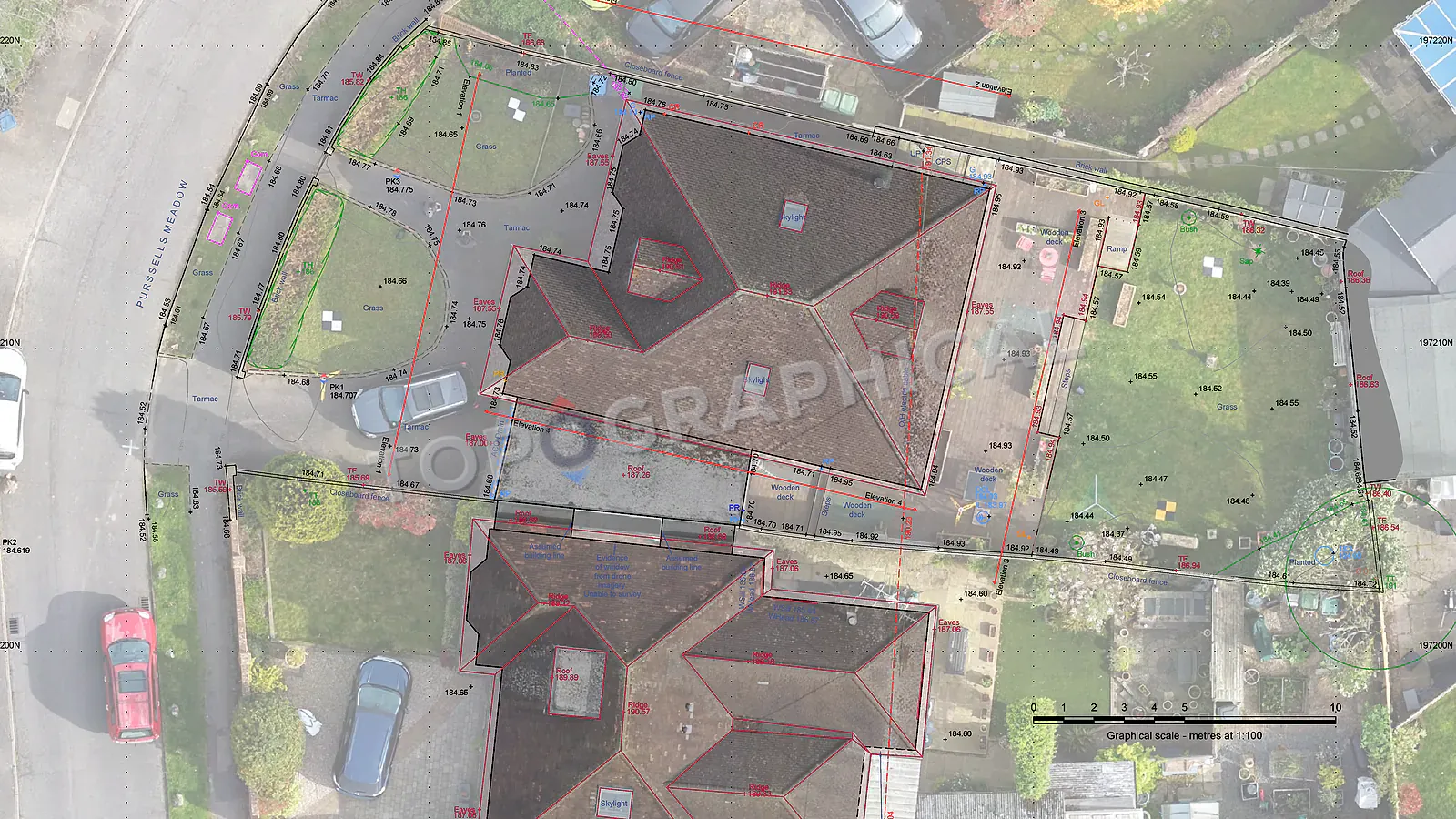
For landscape and garden design, the deliverable is a scaled plan (typically 1:100 or 1:200) showing:
Levels and gradients: Spot levels across the site at a density sufficient to generate contours (usually 0.25m or 0.5m intervals for garden-scale work). These describe the three-dimensional shape of the ground surface and immediately reveal drainage directions, low points where water will pond, and high points that will require cut if terracing is proposed.
Boundary features: Fences, walls, hedges, and their positional relationship to the site. On residential sites, where boundary disputes are a reliable source of project delay and neighbour hostility, having a measured position for a fence line (as distinct from an assumed position based on a title plan drawn at 1:1250) can prevent an entire category of argument.
Trees: Stem positions, canopy spreads, species (where identifiable), and trunk diameters. For sites where BS 5837 applies (and for any garden containing mature trees, the landscape designer should assume it might), this data feeds directly into the arboricultural impact assessment and defines the root protection areas that constrain where you can dig, build, or change levels.
Built features and surfaces: Paths, patios, steps, manhole covers (surface positions only), garden structures, and the interface between house and garden including threshold levels, airbrick positions, and DPC heights.
Drainage directions and falls: Visible surface drainage routes, gully positions, and the gradients of existing hard surfaces, so the designer can work with existing drainage rather than inadvertently redirecting it.
Why tape measurements are not a substitute
A tape measure in the hands of a competent person can establish horizontal distances between two visible points with reasonable accuracy. What it cannot do, without a level or total station, is establish the vertical relationship between those points, or between either of them and a fixed datum. A garden that is "about 25 metres long" and "roughly flat" might, when properly surveyed, prove to be 24.3 metres to the boundary (not the fence, which is 600mm inside the boundary), with a 900mm fall from the house toward the rear, a cross-fall of 400mm from left to right, and a localised depression in the centre where an old soakaway has collapsed beneath the turf.
Every one of those facts affects the design. None of them is discoverable with a tape measure and a keen eye.
The Cost of "Assuming It's Flat"
| Design Element | Working without a Survey | Working with a Topographic Survey |
|---|---|---|
| Patios & Terraces | Surprise step-ups or massive sub-base fill required | Pre-calculated cut and fill volumes |
| Drainage | Puddling, run-off directed at thresholds | Engineered falls managing surface water |
| Retaining Walls | Unplanned structural additions during build | Integrated into initial concept and budget |
| Trees (BS 5837) | Accidental root damage | Precise Root Protection Areas mapped |
The specific value for landscape architects
For landscape architects working on larger residential or commercial schemes (hotel grounds, public realm, corporate campus landscapes), the topographic survey serves a different but equally structural purpose: it is the coordination document. The civil engineer designing the surface water drainage strategy, the structural engineer designing retaining walls, the ecologist mapping habitat constraints, and the landscape architect designing the planting and hard works all need to be operating from the same measured base. When they are not (when each discipline has produced their own approximate site sketch), the clashes emerge at construction stage and cost multiples of what the survey would have cost at the outset.
A garden-scale topographic survey for a typical residential plot, delivered as a 2D plan with spot levels and a 3D model for those who want to work in three dimensions, is a fixed-price deliverable quoted before any fieldwork begins. The client knows what it costs. The designer knows what they are getting. The contractor, when they eventually price the job, knows that the levels on the drawing are the levels on the ground, and can price accordingly rather than burying a contingency for "unknown ground conditions" in every measured item.
When to commission (the answer is: before you design)
The number of garden designers who commission a topographic survey after completing their concept design, discover that the concept requires either 800mm of imported fill or a retaining wall that was not in the budget, and must then redesign around the actual terrain, remains higher than it should be. The survey is not a validation step. It is the foundation of the design. The concept that emerges from measured data is the concept that can be built as drawn, priced as designed, and constructed without the species of polite mutual surprise that occurs when a landscaper arrives to build a "level terrace" on ground that falls 600mm across the proposed footprint.
Commission the survey before the first pencil line. Not after the client has fallen in love with a scheme that the site geometry will not accommodate.
Frequently Asked Questions (FAQ)
Do I really need a topographic survey for a garden? Yes, if you are changing levels, adding hardscaping, or dealing with mature trees. Visual assessment cannot detect the subtle gradients that dictate surface water drainage and terrace construction.
Can't my landscaper just use a tape measure? A tape measure only captures horizontal distance. It cannot establish the critical vertical relationships between thresholds, existing ground, and boundaries that dictate the entire hardscaping build.
When should the garden designer instruct the survey? Before the concept design begins. Designing a garden without a survey guarantees you will design something that the site geometry cannot support, leading to costly redesigns.
Ready to brief a survey?
Draw your site, define the scope, and receive a fixed-price quote.
Start a Survey Quote