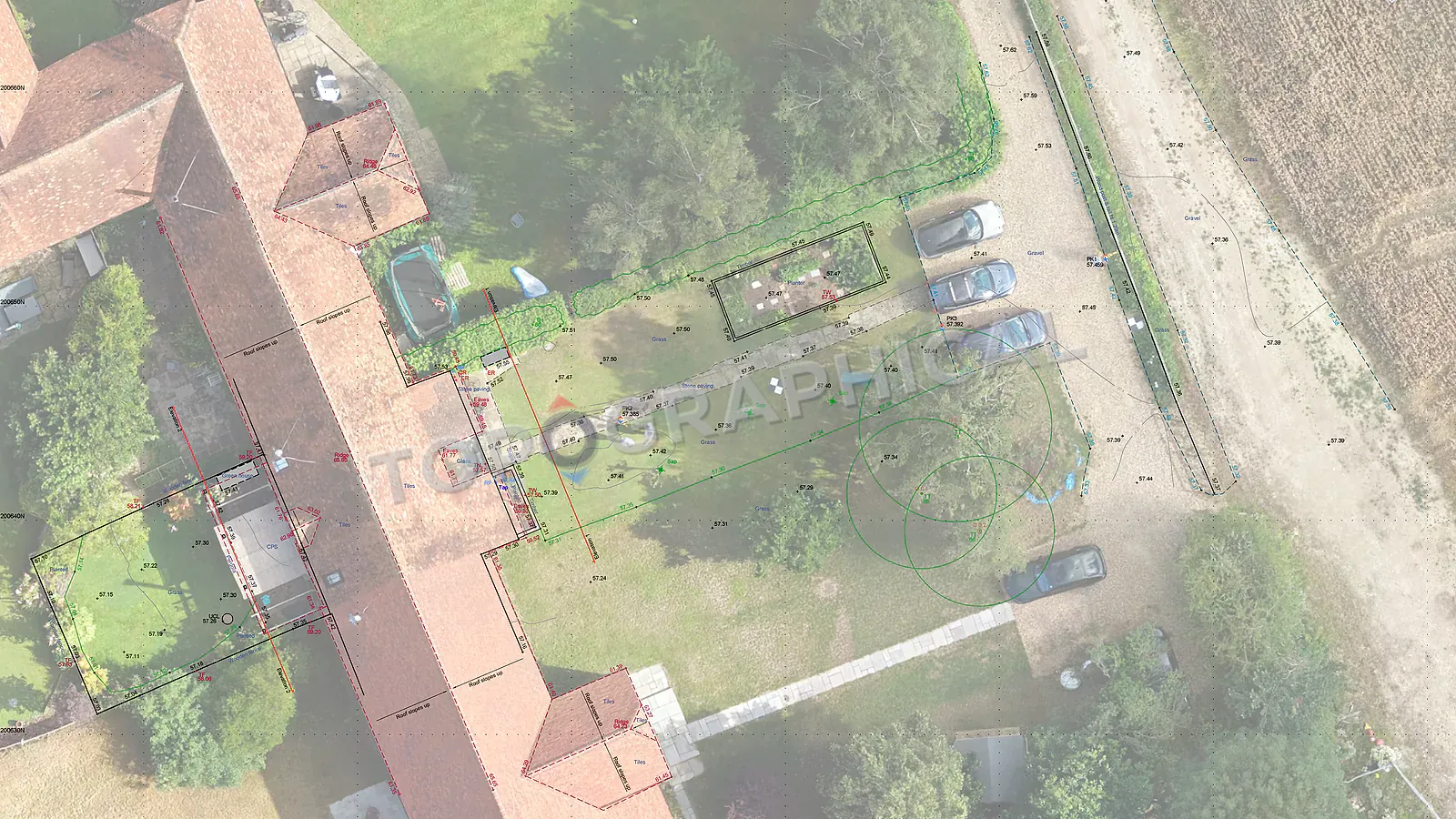
Topographic Surveys and Flood Risk Assessments
Why flood risk assessments need measured levels tied to datum, not approximate contours or unverified mapping.
The Environment Agency will reject your Flood Risk Assessment if it relies on OS contour maps. You must commission a topographic survey tied to Ordnance Datum to prove the exact freeboard relationship between your finished floor levels and the modelled flood level.
A flood risk assessment without measured site levels is, in the regulatory sense, not a flood risk assessment. It is a narrative. The Environment Agency's site-specific FRA checklist requires, explicitly, "a survey and cross-section showing existing and proposed site levels, average site level, ground level of the access road(s), and finished floor levels of the lowest rooms," with all levels expressed in metres above Ordnance Datum. The GOV.UK guidance adds, with the particular brand of polite finality that government documents deploy when they mean it: "You may be able to find Ordnance Datum information from the Ordnance Survey. If not, you will need to pay for a land survey by a qualified surveyor."
That conditional ("if not") is doing extraordinary load-bearing work, because for any site where flood risk is a genuine constraint rather than a desk-study formality, OS data at publicly available resolution will not satisfy the requirement. The assessment depends on the relationship between specific floor levels, specific ground levels, and a modelled flood level, measured in millimetres of freeboard. Establishing those relationships from contour data interpolated at 5m intervals from source data whose vertical accuracy is plus or minus 150mm is not conservative. It is fiction presented as calculation.
What the FRA actually needs from your topographic survey
The flood risk consultant preparing your FRA requires the following from the topographic survey, and requires all of it tied to Ordnance Datum Newlyn (or the appropriate local datum for Shetland/Western Isles):
Existing site levels across the entire site at a density sufficient to describe the terrain accurately, including (critically) any localised low points where water will naturally accumulate. A 5m grid may suffice for a flat site; a site with significant variation needs adaptive density, with additional levels at every break of slope, depression, ridge, and drainage feature.
Levels along access routes from the public highway to the building(s). The FRA must demonstrate that occupants can access and egress the development safely during a flood event, which requires knowing the level of the access route relative to the predicted flood level at every point between the building and dry ground.
Levels at building interfaces including existing threshold levels (where buildings exist) and the ground levels at which proposed buildings will sit. The 600mm freeboard requirement (finished floor levels set a minimum of 600mm above the higher of the average ground level, adjacent road level, or estimated flood level) is meaningless without knowing what the ground level actually is at the point where the building meets it.
Cross-section lines through the site at positions agreed with the flood risk consultant, showing the vertical profile of the terrain and its relationship to estimated flood levels. These typically run from the watercourse (or flood source) through the development site to the highest ground, and must be derived from measured data rather than interpolated from sparse OS information.
Levels of watercourses, ditches, and drainage features where they exist on or adjacent to the site. Bank-top levels, channel invert levels (where visible and accessible from above without entering the watercourse), and the positional relationship between the watercourse and the proposed development all feed the FRA assessment.
Why the accuracy matters (in specifically quantifiable terms)
The Environment Agency's standard freeboard requirement is 600mm above the estimated flood level. On a site where the 1% annual probability (1-in-100-year) flood level is modelled at, say, 45.20m AOD, and the proposed finished floor level is 45.80m AOD, the freeboard is exactly 600mm. If the topographic survey data used to determine "ground level" or "access level" carries an uncertainty of plus or minus 100mm (which OS data easily could), then the stated freeboard of 600mm might actually be anywhere between 500mm and 700mm, and a flood risk consultant cannot sign off an assessment on the basis of "probably enough freeboard."
A survey-grade topographic survey delivers vertical accuracy of plus or minus 15mm to 20mm on spot levels. At that precision, the relationship between ground levels, floor levels, and modelled flood levels is established with a confidence that supports engineering decisions, satisfies the Environment Agency, and does not require the flood risk consultant to pad their recommendations with additional safety margins to cover for data uncertainty.
Flood Risk Data: OS Mapping vs. Topographic Survey
| Data Source | Vertical Accuracy | Result in Flood Risk Assessment |
|---|---|---|
| OS Contour Data | ±150mm (interpolated) | Fails EA validation; introduces unacceptable risk |
| Topographic Survey | ±15mm to 20mm (measured) | Meets stringent FRA requirements for freeboard |
| Impact on Floor Levels | Forces consultant to over-engineer safety margins | Allows precise, cost-effective floor level design |
When the LPA and Environment Agency reject your FRA
The most common reason for an FRA being returned as "insufficient" by either the local planning authority or the Environment Agency is not that the hydrological analysis is wrong. It is that the site-specific levels data is absent, approximate, or not demonstrably tied to Ordnance Datum. The assessor cannot verify the critical calculation (floor level minus flood level equals freeboard) if the floor level is stated as "approximately 45.8m AOD based on OS data" rather than "45.82m AOD as surveyed on date by firm to survey-grade accuracy."
This rejection does not mean the development is unacceptable. It means the evidence is inadequate. The fix is a topographic survey, delivered in the same timeframe it would have been delivered had it been commissioned at the start. The difference is that commissioning it after the FRA is rejected adds the FRA revision time, the re-consultation period with the Environment Agency, and (if the corrected levels reveal a different relationship between site and flood level than the original assessment assumed) potentially a redesign of the floor levels, access strategy, or drainage scheme.
The coordination with your flood risk consultant
The flood risk consultant and the surveyor need to be in communication before fieldwork begins, because the FRA will require levels at specific locations that the consultant (but not the surveyor, without instruction) can identify:
- The location of cross-section lines that correspond to the hydraulic model transects
- The position of any flood defence structures whose crest levels affect the assessment
- Watercourse locations where bank levels and (where visible) channel geometry are needed
- Access route profiles from building to highway
A surveyor who receives a brief saying "topographic survey of site for flood risk assessment purposes" without further detail will capture a standard topographic dataset, which may or may not include levels at the specific positions the FRA requires. A surveyor who receives a brief that includes cross-section positions, watercourse locations, and access routes marked on a plan will capture exactly what the consultant needs, first time, without a supplementary visit.
This coordination costs nothing. It takes a ten-minute conversation between the flood risk consultant and the surveyor before the specification is finalised. The cost of not having that conversation is a supplementary survey visit to capture the three spot levels at the culvert headwall that the consultant needed and the surveyor did not know about.
The deliverable for FRA purposes
A topographic survey commissioned to support a flood risk assessment should deliver:
- A 2D plan with spot levels at all captured positions, contours at 0.25m or 0.5m intervals, and all drainage/watercourse features in measured position
- Cross-sections at agreed positions, showing existing ground profile with levels at every break of slope
- All levels tied to Ordnance Datum Newlyn with stated accuracy
- A clear datum statement on the drawing confirming the control methodology and the level datum used
The flood risk consultant imports this data, overlays the modelled flood extents and levels, and produces an assessment that is grounded in measured reality rather than cartographic approximation. The planning officer receives an FRA supported by survey evidence. The Environment Agency receives an assessment they can verify. The application proceeds without the three-to-six-week delay that a data inadequacy objection introduces.
That delay, on a site in Flood Zone 2 or 3 where the flood risk assessment is on the critical path to determination, is not an inconvenience. It is programme cost, measured in weeks of holding fees, delayed design programmes, and the specific irritation of a client who has been told their application cannot proceed because someone decided that OS data was "probably accurate enough" for the levels calculation that determines whether the building floods.
Frequently Asked Questions (FAQ)
Why won't the Environment Agency accept OS data for an FRA? OS data is interpolated at 5m intervals with a vertical accuracy of ±150mm. The EA requires precise freeboard calculations (e.g., exactly 600mm above flood level), which demands survey-grade accuracy.
What specific levels does my flood risk consultant need? They need existing site levels, access route profiles, building interface levels, and cross-sections running from the flood source through the development, all tied to Ordnance Datum Newlyn.
When should I coordinate the survey with the flood risk consultant? Before the surveyor goes to site. A 10-minute conversation ensures the surveyor captures the exact cross-sections and culvert levels the consultant needs, avoiding costly return visits.
Ready to brief a survey?
Draw your site, define the scope, and receive a fixed-price quote.
Start a Survey Quote