Site Appraisal: What Survey Data Tells You Before You Commit
How measured site data can reveal gradients, boundary issues, access constraints, and cost risks before acquisition or design commitment.
Never acquire land based on optimism and OS maps. Commissioning a topographic survey before exchange reveals hidden gradients, boundary discrepancies, and tree constraints, protecting your residual land value calculations from catastrophic earthworks variations.
The residual land value calculation (gross development value minus construction costs minus fees minus profit equals what the land is worth) is only as reliable as the construction cost assumptions it contains, and the construction cost assumptions are only as reliable as the site information they are predicated on. A developer who acquires a site on the basis of a feasibility appraisal built from OS mapping, an assumed "flat" topography, and a site boundary scaled from the title plan, has not conducted due diligence. They have conducted optimism, and optimism has a specific half-life in property development: it survives until the first technical report arrives and reveals that the site is not flat, the boundary is not where the title plan showed it, and the earthworks cost they assumed at £50,000 is actually £180,000 (an indicative baseline based on standard industry parameters) because the ground falls 3 metres from front to rear across a site they evaluated from a car window and a PDF.
What you do not know (and what it costs you not to know)
Ground levels and gradients. A site that appears "generally flat" from the road may fall significantly to the rear, requiring retaining structures, stepped foundations, or earthworks that transform the build cost. A site that rises from the highway requires cut to achieve platform levels, with disposal costs for material that cannot be reused on site. Neither condition is visible from a desktop assessment or a site visit conducted without a level.
Developable area versus title area. The title plan shows the land you are buying. The topographic survey shows the land you can build on, which is frequently less: boundary features that sit inside the title extent, easement corridors defined by physical features, root protection zones around mature trees, and watercourse setbacks all reduce the buildable footprint below what the red line implies.
Boundary discrepancies. If the existing fence line (which has defined the operational boundary for thirty years) sits 500mm inside the title plan extent, you do not have 500mm of additional buildable land. You have a potential dispute with a neighbour who believes the fence is the boundary, and a legal question about whether adverse possession or acquiescence applies. Discovering this before exchange rather than after planning permission has been granted on the full title extent is the difference between a negotiation and a crisis.
Tree constraints. A site containing twenty mature trees of which eight are protected by TPO or conservation area designation, and of which five have root protection zones that overlap the most commercially attractive part of the site, is not the site the developer thought they were buying if their appraisal assumed the entire area was available for development. Tree constraints are spatial constraints, and spatial constraints require spatial data to quantify.
Access levels and highway interface. The level difference between the site and the adjacent highway determines the cost and complexity of the access junction. A 1.5m level difference between the site entrance and the road requires either a ramped access (which consumes land) or significant earthworks to regrade (which costs money). Neither is visible from the title plan.
Desktop Feasibility vs. Topographic Reality
| Constraint | Desktop Assumption | Topographic Survey Reality |
|---|---|---|
| Ground Gradients | "Generally flat" | Reveals 3m falls requiring £100k+ in retaining structures |
| Developable Area | Matches legal title plan | Reduced by physical boundaries and easement corridors |
| Tree Impacts | Ignored or guessed | Precise Root Protection Zones map the unbuildable zones |
| Highway Access | Appears seamless | Identifies level differences requiring ramps or earthworks |
When to commission (relative to the acquisition timeline)
For unconditional purchases, the topographic survey should be commissioned before exchange. The data it provides feeds directly into the feasibility appraisal, allowing the developer to price with confidence (or to walk away if the site constraints invalidate the assumed scheme). The cost of a survey (typically between £500 and £2,500 for a residential development site, depending on size, as an indicative baseline) is trivially small relative to the acquisition value and negligible relative to the cost of discovering unforeseen site constraints after you own the land.
For conditional purchases (subject to planning), the survey can be commissioned during the option period, allowing the design team to begin work from measured data from day one. The survey cost is sunk if the option is not exercised, but the alternative (delaying the survey until after option exercise, and then discovering that the site constraints require a redesign that pushes the planning timeline beyond the option longstop date) is worse.
For competitive bids (best and final offers on sites with multiple bidders), the topographic survey provides a competitive advantage that other bidders may not have: the ability to submit a scheme designed to measured site constraints, with an earthworks cost built from actual volumes and a layout that accounts for the real tree positions rather than those scaled from aerial photographs. The bid that demonstrates understanding of the site conditions signals competence, and competence is a factor in vendor selection alongside price.
What the survey tells you that the marketing brochure does not
The agent's site marketing pack will include a title plan, a location plan, possibly an aerial photograph, and a description that uses words like "level," "regular," and "accessible" with a confidence inversely proportional to the evidence behind them. What it will not include is:
- Measured levels demonstrating whether the site is actually level (most are not)
- Tree positions with RPZ calculations showing the actual development constraint
- Measured boundary features recorded to the agreed project specification
- Access interface levels showing the relationship between site and highway
- Drainage feature positions showing watercourse setbacks and surface water flow paths
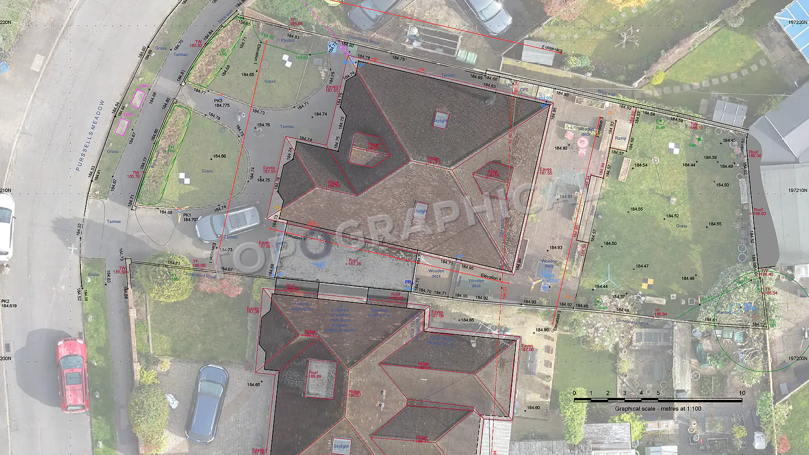
A topographic survey provides all of these in a single fixed-price commission, delivered in CAD format that your architect and engineer can immediately work from. The feasibility sketch that emerges from survey data is the feasibility sketch that represents reality, which means the appraisal built on top of it prices the scheme you can actually build rather than the scheme you could build if the site were flat, tree-free, and dimensioned exactly as the title plan suggests.
The cost comparison
A topographic survey of a 0.5-hectare residential development site costs between £1,000 and £1,500 (an indicative baseline based on standard industry parameters). The construction cost estimate for the same site is probably in the range of £2 million to £5 million. The survey represents somewhere between 0.02% and 0.075% of the construction budget.
The earthworks contingency a QS adds when they do not have survey-grade ground data typically sits between 10% and 20% of the earthworks line item. On a site requiring £200,000 of earthworks, that contingency represents £20,000 to £40,000 (an indicative baseline) of cost that either never materialises (in which case it is profit the developer failed to capture at appraisal stage) or does materialise (in which case the appraisal should have included it from the start).
Either way, the survey eliminates the uncertainty, and uncertainty in a residual land value calculation either costs you money you did not need to spend, or conceals costs you needed to know about. Neither outcome serves the developer's interest. Both are preventable for the cost of a survey.
The professionals who need this data
The topographic survey, commissioned at the feasibility stage, is immediately useful to:
- The architect designing the scheme layout, building positions, and access strategy
- The civil engineer calculating platform levels, earthworks volumes, and drainage strategy
- The planning consultant assessing whether the scheme complies with policy on levels, trees, and site context
- The quantity surveyor pricing the earthworks, retaining structures, and access works from measured volumes rather than assumptions
- The arboriculturist assessing tree constraints against measured positions and RPZ extents
- The flood risk consultant assessing levels relative to Ordnance Datum for FRA purposes
All of these professionals need the same base data, and all of them work more accurately, more quickly, and more cheaply when that data exists before they begin. The survey is not a cost. It is an input that makes every subsequent cost more accurate and every subsequent decision more defensible.
Frequently Asked Questions (FAQ)
Why isn't a title plan enough for site appraisal? A title plan only shows legal ownership lines. It does not show topography, actual physical fence lines, tree root protection zones, or ground levels, all of which dictate the buildable footprint.
When should a developer commission the survey? For unconditional purchases, before exchange. For conditional purchases, during the option period. This embeds real spatial data into the feasibility appraisal from day one.
Does a survey help with competitive land bids? Yes. Designing a scheme against measured constraints proves competence to the vendor and allows you to submit a bid based on factual earthworks volumes, removing the need for massive risk contingencies.
Ready to brief a survey?
Draw your site, define the scope, and receive a fixed-price quote.
Start a Survey Quote