Topographical.co.uk were recently awarded a detailed topographic survey project in Leicester for a national utility supplier. A detailed specification was provided by the client's consultant and after thoroughly checking that we could comply with the specification, our winning tender bid was put forward.
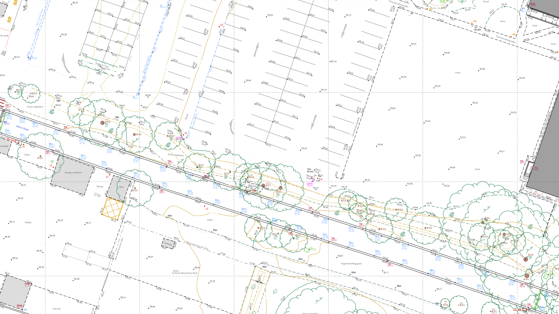
Topographic surveys were commissioned for multiple sites across the UK and Topographical.co.uk started with a busy site in Leicester. The topographical survey was to be supplied in 2d and 3d formats, in a BIM compliant deliverable package.
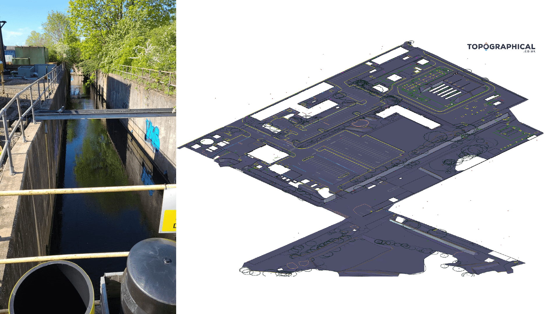
An open channel watercourse running through the site required accurately plotting along with numerous drainage outfalls. The accurate plotting of the outfalls allowed the utility mapping surveyors that followed us - to accurately trace the buried pipes from the outfall to their source.
Elsewhere, the presence of numerous industry specific utility features and the fact that this was an already developed site - meant that significant fine detail work was required of our surveyors.
The resulting topographic survey, delivered in a BIM compliant format, enabled the client's planning consultant, architect and numerous other consultants to work on proposals and further reports, underpinned by the site survey data. These works will likely come together as part of a planning application to Leicester City Council, who routinely require a topographic survey of sites that require planning permission.