
Situated a stones throw from Derby, Topographical.co.uk are frequently tasked with undertaking topographic surveys in Derby and the surrounding Derbyshire area.
We recently provided a speedy and comprehensive service to a client with planning permission on a small parcel of land. They required a topographical survey in order to discharge conditions in relation to a planning decision notice issued by Derby City Council.
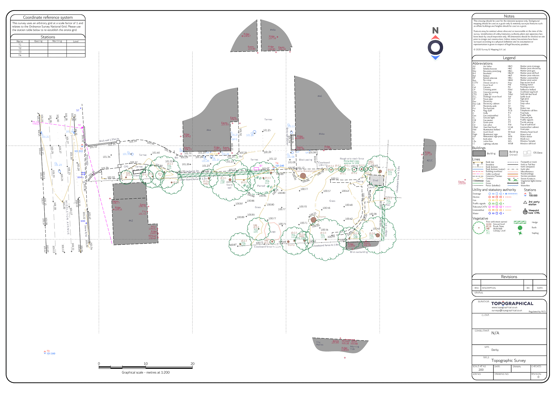
Carefully measuring and mapping the position of all key features on site, our surveyor also located key on-site and off-site levels using a Leica total station. The survey was then orientated to Ordnance Survey national grid and the site levels adjusted in respect of ordnance datum, to enable relevant interpretation by the flood risk consultant when assessing the site in relation to flood risk maps of the Derbyshire area.
This detailed topographic survey enabled the client's architect to confirm the position of the proposed dwelling in relation to the actual position of existing boundaries and buildings, along with informing the design of final proposed levels for the new dwelling, a key condition requiring discharge before building work could begin.
